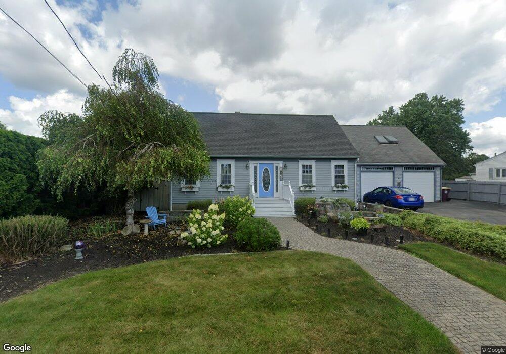
9 Michael Way Acushnet, MA 02743
Estimated Value: $533,454 - $644,000
3
Beds
2
Baths
2,103
Sq Ft
$286/Sq Ft
Est. Value
About This Home
This home is located at 9 Michael Way, Acushnet, MA 02743 and is currently estimated at $601,614, approximately $286 per square foot. 9 Michael Way is a home located in Bristol County with nearby schools including Acushnet Elementary School, Albert F Ford Middle School, and Alma Del Mar Charter School.
Ownership History
Date
Name
Owned For
Owner Type
Purchase Details
Closed on
Dec 13, 1985
Bought by
Gelinas Philip A and Gelinas Rita J
Current Estimated Value
Create a Home Valuation Report for This Property
The Home Valuation Report is an in-depth analysis detailing your home's value as well as a comparison with similar homes in the area
Home Values in the Area
Average Home Value in this Area
Purchase History
| Date | Buyer | Sale Price | Title Company |
|---|---|---|---|
| Gelinas Philip A | -- | -- |
Source: Public Records
Mortgage History
| Date | Status | Borrower | Loan Amount |
|---|---|---|---|
| Open | Gelinas Philip A | $25,000 | |
| Closed | Gelinas Philip A | $15,530 | |
| Closed | Gelinas Philip A | $5,020 | |
| Closed | Gelinas Philip A | $80,000 |
Source: Public Records
Tax History
| Year | Tax Paid | Tax Assessment Tax Assessment Total Assessment is a certain percentage of the fair market value that is determined by local assessors to be the total taxable value of land and additions on the property. | Land | Improvement |
|---|---|---|---|---|
| 2025 | $47 | $435,800 | $125,400 | $310,400 |
| 2024 | $4,485 | $393,100 | $118,800 | $274,300 |
| 2023 | $4,537 | $378,100 | $107,800 | $270,300 |
| 2022 | $4,484 | $337,900 | $101,200 | $236,700 |
| 2021 | $4,143 | $299,600 | $101,200 | $198,400 |
| 2020 | $4,084 | $293,000 | $94,600 | $198,400 |
| 2019 | $3,880 | $273,600 | $90,200 | $183,400 |
| 2018 | $3,752 | $260,200 | $90,200 | $170,000 |
| 2017 | $3,642 | $252,200 | $90,200 | $162,000 |
| 2016 | $3,666 | $252,300 | $90,200 | $162,100 |
| 2015 | $3,363 | $235,500 | $90,200 | $145,300 |
Source: Public Records
Map
Nearby Homes
- 0 Hathaway Rd Unit 73469544
- 12 White St
- 14 Hayes St Unit 1
- 12 Hayes St Unit 1
- 11 Boylston St
- 91 S Main St
- 23 Oliveira Ave
- 25 Pershing Ave
- 41 Chershire Ave
- 112 Lawson Ave
- 20 Jake Ln
- 4 Sam St
- 44 Bernard St
- 363 Main St
- 5 William St
- 81 Sylvia St
- 53 Howard Ave
- 759 Belleville Ave
- 7 Deerfield Ln
- 99 Hatch St