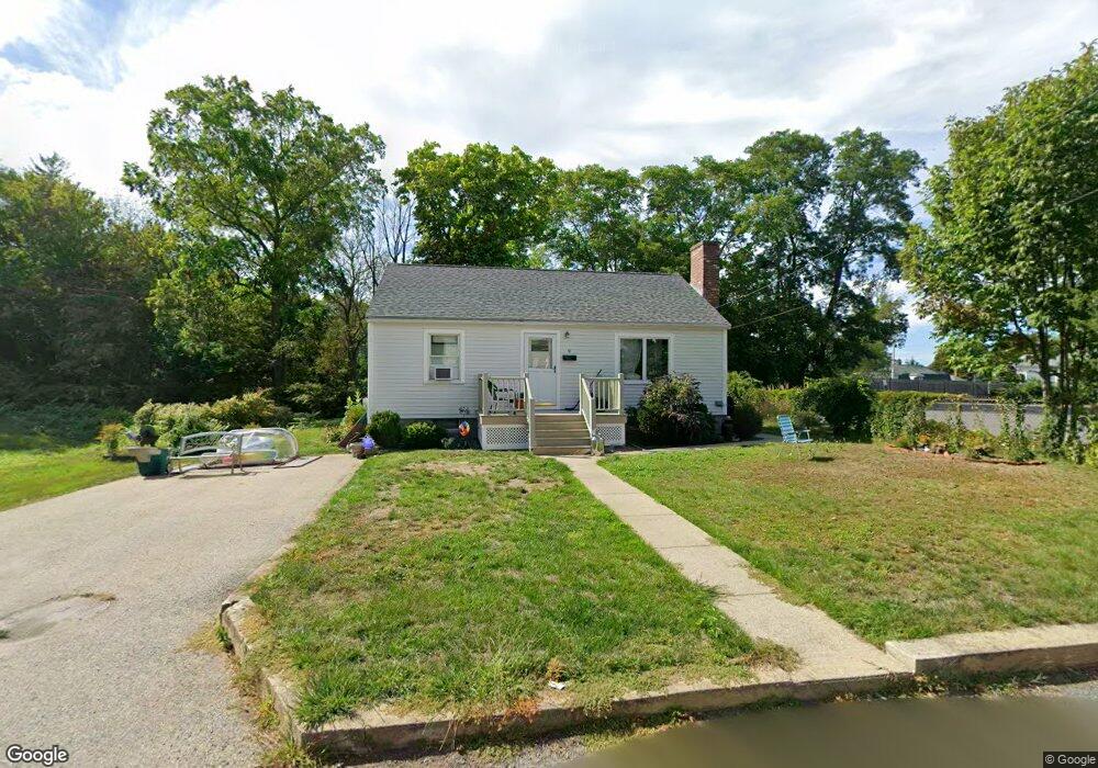
9 Morgan Ave Gloucester, MA 01930
Estimated Value: $572,000 - $692,000
2
Beds
1
Bath
884
Sq Ft
$704/Sq Ft
Est. Value
About This Home
This home is located at 9 Morgan Ave, Gloucester, MA 01930 and is currently estimated at $621,929, approximately $703 per square foot. 9 Morgan Ave is a home located in Essex County with nearby schools including Plum Cove School, Ralph B O'maley Middle School, and Gloucester High School.
Ownership History
Date
Name
Owned For
Owner Type
Purchase Details
Closed on
Sep 26, 1997
Sold by
Young Ralph David and Young Frederick P
Bought by
Carlson Susan D and Gentile James R
Current Estimated Value
Home Financials for this Owner
Home Financials are based on the most recent Mortgage that was taken out on this home.
Original Mortgage
$55,000
Interest Rate
7.47%
Mortgage Type
Purchase Money Mortgage
Create a Home Valuation Report for This Property
The Home Valuation Report is an in-depth analysis detailing your home's value as well as a comparison with similar homes in the area
Purchase History
| Date | Buyer | Sale Price | Title Company |
|---|---|---|---|
| Carlson Susan D | $90,000 | -- |
Source: Public Records
Mortgage History
| Date | Status | Borrower | Loan Amount |
|---|---|---|---|
| Open | Carlson Susan D | $72,000 | |
| Closed | Carlson Susan D | $25,000 | |
| Closed | Carlson Susan D | $55,000 |
Source: Public Records
Tax History
| Year | Tax Paid | Tax Assessment Tax Assessment Total Assessment is a certain percentage of the fair market value that is determined by local assessors to be the total taxable value of land and additions on the property. | Land | Improvement |
|---|---|---|---|---|
| 2025 | $4,508 | $463,800 | $215,600 | $248,200 |
| 2024 | $4,375 | $449,600 | $205,300 | $244,300 |
| 2023 | $4,376 | $413,200 | $183,300 | $229,900 |
| 2022 | $4,107 | $350,100 | $155,800 | $194,300 |
| 2021 | $4,108 | $330,200 | $141,700 | $188,500 |
| 2020 | $3,822 | $310,000 | $141,700 | $168,300 |
| 2019 | $3,771 | $297,200 | $141,700 | $155,500 |
| 2018 | $3,706 | $286,600 | $141,700 | $144,900 |
| 2017 | $3,680 | $279,000 | $134,900 | $144,100 |
| 2016 | $3,500 | $257,200 | $135,400 | $121,800 |
| 2015 | $3,460 | $253,500 | $135,400 | $118,100 |
Source: Public Records
Map
Nearby Homes
- 43 High St Unit B
- 10 Emerald St
- 7 Colburn St
- 94 Phillips Ave
- 13 Phillips Ave
- 32 Haven Ave
- 33 Quarry Ridge Ln Unit 33
- 5 Smith St Unit R
- 672 Washington St
- 1 Charte Ct
- 1 Main St Unit R
- 1 Main St Unit C
- 177 Main St
- 16 Hodgkins Rd Unit 2
- 27 Hodgkins Rd
- 4 Norwood Ave
- 226 Atlantic St
- 2 Breezy Point Rd
- 34R Summer St
- 2 Finch Ln
- 13 Morgan Ave
- 8 Morgan Ave
- 1111R Washington St
- 1111 Washington St
- 54 High St
- 56 High St
- 1127 Washington St
- 16 Morgan Ave
- 1107 Washington St
- 1107A Washington St
- 1131 Washington St
- 50 High St
- 60 High St
- 18 Morgan Ave
- 1104 Washington St
- 1099 Washington St
- 1106 Washington St
- 1097A Washington St
- 1097 Washington St
- 1100 Washington St
Your Personal Tour Guide
Ask me questions while you tour the home.