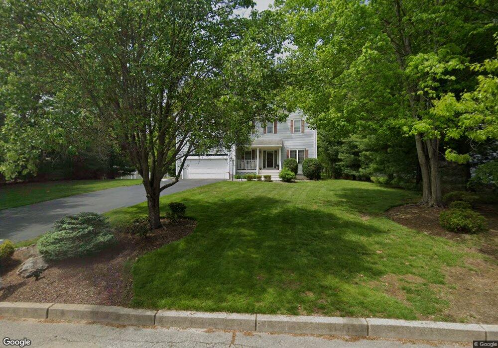
9 Mulberry Dr Cranston, RI 02921
Western Cranston NeighborhoodEstimated Value: $818,000 - $1,054,000
4
Beds
3
Baths
3,661
Sq Ft
$253/Sq Ft
Est. Value
About This Home
This home is located at 9 Mulberry Dr, Cranston, RI 02921 and is currently estimated at $927,120, approximately $253 per square foot. 9 Mulberry Dr is a home located in Providence County with nearby schools including Orchard Farms El. School, Hope Highlands Middle School, and Cranston High School West.
Ownership History
Date
Name
Owned For
Owner Type
Purchase Details
Closed on
Nov 26, 2024
Sold by
Nolte Peter R
Bought by
Nolte Christine A
Current Estimated Value
Home Financials for this Owner
Home Financials are based on the most recent Mortgage that was taken out on this home.
Original Mortgage
$380,000
Interest Rate
6.63%
Mortgage Type
Purchase Money Mortgage
Purchase Details
Closed on
Jun 22, 1998
Sold by
Jgp Builders Inc
Bought by
Nolte Peter R and Nolte Christine
Create a Home Valuation Report for This Property
The Home Valuation Report is an in-depth analysis detailing your home's value as well as a comparison with similar homes in the area
Home Values in the Area
Average Home Value in this Area
Purchase History
| Date | Buyer | Sale Price | Title Company |
|---|---|---|---|
| Nolte Christine A | -- | -- | |
| Nolte Christine A | -- | -- | |
| Nolte Christine A | -- | None Available | |
| Nolte Christine A | -- | None Available | |
| Nolte Peter R | $225,000 | -- | |
| Nolte Peter R | $225,000 | -- |
Source: Public Records
Mortgage History
| Date | Status | Borrower | Loan Amount |
|---|---|---|---|
| Previous Owner | Nolte Christine A | $380,000 | |
| Previous Owner | Nolte Peter R | $24,573 | |
| Previous Owner | Nolte Peter R | $420,000 | |
| Previous Owner | Nolte Peter R | $24,000 |
Source: Public Records
Tax History Compared to Growth
Tax History
| Year | Tax Paid | Tax Assessment Tax Assessment Total Assessment is a certain percentage of the fair market value that is determined by local assessors to be the total taxable value of land and additions on the property. | Land | Improvement |
|---|---|---|---|---|
| 2025 | $8,761 | $631,200 | $173,500 | $457,700 |
| 2024 | $8,591 | $631,200 | $173,500 | $457,700 |
| 2023 | $8,783 | $464,700 | $119,600 | $345,100 |
| 2022 | $8,602 | $464,700 | $119,600 | $345,100 |
| 2021 | $8,365 | $464,700 | $119,600 | $345,100 |
| 2020 | $8,522 | $410,300 | $132,400 | $277,900 |
| 2019 | $8,522 | $410,300 | $132,400 | $277,900 |
| 2018 | $8,325 | $410,300 | $132,400 | $277,900 |
| 2017 | $8,926 | $389,100 | $132,400 | $256,700 |
| 2016 | $8,735 | $389,100 | $132,400 | $256,700 |
| 2015 | $8,735 | $389,100 | $132,400 | $256,700 |
| 2014 | $7,944 | $347,800 | $106,800 | $241,000 |
Source: Public Records
Map
Nearby Homes
- 2 Mulberry Dr
- 10 Honey Lou Ct
- 80 Tomahawk Trail
- 121 Ashbrook Dr
- 0 Anthony Dr Unit 1394338
- 102 Moccasin Trail
- 12 Beechwood Dr
- 02 Paula Ln
- 01 Paula Ln
- 18 Quail Ridge Rd
- 311 Hope Rd
- 3 Equestrian Ln
- 9 Gray Coach E
- 129 Valerie Ct
- 321 Laten Knight Rd
- 2 Elizabeth Ln
- 3 Elizabeth Ln
- 5 Elizabeth Ln
- 53 Charcalee Dr
- 1213 Phenix Ave
- 5 Mulberry Dr
- 23 Ashbrook Dr
- 9 Green Bush Dr
- 25 Ashbrook Dr
- 40 Orchard Valley Dr
- 3 Green Bush Dr
- 17 Ashbrook Dr
- 44 Orchard Valley Dr
- 14 Paddock Dr
- 28 Orchard Valley Dr
- 10 Green Bush Dr
- 9 Ashbrook Dr
- 50 Orchard Valley Dr
- 4 Green Bush Dr
- 28 Ashbrook Dr
- 53 Orchard Valley Dr
- 16 Ashbrook Dr
- 45 Orchard Valley Dr
- 34 Ashbrook Dr
- 40 Ashbrook Dr