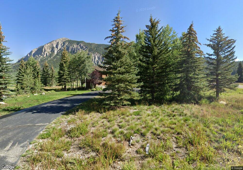
9 Mulligan Dr Crested Butte, CO 81224
Estimated Value: $3,199,655 - $4,393,000
4
Beds
4
Baths
4,187
Sq Ft
$908/Sq Ft
Est. Value
About This Home
This home is located at 9 Mulligan Dr, Crested Butte, CO 81224 and is currently estimated at $3,802,164, approximately $908 per square foot. 9 Mulligan Dr is a home located in Gunnison County with nearby schools including Gunnison Elementary School, Crested Butte Community School, and Gunnison Middle School.
Ownership History
Date
Name
Owned For
Owner Type
Purchase Details
Closed on
Apr 6, 2018
Sold by
Corporate Energy Properties Llc
Bought by
Pecos Valley Energy Llc
Current Estimated Value
Purchase Details
Closed on
Apr 24, 2009
Sold by
Corporate Energy Limited
Bought by
Corporate Energy Properties Llc
Purchase Details
Closed on
Sep 5, 2003
Sold by
Walton Ralph O
Bought by
Corporate Energy Limited
Purchase Details
Closed on
Jan 13, 2000
Sold by
Mangurain Pierce Trust
Bought by
Walton Ralph O
Purchase Details
Closed on
Aug 19, 1998
Sold by
Cox James B
Bought by
Pierce Mangurian Trust
Purchase Details
Closed on
Oct 26, 1995
Create a Home Valuation Report for This Property
The Home Valuation Report is an in-depth analysis detailing your home's value as well as a comparison with similar homes in the area
Home Values in the Area
Average Home Value in this Area
Purchase History
| Date | Buyer | Sale Price | Title Company |
|---|---|---|---|
| Pecos Valley Energy Llc | $1,720,000 | Land Title Guarantee Company | |
| Corporate Energy Properties Llc | -- | None Available | |
| Corporate Energy Limited | $1,355,000 | -- | |
| Walton Ralph O | $179,000 | -- | |
| Pierce Mangurian Trust | $145,000 | -- | |
| -- | $120,000 | -- |
Source: Public Records
Tax History
| Year | Tax Paid | Tax Assessment Tax Assessment Total Assessment is a certain percentage of the fair market value that is determined by local assessors to be the total taxable value of land and additions on the property. | Land | Improvement |
|---|---|---|---|---|
| 2025 | $12,319 | $155,940 | $30,240 | $125,700 |
| 2024 | $12,319 | $176,740 | $30,880 | $145,860 |
| 2023 | $13,206 | $173,060 | $30,240 | $142,820 |
| 2022 | $12,513 | $140,150 | $18,630 | $121,520 |
| 2021 | $11,518 | $144,180 | $19,160 | $125,020 |
| 2020 | $10,861 | $129,020 | $16,890 | $112,130 |
| 2019 | $10,710 | $129,020 | $16,890 | $112,130 |
| 2018 | $10,856 | $120,680 | $14,000 | $106,680 |
| 2017 | $10,927 | $120,680 | $14,000 | $106,680 |
| 2016 | $11,252 | $129,420 | $19,900 | $109,520 |
| 2015 | $4,933 | $129,420 | $19,900 | $109,520 |
| 2014 | $4,933 | $102,020 | $18,100 | $83,920 |
Source: Public Records
Map
Nearby Homes
- 227 Larkspur Loop
- 262 Larkspur Loop
- 115 Larkspur Loop
- 156 Coyote Cir
- 34 Saint Andrews Cir Unit 34
- 42 Lexie Ct
- 8 Vista Ct
- 350 Country Club Dr Unit 218A
- 412 Ridge Rd
- 140 Alpine Ct
- 50 Vista Ct
- 22 Links Ln
- 64 Vista Ct
- 0 Tbd Saddle Ridge Rd
- 179 Aspen Ln
- 168 W Silver Sage Dr
- 44 County Road 738a Brush Creek Rd
- 136 N Avion Dr
- 231 S Avion Dr
- 163 N Avion Dr
- S-150 Skyland
- S-160 Skyland
- S131 Skyland
- S182 Skyland
- S181 Skyland Dr
- S-116, Skyland Dr
- S-178, Skyland Dr
- 0 Lot S-169 Unit 2189
- S-133, Skyland Dr
- S-155, Skyland Dr
- S-179, Skyland Dr
- S-177, Skyland Dr
- S-173, Skyland Dr
- S-172, Skyland Dr
- S-171, Skyland Dr
- S-139, Skyland Dr
- 29 Mulligan Dr
- 1 Mountain Horizons Dr Unit 1
- 4 Mountain Horizons Dr Unit 4 BLDG B MOUNTA
- 3 Mountain Horizons Dr Unit 3 Bldg B, Mount
Your Personal Tour Guide
Ask me questions while you tour the home.