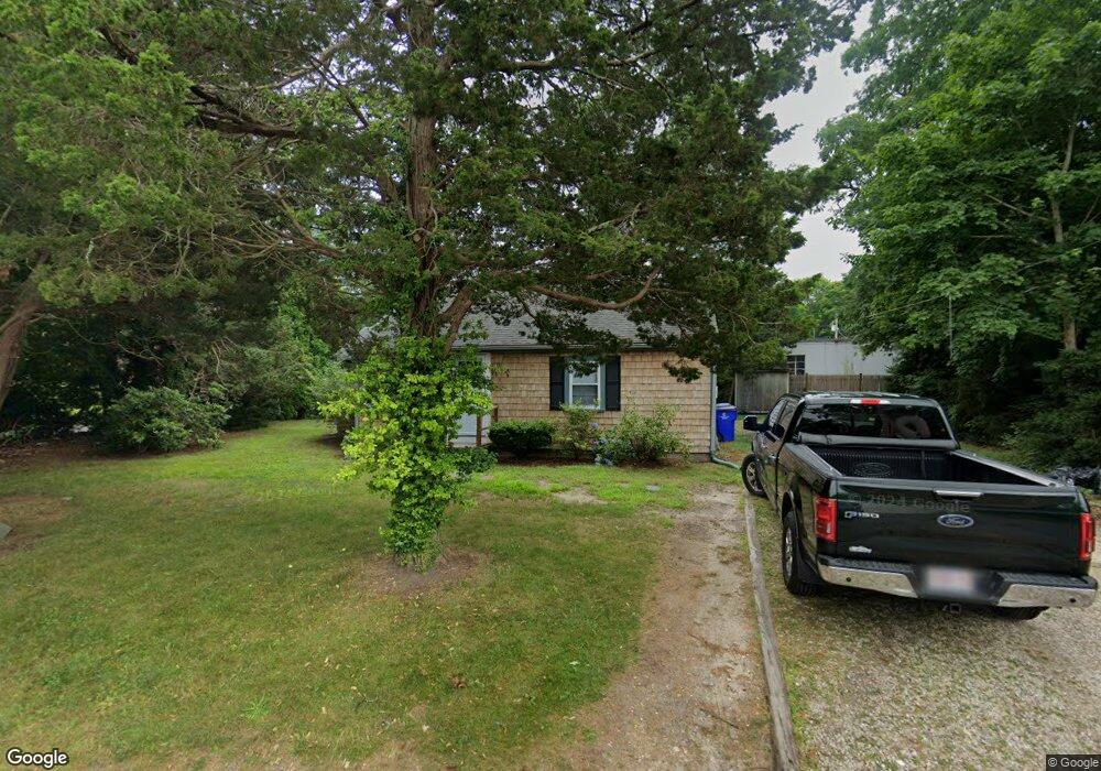
9 River Rd Pocasset, MA 02559
Pocasset NeighborhoodEstimated Value: $506,000 - $628,000
3
Beds
1
Bath
840
Sq Ft
$682/Sq Ft
Est. Value
About This Home
This home is located at 9 River Rd, Pocasset, MA 02559 and is currently estimated at $572,488, approximately $681 per square foot. 9 River Rd is a home located in Barnstable County with nearby schools including Bourne High School, Cadence Academy Preschool - Bourne, and St Margaret Regional School.
Ownership History
Date
Name
Owned For
Owner Type
Purchase Details
Closed on
Oct 30, 2024
Sold by
Saade Joseph
Bought by
Saade Ft and Saade
Current Estimated Value
Purchase Details
Closed on
Sep 3, 2020
Sold by
Richard Michael
Bought by
Saade Joseph
Home Financials for this Owner
Home Financials are based on the most recent Mortgage that was taken out on this home.
Original Mortgage
$211,875
Interest Rate
3%
Mortgage Type
New Conventional
Purchase Details
Closed on
May 18, 2011
Sold by
Jpatricia C Thoma Rt and Cahir
Bought by
Richard Michael
Create a Home Valuation Report for This Property
The Home Valuation Report is an in-depth analysis detailing your home's value as well as a comparison with similar homes in the area
Home Values in the Area
Average Home Value in this Area
Purchase History
| Date | Buyer | Sale Price | Title Company |
|---|---|---|---|
| Saade Ft | -- | None Available | |
| Saade Ft | -- | None Available | |
| Saade Ft | -- | None Available | |
| Saade Joseph | $282,500 | None Available | |
| Saade Joseph | $282,500 | None Available | |
| Saade Joseph | $282,500 | None Available | |
| Richard Michael | $176,000 | -- | |
| Richard Michael | $176,000 | -- |
Source: Public Records
Mortgage History
| Date | Status | Borrower | Loan Amount |
|---|---|---|---|
| Previous Owner | Saade Joseph | $211,875 |
Source: Public Records
Tax History Compared to Growth
Tax History
| Year | Tax Paid | Tax Assessment Tax Assessment Total Assessment is a certain percentage of the fair market value that is determined by local assessors to be the total taxable value of land and additions on the property. | Land | Improvement |
|---|---|---|---|---|
| 2025 | $3,459 | $442,900 | $311,100 | $131,800 |
| 2024 | $3,119 | $388,900 | $263,400 | $125,500 |
| 2023 | $3,032 | $344,100 | $233,100 | $111,000 |
| 2022 | $2,536 | $251,300 | $135,400 | $115,900 |
| 2021 | $2,191 | $203,400 | $123,200 | $80,200 |
| 2020 | $2,127 | $198,000 | $122,000 | $76,000 |
| 2019 | $2,036 | $193,700 | $122,000 | $71,700 |
| 2018 | $1,907 | $180,900 | $116,200 | $64,700 |
| 2017 | $1,846 | $179,200 | $115,100 | $64,100 |
| 2016 | $1,686 | $165,900 | $109,700 | $56,200 |
| 2015 | $1,504 | $149,400 | $93,200 | $56,200 |
Source: Public Records
Map
Nearby Homes
- 171 Bellavista Dr
- 34 Kenwood Rd
- 45 Kenwood Rd
- 70 Wings Neck Rd
- 14 Navajo Rd
- 24 Richmond Rd
- 254 Barlows Landing Rd
- 940 County Rd
- 709 County Rd
- 39 Bennets Neck Dr
- 174 Barlows Landing Rd
- 15 1st St
- 89 Harbor Dr
- 7 4th Ave
- 22 Nairn Rd
- 515 County Rd
- 566 Shore Rd
- 501 County Rd
- 940 County Rd
- 48 Red Brook Harbor Rd
- 10 River Rd
- 372 Barlows Landing Rd
- 2 River Rd
- 3 River Rd
- 376 Barlows Landing Rd
- 11 River Rd
- 1 River Rd
- 1 River Rd Unit 1-13A
- 6 River Rd
- 4 River Rd
- 5 River Rd
- 380 Barlows Landing Rd
- 375 Barlows Landing Rd
- 833 Shore Rd
- 12 River Rd
- 7 River Rd
- 8 River Rd
- 369 Barlows Landing Rd
- 365 Barlows Landing Rd Unit B
- 829 Shore Rd