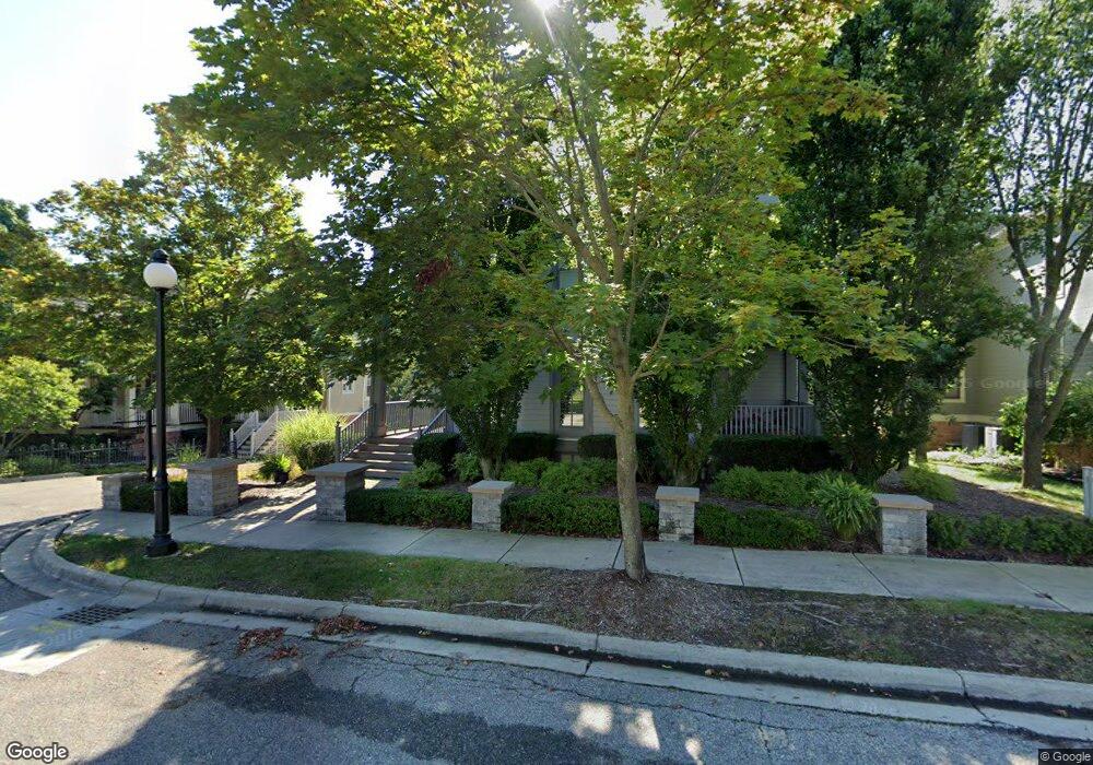
9 Riverbank Dr Beverly Hills, MI 48025
Estimated Value: $850,107 - $1,003,000
4
Beds
4
Baths
3,433
Sq Ft
$271/Sq Ft
Est. Value
About This Home
This home is located at 9 Riverbank Dr, Beverly Hills, MI 48025 and is currently estimated at $931,277, approximately $271 per square foot. 9 Riverbank Dr is a home located in Oakland County with nearby schools including Bingham Farms Elementary School, Wylie E. Groves High School, and Berkshire Middle School.
Ownership History
Date
Name
Owned For
Owner Type
Purchase Details
Closed on
Aug 5, 2022
Sold by
Romano Virginia L and Romano Jerry
Bought by
Virginia L Romano Trust
Current Estimated Value
Purchase Details
Closed on
Mar 18, 2005
Sold by
Mackenzie Douglas A and Mackenzie Gwen
Bought by
Yee Jerry and Romano Virginia L
Home Financials for this Owner
Home Financials are based on the most recent Mortgage that was taken out on this home.
Original Mortgage
$175,000
Interest Rate
5.64%
Mortgage Type
Credit Line Revolving
Purchase Details
Closed on
Jul 6, 2000
Sold by
Westwood Land Co Inc
Bought by
Mackenzie Douglas A
Create a Home Valuation Report for This Property
The Home Valuation Report is an in-depth analysis detailing your home's value as well as a comparison with similar homes in the area
Home Values in the Area
Average Home Value in this Area
Purchase History
| Date | Buyer | Sale Price | Title Company |
|---|---|---|---|
| Virginia L Romano Trust | -- | -- | |
| Yee Jerry | -- | Metropolitan Title Company | |
| Mackenzie Douglas A | -- | -- |
Source: Public Records
Mortgage History
| Date | Status | Borrower | Loan Amount |
|---|---|---|---|
| Previous Owner | Yee Jerry | $175,000 |
Source: Public Records
Tax History Compared to Growth
Tax History
| Year | Tax Paid | Tax Assessment Tax Assessment Total Assessment is a certain percentage of the fair market value that is determined by local assessors to be the total taxable value of land and additions on the property. | Land | Improvement |
|---|---|---|---|---|
| 2024 | $9,155 | $374,980 | $0 | $0 |
| 2023 | $8,784 | $362,220 | $0 | $0 |
| 2022 | $9,527 | $360,860 | $0 | $0 |
| 2021 | $9,605 | $339,950 | $0 | $0 |
| 2020 | $8,046 | $333,740 | $0 | $0 |
| 2019 | $6,357 | $324,580 | $0 | $0 |
| 2018 | $9,090 | $310,090 | $0 | $0 |
| 2017 | $9,055 | $310,090 | $0 | $0 |
| 2016 | $9,091 | $303,250 | $0 | $0 |
| 2015 | -- | $277,050 | $0 | $0 |
| 2014 | -- | $224,430 | $0 | $0 |
| 2011 | -- | $218,530 | $0 | $0 |
Source: Public Records
Map
Nearby Homes
- 21700 W 13 Mile Rd
- 31111 Lahser Rd
- 21993 Riverview Dr
- 31430 Lahser Rd
- 000 Beverly Rd
- 31065 Old Stage Rd
- 30372 Georgetown Dr
- 0000 Farmbrook Rd
- 22601 Highbank Dr
- 29585 Woodhaven Ln
- 31301 Coachlight Ln
- 22025 Orchard Way
- 32175 Spruce Ln
- 20666 Southome St
- 32326 Spruce Ln Unit 31
- 29140 Briarbank Ct
- 31462 Waltham Rd
- 0000 Woodlynne Dr
- 29600 Bristol Ln
- 20079 Forestwood St
- 11 Riverbank Dr Unit 14
- 7 Riverbank Dr Unit 12
- 15 Riverbank Dr
- 2 Riverbank Dr Unit 9
- 2 Riverbank Dr
- 5 Riverbank Dr
- 5 Riverbank Dr Unit 11
- 17 Riverbank Dr
- 3 Riverbank Dr
- 4 Riverbank Dr Unit 8
- 6 Riverbank Dr
- 19 Riverbank Dr Unit 17
- 8 Riverbank Dr
- 21 Riverbank Dr
- 10 Riverbank Dr
- 10 Riverbank Dr Unit 5
- 21655 W 13 Mile Rd
- 1 Brady Ln Unit 23
- 12 Riverbank Dr
- 21705 W 13 Mile Rd