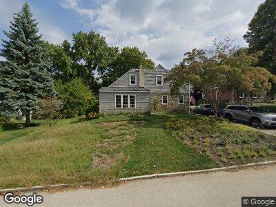
9 Rodney Rd Bryn Mawr, PA 19010
Rosemont NeighborhoodEstimated Value: $673,000 - $1,010,000
5
Beds
4
Baths
1,970
Sq Ft
$409/Sq Ft
Est. Value
About This Home
This home is located at 9 Rodney Rd, Bryn Mawr, PA 19010 and is currently estimated at $804,878, approximately $408 per square foot. 9 Rodney Rd is a home located in Delaware County with nearby schools including Radnor El School, Radnor Middle School, and Radnor Senior High School.
Ownership History
Date
Name
Owned For
Owner Type
Purchase Details
Closed on
Oct 19, 2012
Sold by
Celenza Gaetano J and Brown Elizabeth Ann
Bought by
Galloway Brian and Galloway Deanna
Current Estimated Value
Home Financials for this Owner
Home Financials are based on the most recent Mortgage that was taken out on this home.
Original Mortgage
$239,200
Interest Rate
3.5%
Mortgage Type
New Conventional
Create a Home Valuation Report for This Property
The Home Valuation Report is an in-depth analysis detailing your home's value as well as a comparison with similar homes in the area
Home Values in the Area
Average Home Value in this Area
Purchase History
| Date | Buyer | Sale Price | Title Company |
|---|---|---|---|
| Galloway Brian | $299,000 | None Available |
Source: Public Records
Mortgage History
| Date | Status | Borrower | Loan Amount |
|---|---|---|---|
| Open | Galloway Brian | $100,000 | |
| Open | Galloway Brian | $303,000 | |
| Closed | Galloway Brian | $70,000 | |
| Closed | Galloway Brian | $25,000 | |
| Closed | Galloway Brian | $25,000 | |
| Closed | Galloway Brian | $239,200 |
Source: Public Records
Tax History Compared to Growth
Tax History
| Year | Tax Paid | Tax Assessment Tax Assessment Total Assessment is a certain percentage of the fair market value that is determined by local assessors to be the total taxable value of land and additions on the property. | Land | Improvement |
|---|---|---|---|---|
| 2024 | $9,781 | $483,780 | $111,930 | $371,850 |
| 2023 | $9,393 | $483,780 | $111,930 | $371,850 |
| 2022 | $9,291 | $483,780 | $111,930 | $371,850 |
| 2021 | $14,924 | $483,780 | $111,930 | $371,850 |
| 2020 | $7,056 | $202,830 | $63,790 | $139,040 |
| 2019 | $6,857 | $202,830 | $63,790 | $139,040 |
| 2018 | $6,722 | $202,830 | $0 | $0 |
| 2017 | $6,582 | $202,830 | $0 | $0 |
| 2016 | $1,113 | $202,830 | $0 | $0 |
| 2015 | $1,113 | $202,830 | $0 | $0 |
| 2014 | $1,113 | $202,830 | $0 | $0 |
Source: Public Records
Map
Nearby Homes
- 104 Lowrys Ln
- 19 Hawthorne Ln
- 1430 County Line Rd
- 1030 E Lancaster Ave Unit 723
- 1030 E Lancaster Ave Unit 227
- 1030 E Lancaster Ave Unit 330
- 1030 E Lancaster Ave Unit 207
- 1030 E Lancaster Ave Unit 117
- 120 Garrett Ave
- 106 Debaran Ln
- 1220 Wendover Rd
- 166 Meredith Ave
- 419 Thornbrook Ave
- 950 Conestoga Rd
- 40 Wentworth Ln
- 1962 Montgomery Ave
- 138 Montrose Ave Unit 35
- 237 Trianon Ln
- 340 Baintree Rd
- 302 Gramont Ln