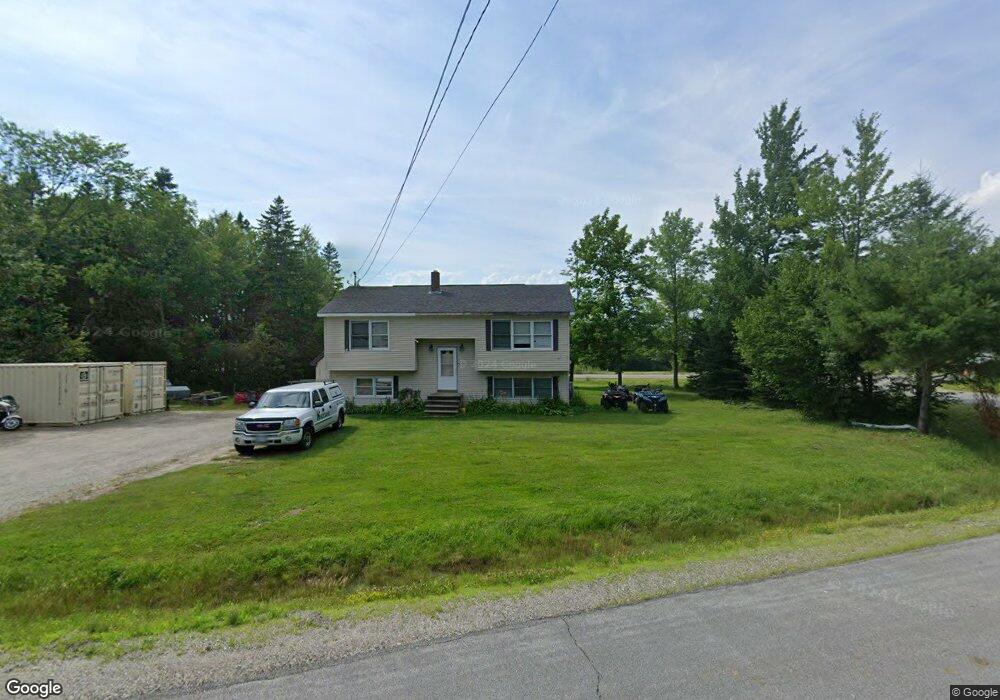
9 Spruce St Bucksport, ME 04416
Estimated Value: $270,000 - $379,000
2
Beds
2
Baths
1,824
Sq Ft
$172/Sq Ft
Est. Value
About This Home
This home is located at 9 Spruce St, Bucksport, ME 04416 and is currently estimated at $314,273, approximately $172 per square foot. 9 Spruce St is a home located in Hancock County with nearby schools including G. Herbert Jewett School, Miles Lane School, and Bucksport Middle School.
Ownership History
Date
Name
Owned For
Owner Type
Purchase Details
Closed on
Feb 4, 2023
Sold by
Megno Sandi D and Noyes Brian K
Bought by
Megno Sandi D and Megno Kevin M
Current Estimated Value
Home Financials for this Owner
Home Financials are based on the most recent Mortgage that was taken out on this home.
Original Mortgage
$128,205
Outstanding Balance
$124,153
Interest Rate
6.48%
Mortgage Type
FHA
Estimated Equity
$190,120
Purchase Details
Closed on
Aug 14, 2017
Sold by
Bucksport Town Of
Bought by
Megno Sandi D and Noyes Brian K
Purchase Details
Closed on
Feb 27, 2006
Sold by
Smedal Gregory W
Bought by
Martin-Smedal Deborah A and Smedel Gregory W
Home Financials for this Owner
Home Financials are based on the most recent Mortgage that was taken out on this home.
Original Mortgage
$166,250
Interest Rate
9%
Mortgage Type
Adjustable Rate Mortgage/ARM
Create a Home Valuation Report for This Property
The Home Valuation Report is an in-depth analysis detailing your home's value as well as a comparison with similar homes in the area
Home Values in the Area
Average Home Value in this Area
Purchase History
| Date | Buyer | Sale Price | Title Company |
|---|---|---|---|
| Megno Sandi D | -- | None Available | |
| Megno Sandi D | -- | None Available | |
| Megno Sandi D | -- | -- | |
| Martin-Smedal Deborah A | -- | -- | |
| Martin-Smedal Deborah A | -- | -- | |
| Martin-Smedal Deborah A | -- | -- |
Source: Public Records
Mortgage History
| Date | Status | Borrower | Loan Amount |
|---|---|---|---|
| Open | Megno Sandi D | $128,205 | |
| Closed | Megno Sandi D | $128,205 | |
| Previous Owner | Martin-Smedal Deborah A | $97,448 | |
| Previous Owner | Martin-Smedal Deborah A | $166,250 |
Source: Public Records
Tax History Compared to Growth
Tax History
| Year | Tax Paid | Tax Assessment Tax Assessment Total Assessment is a certain percentage of the fair market value that is determined by local assessors to be the total taxable value of land and additions on the property. | Land | Improvement |
|---|---|---|---|---|
| 2024 | $2,620 | $197,710 | $49,150 | $148,560 |
| 2023 | $2,521 | $197,710 | $49,150 | $148,560 |
| 2022 | $2,144 | $126,470 | $42,440 | $84,030 |
| 2021 | $2,055 | $126,470 | $42,440 | $84,030 |
| 2020 | $2,055 | $126,470 | $42,440 | $84,030 |
| 2019 | $2,061 | $126,470 | $42,440 | $84,030 |
| 2018 | $1,735 | $126,470 | $42,440 | $84,030 |
| 2017 | $2,935 | $124,310 | $43,030 | $81,280 |
| 2016 | $2,051 | $124,310 | $43,030 | $81,280 |
| 2015 | $2,120 | $124,000 | $43,000 | $81,000 |
| 2014 | $1,739 | $123,218 | $43,028 | $80,190 |
| 2013 | $1,670 | $123,120 | $43,030 | $80,090 |
Source: Public Records
Map
Nearby Homes
- 53-04 Race Course Rd
- 53-03 Race Course Rd
- 326 Silver Lake Rd
- 5 Scotts Ln
- 62 Pine St
- 19 Katahdin Dr
- 12 Twin Oaks Ln
- 63 Pond St
- 61 Baxter Blvd
- 23 Pond St
- Lot 96 Pond Street Extension St
- 49 Mechanic St
- Map2Lot24 Park St
- Map2Lot27 Park St
- Map2Lot68 Park St
- 13 Buck St
- 21 Federal St
- 8 Bridge St
- 100 Us Route 1
- 12 Silver St
- 0 Spruce St
- 0 Woodland Heights Unit 818253
- 0 Woodland Heights Unit 793919
- 0 Woodland Heights Unit 762403
- 0 Woodland Heights Unit 401415
- 0 Woodland Heights Unit 305898
- 0 Woodland Heights Unit 261821
- 0 Woodland Heights Unit 758699
- 0 Woodland Heights Unit 783283
- 0 Woodland Heights Unit 331477
- 0 Woodland Heights Unit 278025
- 0 Woodland Heights Unit 949609
- 0 Woodland Heights Unit 1115505
- 0 Woodland Heights Unit 1156344
- 0 Woodland Heights Unit 1161575
- 289 Central St
- 280 Central St
- 269 Central St
- 282 Central St
- 10 Spruce St