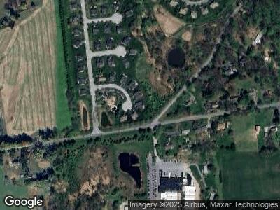
9 Strand Rd Avondale, PA 19311
Estimated Value: $568,000 - $598,000
4
Beds
4
Baths
2,780
Sq Ft
$209/Sq Ft
Est. Value
About This Home
This home is located at 9 Strand Rd, Avondale, PA 19311 and is currently estimated at $580,292, approximately $208 per square foot. 9 Strand Rd is a home located in Chester County with nearby schools including Penn London Elementary School, Avon Grove Intermediate School, and Fred S Engle Middle School.
Ownership History
Date
Name
Owned For
Owner Type
Purchase Details
Closed on
Jun 28, 2012
Sold by
Nvr Inc
Bought by
Bocci Francis R and Bocci Gwendolyn
Current Estimated Value
Home Financials for this Owner
Home Financials are based on the most recent Mortgage that was taken out on this home.
Original Mortgage
$50,000
Interest Rate
3.78%
Mortgage Type
New Conventional
Purchase Details
Closed on
Apr 6, 2012
Sold by
Inniscrone Development Co Inc
Bought by
Nvr Inc and Ryan Homes
Create a Home Valuation Report for This Property
The Home Valuation Report is an in-depth analysis detailing your home's value as well as a comparison with similar homes in the area
Home Values in the Area
Average Home Value in this Area
Purchase History
| Date | Buyer | Sale Price | Title Company |
|---|---|---|---|
| Bocci Francis R | $370,290 | None Available | |
| Nvr Inc | $61,516 | None Available |
Source: Public Records
Mortgage History
| Date | Status | Borrower | Loan Amount |
|---|---|---|---|
| Open | Bocci Francis R | $50,000 | |
| Closed | Bocci Francis R | $50,000 | |
| Previous Owner | Inniscrone Development Company Inc | $130,000 | |
| Previous Owner | Inniscrone Development Company Inc | $579,310 |
Source: Public Records
Tax History Compared to Growth
Tax History
| Year | Tax Paid | Tax Assessment Tax Assessment Total Assessment is a certain percentage of the fair market value that is determined by local assessors to be the total taxable value of land and additions on the property. | Land | Improvement |
|---|---|---|---|---|
| 2024 | $8,903 | $218,470 | $44,120 | $174,350 |
| 2023 | $8,717 | $218,470 | $44,120 | $174,350 |
| 2022 | $8,590 | $218,470 | $44,120 | $174,350 |
| 2021 | $8,414 | $218,470 | $44,120 | $174,350 |
| 2020 | $8,133 | $218,470 | $44,120 | $174,350 |
| 2019 | $7,932 | $218,470 | $44,120 | $174,350 |
| 2018 | $7,731 | $218,470 | $44,120 | $174,350 |
| 2017 | $7,572 | $218,470 | $44,120 | $174,350 |
| 2016 | $981 | $218,470 | $44,120 | $174,350 |
| 2015 | $981 | $218,470 | $44,120 | $174,350 |
| 2014 | $981 | $218,470 | $44,120 | $174,350 |
Source: Public Records
Map
Nearby Homes
- 301 Whitestone Rd
- 103 Dylan Cir
- 607 Martin Dr
- 125 Maloney Terrace
- 4 Sullivan Chase Dr
- 228 Schoolhouse Rd
- 1935 Garden Station Rd
- 38 Angelica Dr
- 6 Letchworth Ln
- 12 Rushford Place
- 179 Ellicott Rd
- 183 Ellicott Rd
- 167 Ellicott Rd
- 314 Dawnwood Dr
- 175 Ellicott Rd
- 17 Nottingham Dr
- 1 Picket Ln
- 542 Auburn Rd
- 225 State Rd
- 30 Inniscrone Dr
- 9 Strand Rd
- 11 Strand Rd
- 7 Strand Rd
- 5 Strand Rd
- 6 Strand Rd
- 3 Strand Rd
- 1 Strand Rd
- 866 Garden Station Rd
- 853 Sullivan Rd
- 318 Whitestone Rd
- 323 Whitestone Rd
- 316 Whitestone Rd
- 321 Whitestone Rd
- 765 Sullivan Rd
- 933 Garden Station Rd
- 920 Garden Station Rd
- 319 Whitestone Rd
- 529 Garden Station Rd
- 0 Strand Rd
- 317 Whitestone Rd
