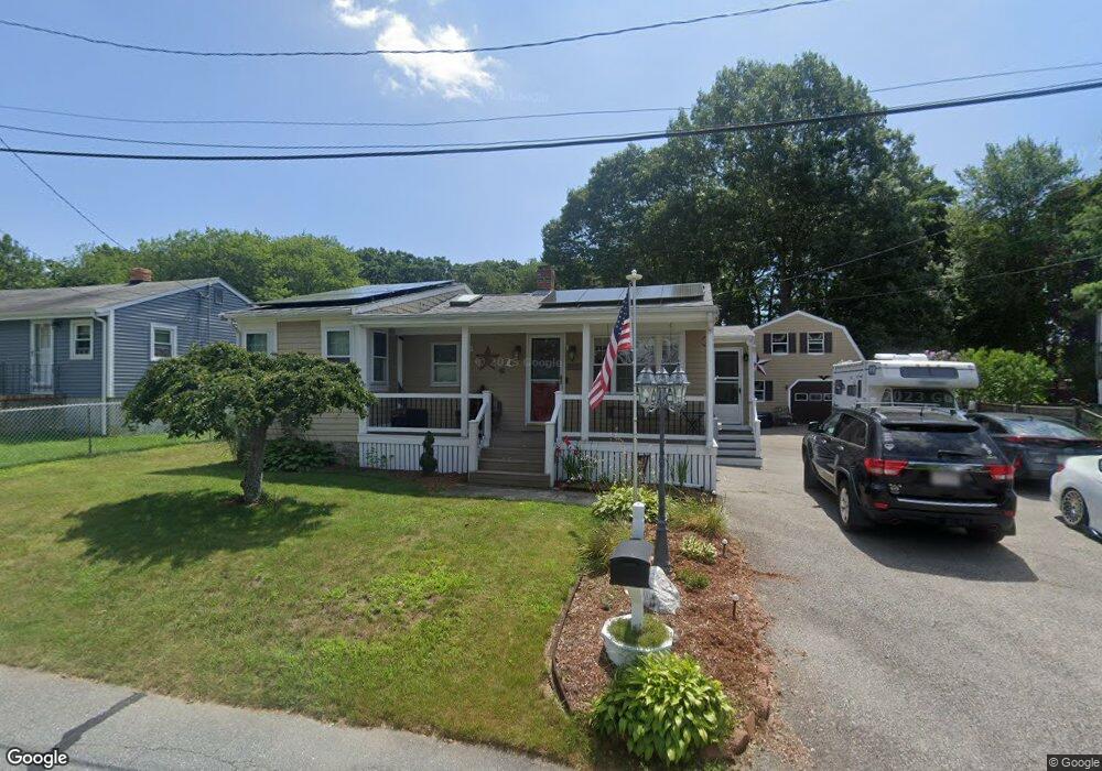
9 Swift St Fairhaven, MA 02719
East Fairhaven NeighborhoodEstimated Value: $440,000 - $495,000
2
Beds
2
Baths
1,096
Sq Ft
$429/Sq Ft
Est. Value
About This Home
This home is located at 9 Swift St, Fairhaven, MA 02719 and is currently estimated at $470,206, approximately $429 per square foot. 9 Swift St is a home located in Bristol County with nearby schools including Fairhaven High School, St. Joseph School, and Holy Family Holy Name School.
Ownership History
Date
Name
Owned For
Owner Type
Purchase Details
Closed on
Jan 19, 1989
Sold by
Antonsen Robert P
Bought by
Rock Richard C
Current Estimated Value
Home Financials for this Owner
Home Financials are based on the most recent Mortgage that was taken out on this home.
Original Mortgage
$88,230
Interest Rate
10.38%
Mortgage Type
Purchase Money Mortgage
Create a Home Valuation Report for This Property
The Home Valuation Report is an in-depth analysis detailing your home's value as well as a comparison with similar homes in the area
Home Values in the Area
Average Home Value in this Area
Purchase History
| Date | Buyer | Sale Price | Title Company |
|---|---|---|---|
| Rock Richard C | $90,000 | -- |
Source: Public Records
Mortgage History
| Date | Status | Borrower | Loan Amount |
|---|---|---|---|
| Open | Rock Richard C | $78,000 | |
| Closed | Rock Richard C | $89,400 | |
| Closed | Rock Richard C | $88,230 |
Source: Public Records
Tax History
| Year | Tax Paid | Tax Assessment Tax Assessment Total Assessment is a certain percentage of the fair market value that is determined by local assessors to be the total taxable value of land and additions on the property. | Land | Improvement |
|---|---|---|---|---|
| 2025 | $33 | $359,300 | $171,700 | $187,600 |
| 2024 | $3,114 | $337,400 | $171,700 | $165,700 |
| 2023 | $2,972 | $298,700 | $150,400 | $148,300 |
| 2022 | $2,820 | $275,900 | $139,800 | $136,100 |
| 2021 | $2,659 | $235,500 | $126,500 | $109,000 |
| 2020 | $2,605 | $235,500 | $126,500 | $109,000 |
| 2019 | $2,469 | $211,600 | $104,900 | $106,700 |
| 2018 | $2,357 | $200,600 | $99,800 | $100,800 |
| 2017 | $2,351 | $195,300 | $99,800 | $95,500 |
| 2016 | $2,323 | $190,700 | $99,800 | $90,900 |
| 2015 | $2,294 | $188,800 | $99,800 | $89,000 |
Source: Public Records
Map
Nearby Homes
- 00 Huttleston Ave
- 33 Narragansett Blvd
- 00 Copeland St
- 3 Earle St
- 3.5 Golf St
- 421 Huttleston Ave
- 190 Sconticut Neck Rd
- 15 Bayview Ave
- 27 Bayview Ave
- 58 Bayview Ave
- 181 Washington St
- 8 Manor Dr
- 20 Nantucket Dr
- 77 Adams St
- 2 Washburn Ave
- 145 Pleasant St
- 11 Lawton St
- 39 Christian St
- 15 School St
- 16 Ash St
Your Personal Tour Guide
Ask me questions while you tour the home.