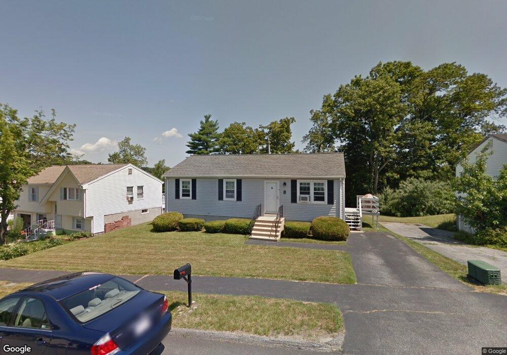
9 Timrod Dr Worcester, MA 01603
Webster Square NeighborhoodEstimated Value: $348,000 - $423,094
2
Beds
2
Baths
1,344
Sq Ft
$295/Sq Ft
Est. Value
About This Home
This home is located at 9 Timrod Dr, Worcester, MA 01603 and is currently estimated at $397,024, approximately $295 per square foot. 9 Timrod Dr is a home located in Worcester County with nearby schools including Chandler Magnet, Jacob Hiatt Magnet School, and Heard Street Discovery Academy.
Create a Home Valuation Report for This Property
The Home Valuation Report is an in-depth analysis detailing your home's value as well as a comparison with similar homes in the area
Home Values in the Area
Average Home Value in this Area
Tax History
| Year | Tax Paid | Tax Assessment Tax Assessment Total Assessment is a certain percentage of the fair market value that is determined by local assessors to be the total taxable value of land and additions on the property. | Land | Improvement |
|---|---|---|---|---|
| 2025 | $4,494 | $340,700 | $98,300 | $242,400 |
| 2024 | $4,340 | $315,600 | $98,300 | $217,300 |
| 2023 | $4,240 | $295,700 | $85,500 | $210,200 |
| 2022 | $3,758 | $247,100 | $68,400 | $178,700 |
| 2021 | $3,606 | $221,500 | $54,700 | $166,800 |
| 2020 | $3,443 | $202,500 | $54,300 | $148,200 |
| 2019 | $3,204 | $178,000 | $47,500 | $130,500 |
| 2018 | $3,088 | $163,300 | $47,500 | $115,800 |
| 2017 | $3,081 | $160,300 | $47,500 | $112,800 |
| 2016 | $3,005 | $145,800 | $33,800 | $112,000 |
| 2015 | $2,926 | $145,800 | $33,800 | $112,000 |
| 2014 | $2,849 | $145,800 | $33,800 | $112,000 |
Source: Public Records
Map
Nearby Homes
- 11 Timrod Dr
- 66 Ledgecrest Dr
- 56 Goddard Memorial Dr
- 34 Scandinavia Ave
- 57 1st St
- 32 Goddard Memorial Dr
- 13 Merchant St
- 1560 Main St
- 1511 Main St Unit C405
- 55 Grandview Ave
- 215 Mill St Unit 113
- 215 Mill St Unit 115
- 37 Gates Rd
- 84 Eureka St
- 103 Henshaw St
- 27 Montague St
- 5 Swan Ave
- 11 Hulbert Rd Unit 13
- 23 Lakewood St
- 415 Mill St
Your Personal Tour Guide
Ask me questions while you tour the home.