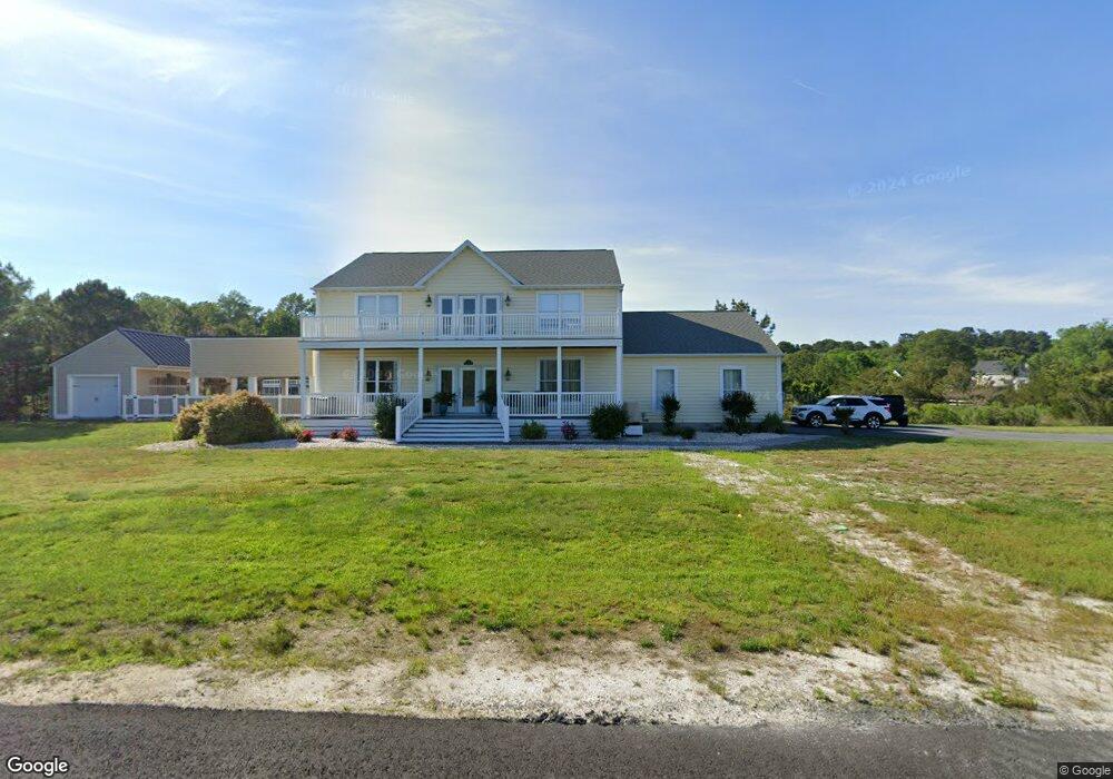
9 W Island Rd Millsboro, DE 19966
Estimated Value: $439,293 - $694,000
4
Beds
--
Bath
3,168
Sq Ft
$178/Sq Ft
Est. Value
About This Home
This home is located at 9 W Island Rd, Millsboro, DE 19966 and is currently estimated at $562,323, approximately $177 per square foot. 9 W Island Rd is a home with nearby schools including Long Neck Elementary School, Millsboro Middle School, and Sussex Central High School.
Ownership History
Date
Name
Owned For
Owner Type
Purchase Details
Closed on
May 17, 2013
Sold by
Eddinger Michael A
Bought by
Eddinger Michael A and Eddinger Denise A
Current Estimated Value
Home Financials for this Owner
Home Financials are based on the most recent Mortgage that was taken out on this home.
Original Mortgage
$417,000
Outstanding Balance
$295,091
Interest Rate
3.45%
Estimated Equity
$267,232
Purchase Details
Closed on
May 10, 2013
Sold by
Eddinger Michael A
Bought by
Eddinger Michael A and Eddinger Denise A
Home Financials for this Owner
Home Financials are based on the most recent Mortgage that was taken out on this home.
Original Mortgage
$417,000
Outstanding Balance
$295,091
Interest Rate
3.45%
Estimated Equity
$267,232
Create a Home Valuation Report for This Property
The Home Valuation Report is an in-depth analysis detailing your home's value as well as a comparison with similar homes in the area
Home Values in the Area
Average Home Value in this Area
Purchase History
| Date | Buyer | Sale Price | Title Company |
|---|---|---|---|
| Eddinger Michael A | $115,000 | -- | |
| Eddinger Michael A | $115,000 | -- |
Source: Public Records
Mortgage History
| Date | Status | Borrower | Loan Amount |
|---|---|---|---|
| Open | Eddinger Michael A | $417,000 | |
| Closed | Eddinger Michael A | $417,000 |
Source: Public Records
Tax History Compared to Growth
Tax History
| Year | Tax Paid | Tax Assessment Tax Assessment Total Assessment is a certain percentage of the fair market value that is determined by local assessors to be the total taxable value of land and additions on the property. | Land | Improvement |
|---|---|---|---|---|
| 2025 | $1,963 | $41,700 | $8,100 | $33,600 |
| 2024 | $1,748 | $41,700 | $8,100 | $33,600 |
| 2023 | $1,746 | $41,700 | $8,100 | $33,600 |
| 2022 | $1,719 | $41,700 | $8,100 | $33,600 |
| 2021 | $1,668 | $41,700 | $8,100 | $33,600 |
| 2020 | $1,593 | $41,700 | $8,100 | $33,600 |
| 2019 | $1,586 | $41,700 | $8,100 | $33,600 |
| 2018 | $1,601 | $41,700 | $0 | $0 |
| 2017 | $1,614 | $41,700 | $0 | $0 |
| 2016 | $1,425 | $41,700 | $0 | $0 |
| 2015 | $1,331 | $40,750 | $0 | $0 |
| 2014 | $1,311 | $38,450 | $0 | $0 |
Source: Public Records
Map
Nearby Homes
- 25473 Scotty St
- 292 Pond Rd
- 25530 Crab Alley W Unit 1385
- 33931 Liberty St Unit 52357
- 285 Pond Rd
- 34276 Westwood Dr N Unit 35061
- 33928 New Moon St Unit C-2
- 29 Creek Dr
- 25721 American Ave
- 25760 Blue Ridge St Unit 22965
- 16 Creek Dr
- 25780 Blue Ridge St Unit 4198
- 25754 Blue Ridge St
- 25784 Blue Ridge St Unit 55774
- 34013 Taylor Dr N Unit 1351
- 34396 High Tide Dr S Unit 21326
- 25920 Atlas St Unit 53011
- 25914 Atlas St
- 34066 Taylor N Unit 1008
- 25908 E Wind Dr Unit 1001