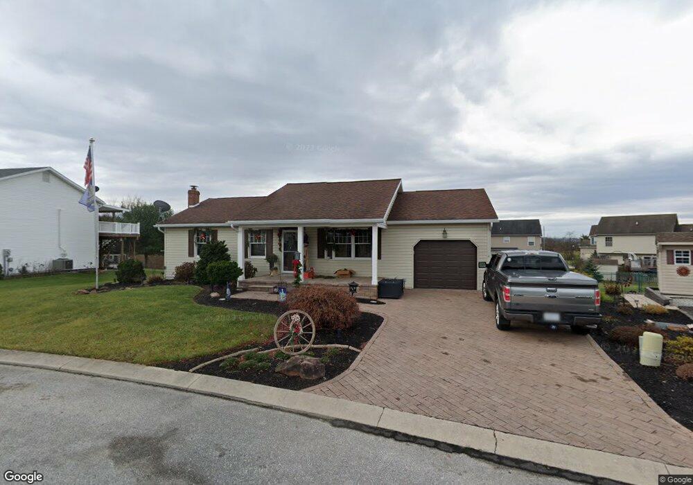
9 White Birch Dr Unit 15 Littlestown, PA 17340
Estimated Value: $261,000 - $311,000
3
Beds
2
Baths
1,134
Sq Ft
$250/Sq Ft
Est. Value
About This Home
This home is located at 9 White Birch Dr Unit 15, Littlestown, PA 17340 and is currently estimated at $283,970, approximately $250 per square foot. 9 White Birch Dr Unit 15 is a home located in Adams County with nearby schools including Rolling Acres El School, Maple Avenue Middle School, and Littlestown Senior High School.
Ownership History
Date
Name
Owned For
Owner Type
Purchase Details
Closed on
Sep 7, 2001
Bought by
Mcmaster Troy J
Current Estimated Value
Create a Home Valuation Report for This Property
The Home Valuation Report is an in-depth analysis detailing your home's value as well as a comparison with similar homes in the area
Home Values in the Area
Average Home Value in this Area
Purchase History
| Date | Buyer | Sale Price | Title Company |
|---|---|---|---|
| Mcmaster Troy J | -- | -- |
Source: Public Records
Tax History Compared to Growth
Tax History
| Year | Tax Paid | Tax Assessment Tax Assessment Total Assessment is a certain percentage of the fair market value that is determined by local assessors to be the total taxable value of land and additions on the property. | Land | Improvement |
|---|---|---|---|---|
| 2025 | $4,552 | $185,000 | $27,400 | $157,600 |
| 2024 | $3,795 | $185,000 | $27,400 | $157,600 |
| 2023 | $3,682 | $185,000 | $27,400 | $157,600 |
| 2022 | $3,537 | $183,500 | $27,400 | $156,100 |
| 2021 | $3,422 | $183,500 | $27,400 | $156,100 |
| 2020 | $3,589 | $183,500 | $27,400 | $156,100 |
| 2019 | $3,515 | $183,500 | $27,400 | $156,100 |
| 2018 | $3,246 | $183,500 | $27,400 | $156,100 |
| 2017 | $3,154 | $183,500 | $27,400 | $156,100 |
| 2016 | -- | $183,500 | $27,400 | $156,100 |
| 2015 | -- | $183,500 | $27,400 | $156,100 |
| 2014 | -- | $183,500 | $27,400 | $156,100 |
Source: Public Records
Map
Nearby Homes
- 67 Cedarfield Dr
- 28 Bonniefield Cir Unit 25
- 1 Hickory Ave
- 8 Maple St
- 13 N Pine St
- 780 White Hall Rd
- 860 Bon Ox Rd
- 464 Locust Ln
- 549 Grant Dr Unit 549
- 871 Sherman Dr Unit 871
- 948 Heritage Dr Unit 948
- 0 Littlestown Rd
- 930 Hoffman Rd
- 279 Longstreet Dr Unit 279
- 4900 Hanover Rd
- 70 Sells Station Rd
- 80 Sells Station Rd
- 345 Smoketown Rd
- 1365 Hanover Rd Unit 15
- 2325 York Rd
- 7 White Birch Dr Unit 16
- 11 White Birch Dr Unit 20
- 12 Sycamore Ct Unit 69
- 10 Sycamore Ct Unit 68
- 14 Sycamore Ct Unit 70
- 8 Sycamore Ct Unit 67
- 8 White Birch Dr Unit 14
- 13 White Birch Dr Unit 21
- 5 White Birch Dr Unit 17
- 6 Sycamore Ct Unit 66
- 10 White Birch Dr Unit 25
- 16 Sycamore Ct Unit 71
- 1 Holly Ct Unit 13
- 12 White Birch Dr Unit 26
- 15 White Birch Dr Unit 22
- 3 White Birch Dr Unit 18
- 4 Sycamore Ct Unit 65
- 18 Sycamore Ct Unit 72
- 7 Sycamore Ct Unit 63
- 14 White Birch Dr Unit 27