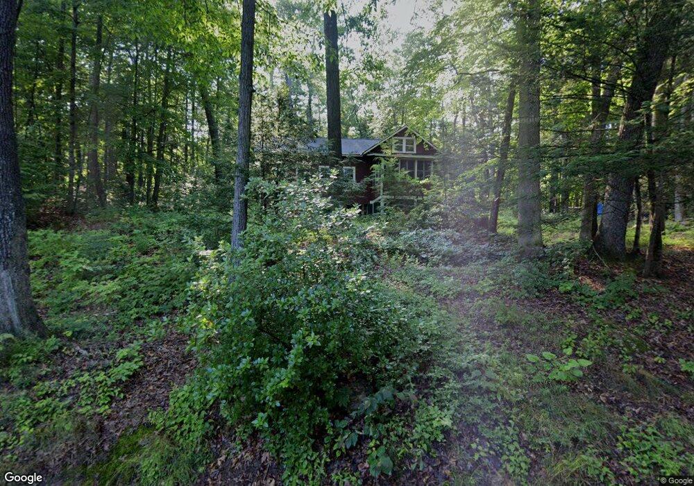
9 Wood Way Northfield, MA 01360
Estimated Value: $137,000 - $183,849
2
Beds
1
Bath
810
Sq Ft
$210/Sq Ft
Est. Value
About This Home
This home is located at 9 Wood Way, Northfield, MA 01360 and is currently estimated at $169,712, approximately $209 per square foot. 9 Wood Way is a home located in Franklin County with nearby schools including Pioneer Valley Regional.
Ownership History
Date
Name
Owned For
Owner Type
Purchase Details
Closed on
Nov 19, 2004
Sold by
Krichko Kip A
Bought by
Krichko Leslie B
Current Estimated Value
Purchase Details
Closed on
May 18, 2001
Sold by
Cruthers Robert D
Bought by
Krichko Kip A
Purchase Details
Closed on
Sep 19, 2000
Sold by
Longley Henry W
Bought by
Cruthers Robert D and Broadhead James L
Purchase Details
Closed on
Aug 29, 1995
Sold by
Longley Henry W and Christine Longley M
Bought by
Longley Henry W
Create a Home Valuation Report for This Property
The Home Valuation Report is an in-depth analysis detailing your home's value as well as a comparison with similar homes in the area
Home Values in the Area
Average Home Value in this Area
Purchase History
| Date | Buyer | Sale Price | Title Company |
|---|---|---|---|
| Krichko Leslie B | -- | -- | |
| Krichko Kip A | $35,000 | -- | |
| Cruthers Robert D | $32,000 | -- | |
| Longley Henry W | $15,000 | -- | |
| Krichko Leslie B | -- | -- | |
| Krichko Kip A | $35,000 | -- |
Source: Public Records
Tax History Compared to Growth
Tax History
| Year | Tax Paid | Tax Assessment Tax Assessment Total Assessment is a certain percentage of the fair market value that is determined by local assessors to be the total taxable value of land and additions on the property. | Land | Improvement |
|---|---|---|---|---|
| 2025 | $1,643 | $118,700 | $42,900 | $75,800 |
| 2024 | $1,555 | $114,500 | $40,400 | $74,100 |
| 2023 | $1,435 | $105,700 | $40,000 | $65,700 |
| 2022 | $1,331 | $96,100 | $40,000 | $56,100 |
| 2021 | $1,575 | $97,700 | $41,600 | $56,100 |
| 2020 | $1,490 | $89,700 | $41,600 | $48,100 |
| 2019 | $1,521 | $87,400 | $41,600 | $45,800 |
| 2018 | $1,511 | $84,600 | $41,600 | $43,000 |
| 2017 | $1,392 | $84,600 | $41,600 | $43,000 |
| 2016 | $1,344 | $84,600 | $41,600 | $43,000 |
| 2015 | $1,422 | $85,400 | $41,600 | $43,800 |
Source: Public Records
Map
Nearby Homes
- 14 Wood Way
- 181 Main St
- 94 Main St
- 22 Old Turnpike Rd
- 719 Mount Hermon Station Rd
- 12 Parker Ave Unit 1
- 294 Capt Beers Plain Rd
- 339 Burt Hill Rd
- 0 Old Tipping Rock Rd Unit 34
- 259 Bolton Rd
- 0 Sears St Unit 23759828
- Lot 14 Northfield Rd
- 49 Whitetail Dr
- 0, Lot 2 Flower Hill Rd
- 0, Lot 1 Flower Hill Rd
- 153 Back Ashuelot Rd
- 12 Wetherby Dr
- 19 Back Ashuelot Rd
- 406 Back Ashuelot Rd
- 111 Warwick Rd