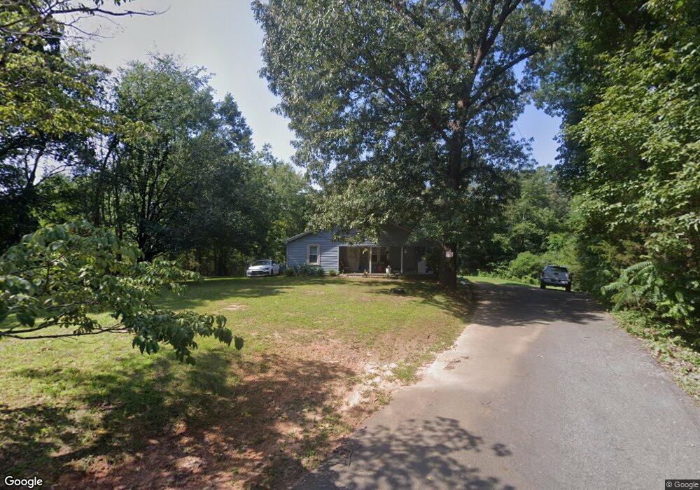
90 Baker St Cookeville, TN 38501
Estimated Value: $207,000 - $229,255
3
Beds
1
Bath
1,132
Sq Ft
$193/Sq Ft
Est. Value
About This Home
This home is located at 90 Baker St, Cookeville, TN 38501 and is currently estimated at $218,752, approximately $193 per square foot. 90 Baker St is a home located in Putnam County with nearby schools including Jere Whitson Elementary School, Cookeville High School, and Avery Trace Middle School.
Ownership History
Date
Name
Owned For
Owner Type
Purchase Details
Closed on
Oct 11, 2023
Sold by
Design Development Of Tennessee Llc
Bought by
Conner Scott and Conner Tonya
Current Estimated Value
Purchase Details
Closed on
Nov 21, 2017
Sold by
Wilson Terry M
Bought by
Jacobs Robin Dawn and Conner Tonya Joan
Purchase Details
Closed on
May 20, 1994
Sold by
Ron Walker
Bought by
Wilson Terry M
Purchase Details
Closed on
Jan 1, 1986
Bought by
Walker Ron
Create a Home Valuation Report for This Property
The Home Valuation Report is an in-depth analysis detailing your home's value as well as a comparison with similar homes in the area
Home Values in the Area
Average Home Value in this Area
Purchase History
| Date | Buyer | Sale Price | Title Company |
|---|---|---|---|
| Conner Scott | $34,900 | None Listed On Document | |
| Jacobs Robin Dawn | -- | -- | |
| Wilson Terry M | -- | -- | |
| Walker Ron | $23,000 | -- |
Source: Public Records
Tax History Compared to Growth
Tax History
| Year | Tax Paid | Tax Assessment Tax Assessment Total Assessment is a certain percentage of the fair market value that is determined by local assessors to be the total taxable value of land and additions on the property. | Land | Improvement |
|---|---|---|---|---|
| 2024 | $1,203 | $33,600 | $13,125 | $20,475 |
| 2023 | $1,203 | $33,600 | $13,125 | $20,475 |
| 2022 | $1,107 | $33,600 | $13,125 | $20,475 |
| 2021 | $1,106 | $33,600 | $13,125 | $20,475 |
| 2020 | $942 | $33,600 | $13,125 | $20,475 |
| 2019 | $942 | $24,050 | $13,125 | $10,925 |
| 2018 | $859 | $24,050 | $13,125 | $10,925 |
| 2017 | $859 | $24,050 | $13,125 | $10,925 |
| 2016 | $859 | $24,050 | $13,125 | $10,925 |
| 2015 | $891 | $24,050 | $13,125 | $10,925 |
| 2014 | $790 | $21,312 | $0 | $0 |
Source: Public Records
Map
Nearby Homes
- 359 Shepherd Hills Rd
- 000 Shepherd Hills Rd
- 23 AC Forrest Rd Tract 1
- 1398 Shipley Rd
- 6.39 Ac Shipley Church Rd
- 0 Shipley Church Rd
- 1688 Farmington Dr
- 1325 Bridle Path
- 328 Wedgewood St
- 1308 Bridle Path
- 1849 Summerhaven Ave
- 1376 Buckingham Place
- 1205 Buckingham Place
- 2760 Shipley Church Rd
- 435 Juniper Dr
- 332 Hemlock Cir
- 1058 Mcgregor Ln
- 1198 N Franklin Ave
- 309 W 12th St
- 1156 Beam Ave
- 65 Baker St
- 489 Dogwood Cir
- 479 Dogwood Cir
- 495 Dogwood Cir
- 50 Baker St
- 470 Dogwood Cir
- 499 Dogwood Cir
- 480 Dogwood Cir
- 409 Shepherd Hills Rd
- 30 Baker St
- 460 Dogwood Cir
- 389 Shepherd Hills Rd
- 490 Dogwood Cir
- 2215 Cliff Ln
- 10 Baker St
- 439 Shepherd Hills Rd
- 500 Dogwood Cir
- 519 Dogwood Cir
- 439 Dogwood Cir
- 440 Dogwood Cir