Estimated Value: $209,000 - $240,000
3
Beds
1
Bath
1,080
Sq Ft
$210/Sq Ft
Est. Value
About This Home
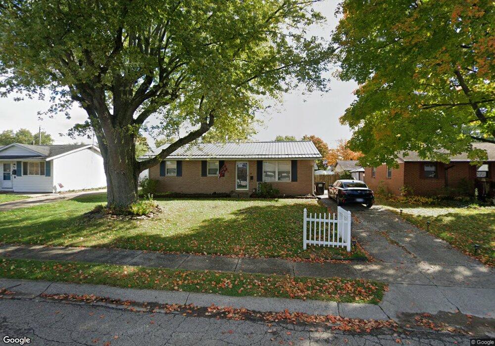
This home is located at 90 Fieldpoint Rd, Heath, OH 43056 and is currently estimated at $227,000, approximately $210 per square foot. 90 Fieldpoint Rd is a home located in Licking County with nearby schools including Garfield Elementary School, Stevenson Elementary School, and Heath Middle School.
Ownership History
Date
Name
Owned For
Owner Type
Purchase Details
Closed on
Jun 12, 2018
Sold by
Willey Edward and Willey Tracy
Bought by
Zado Rentals Llc
Current Estimated Value
Purchase Details
Closed on
Sep 1, 2000
Sold by
O'Dell Howard
Bought by
Willey Edward E and Willey Tracey L
Home Financials for this Owner
Home Financials are based on the most recent Mortgage that was taken out on this home.
Original Mortgage
$86,896
Interest Rate
8.26%
Mortgage Type
FHA
Create a Home Valuation Report for This Property
The Home Valuation Report is an in-depth analysis detailing your home's value as well as a comparison with similar homes in the area
Home Values in the Area
Average Home Value in this Area
Purchase History
| Date | Buyer | Sale Price | Title Company |
|---|---|---|---|
| Zado Rentals Llc | -- | None Available | |
| Willey Edward E | $87,000 | -- |
Source: Public Records
Mortgage History
| Date | Status | Borrower | Loan Amount |
|---|---|---|---|
| Previous Owner | Willey Edward E | $86,896 |
Source: Public Records
Tax History Compared to Growth
Tax History
| Year | Tax Paid | Tax Assessment Tax Assessment Total Assessment is a certain percentage of the fair market value that is determined by local assessors to be the total taxable value of land and additions on the property. | Land | Improvement |
|---|---|---|---|---|
| 2024 | $2,747 | $62,590 | $16,070 | $46,520 |
| 2023 | $3,042 | $62,590 | $16,070 | $46,520 |
| 2022 | $2,346 | $42,390 | $8,330 | $34,060 |
| 2021 | $2,394 | $42,390 | $8,330 | $34,060 |
| 2020 | $2,409 | $42,390 | $8,330 | $34,060 |
| 2019 | $1,993 | $35,640 | $10,400 | $25,240 |
| 2018 | $2,015 | $0 | $0 | $0 |
| 2017 | $1,912 | $0 | $0 | $0 |
| 2016 | $1,818 | $0 | $0 | $0 |
| 2015 | $1,811 | $0 | $0 | $0 |
| 2014 | $869 | $0 | $0 | $0 |
| 2013 | $1,761 | $0 | $0 | $0 |
Source: Public Records
Map
Nearby Homes
- 536 Partridge Rd
- 521 Partridge Rd
- 1055 Weiant Ave
- 146 S 31st St
- 171 Cynthia St
- 878 Oberlin Dr
- 944 Fieldson Dr
- 39 N 31st St
- 915 W Main St
- 25 S 24th St
- 975 Glenmore Ave
- 98 Burt Ave
- 172 S Williams St
- 52 N 24th St
- 132 Cambria St
- 934 Davis Ave
- 35 Stone House Ct
- 46 N 21st St
- 1416 Amesbury Ln
- 623 W Main St
- 92 Fieldpoint Rd
- 86 Fieldpoint Rd
- 94 Fieldpoint Rd
- 573 Partridge Rd
- 569 Partridge Rd
- 581 Partridge Rd
- 85 Fieldpoint Rd
- 563 Partridge Rd
- 83 Fieldpoint Rd
- 84 Fieldpoint Rd
- 587 Partridge Rd
- 96 Fieldpoint Rd
- 87 Fieldpoint Rd
- 89 Fieldpoint Rd
- 557 Partridge Rd
- 593 Partridge Rd
- 82 Fieldpoint Rd
- 98 Fieldpoint Rd
- 79 Fieldpoint Rd
- 91 Fieldpoint Rd