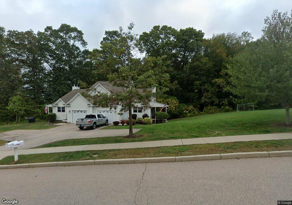
90 Murphys Dr Groton, CT 06340
Estimated Value: $359,524 - $412,000
3
Beds
3
Baths
1,492
Sq Ft
$267/Sq Ft
Est. Value
About This Home
This home is located at 90 Murphys Dr, Groton, CT 06340 and is currently estimated at $398,131, approximately $266 per square foot. 90 Murphys Dr is a home located in New London County with nearby schools including Charles Barnum Discovery Magnet School, Groton Middle School, and Robert E. Fitch High School.
Ownership History
Date
Name
Owned For
Owner Type
Purchase Details
Closed on
Aug 1, 2013
Sold by
Kenyon John
Bought by
White Erik A
Current Estimated Value
Home Financials for this Owner
Home Financials are based on the most recent Mortgage that was taken out on this home.
Original Mortgage
$193,000
Outstanding Balance
$140,969
Interest Rate
3.95%
Estimated Equity
$257,162
Purchase Details
Closed on
Dec 6, 2007
Sold by
Groton Woods Walk Inc
Bought by
Kenyon John
Home Financials for this Owner
Home Financials are based on the most recent Mortgage that was taken out on this home.
Original Mortgage
$133,800
Interest Rate
6.37%
Create a Home Valuation Report for This Property
The Home Valuation Report is an in-depth analysis detailing your home's value as well as a comparison with similar homes in the area
Home Values in the Area
Average Home Value in this Area
Purchase History
| Date | Buyer | Sale Price | Title Company |
|---|---|---|---|
| White Erik A | $218,000 | -- | |
| Kenyon John | $290,600 | -- |
Source: Public Records
Mortgage History
| Date | Status | Borrower | Loan Amount |
|---|---|---|---|
| Open | White Erik A | $193,000 | |
| Previous Owner | Kenyon John | $136,400 | |
| Previous Owner | Kenyon John | $133,800 |
Source: Public Records
Tax History
| Year | Tax Paid | Tax Assessment Tax Assessment Total Assessment is a certain percentage of the fair market value that is determined by local assessors to be the total taxable value of land and additions on the property. | Land | Improvement |
|---|---|---|---|---|
| 2025 | $4,433 | $159,390 | $47,817 | $111,573 |
| 2024 | $4,157 | $159,390 | $47,817 | $111,573 |
| 2023 | $4,005 | $159,390 | $0 | $159,390 |
| 2022 | $3,929 | $159,390 | $0 | $159,390 |
| 2021 | $4,055 | $137,550 | $0 | $137,550 |
| 2020 | $4,012 | $137,550 | $0 | $137,550 |
| 2019 | $3,845 | $137,550 | $0 | $137,550 |
| 2018 | $3,806 | $137,550 | $0 | $137,550 |
| 2017 | $3,732 | $137,550 | $0 | $137,550 |
| 2016 | $3,801 | $150,640 | $0 | $150,640 |
| 2015 | $3,683 | $150,640 | $0 | $150,640 |
| 2014 | $3,597 | $150,640 | $0 | $150,640 |
Source: Public Records
Map
Nearby Homes
- 1260 Route 12
- 0 Briar Hill Rd Unit 24148389
- 1010 Long Cove Rd Unit LOT 23
- 1010 Long Cove Rd Unit LOT 17
- 435 Military Hwy Unit 449
- 1513 Connecticut 12
- 39 Inchcliffe Dr
- 2 John Ave
- 310 Lestertown Rd
- 141 Starr Hill Rd
- 17 Patricia Ct
- 22 Toll Gate Rd
- 944 Long Cove Rd Unit 1
- 1581 Route 12
- 517-571 Gold Star Hwy
- 41 Riverview Ave
- 153 Old Norwich Rd
- 90 Crown Knoll Ct Unit 136
- 85 Crown Knoll Ct Unit 110
- 74 Crown Knoll Ct Unit 162
- 90 Murphys Dr Unit 90
- 88 Murphys Dr
- 88 Murphys Dr Unit 88
- 88 Murphys Dr Unit 4A
- 102 Murphys Dr
- 102 Murphys Dr Unit 5A
- 93 Murphys Dr
- 104 Murphys Dr
- 104 Murphys Dr Unit 104
- 54 Murphys Dr
- 54 Murphys Dr Unit 54
- 95 Murphys Dr
- 95 Murphys Dr Unit 11A
- 56 Murphys Dr
- 56 Murphys Dr Unit 56
- 77 Murphys Dr
- 75 Murphys Dr
- 109 Murphys Dr
- 109 Murphys Dr Unit 109
- 111 Murphys Dr
Your Personal Tour Guide
Ask me questions while you tour the home.