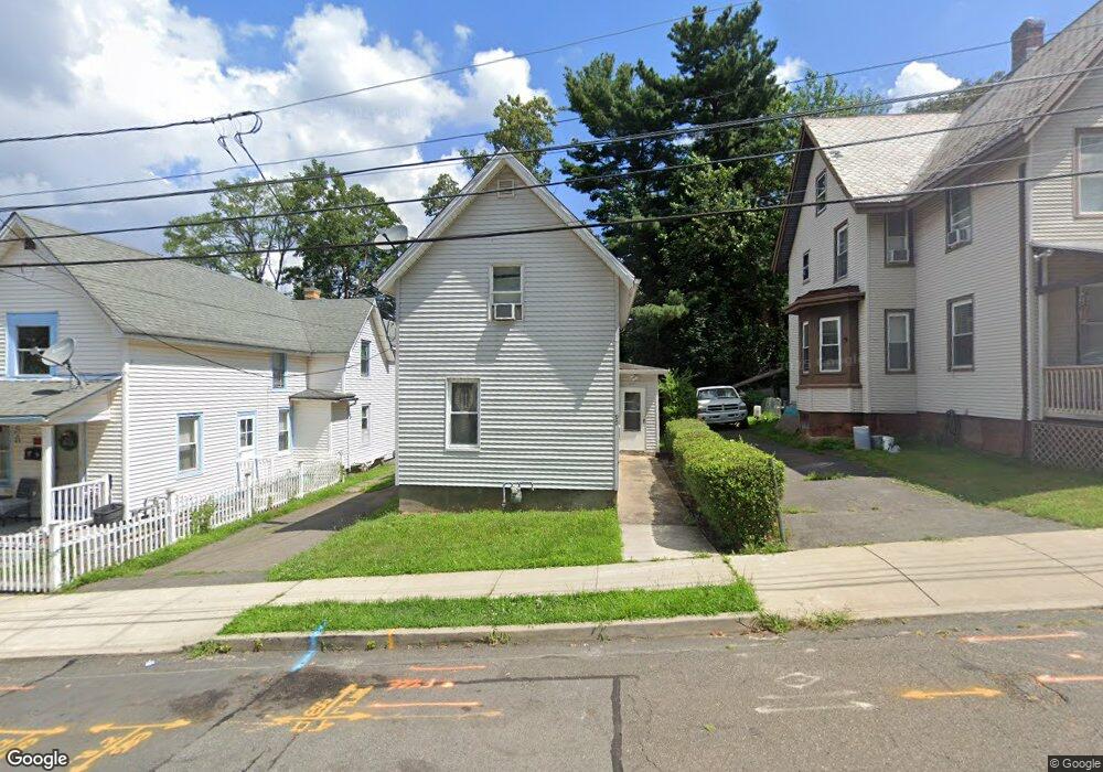
90 Myrtle St Meriden, CT 06450
Estimated Value: $223,342 - $248,000
4
Beds
2
Baths
965
Sq Ft
$242/Sq Ft
Est. Value
About This Home
This home is located at 90 Myrtle St, Meriden, CT 06450 and is currently estimated at $233,336, approximately $241 per square foot. 90 Myrtle St is a home located in New Haven County with nearby schools including Roger Sherman Elementary School, Washington Middle School, and Francis T. Maloney High School.
Ownership History
Date
Name
Owned For
Owner Type
Purchase Details
Closed on
May 5, 2000
Sold by
Blum James and Coleman Michael P
Bought by
Loayza Roberto S and Arroyo Rosaura
Current Estimated Value
Purchase Details
Closed on
Aug 19, 1999
Sold by
Ranno Cherie G and Blum James
Bought by
Coleman Michael P
Purchase Details
Closed on
Jan 11, 1995
Sold by
Ctb Meriden Prop Inc
Bought by
Ranno Cherie G
Create a Home Valuation Report for This Property
The Home Valuation Report is an in-depth analysis detailing your home's value as well as a comparison with similar homes in the area
Home Values in the Area
Average Home Value in this Area
Purchase History
| Date | Buyer | Sale Price | Title Company |
|---|---|---|---|
| Loayza Roberto S | $72,000 | -- | |
| Coleman Michael P | $12,000 | -- | |
| Ranno Cherie G | $12,000 | -- |
Source: Public Records
Mortgage History
| Date | Status | Borrower | Loan Amount |
|---|---|---|---|
| Open | Ranno Cherie G | $85,000 | |
| Closed | Ranno Cherie G | $71,113 | |
| Closed | Ranno Cherie G | $71,113 |
Source: Public Records
Tax History
| Year | Tax Paid | Tax Assessment Tax Assessment Total Assessment is a certain percentage of the fair market value that is determined by local assessors to be the total taxable value of land and additions on the property. | Land | Improvement |
|---|---|---|---|---|
| 2025 | $3,171 | $83,650 | $19,600 | $64,050 |
| 2024 | $3,221 | $83,650 | $19,600 | $64,050 |
| 2023 | $3,105 | $83,650 | $19,600 | $64,050 |
| 2022 | $2,929 | $83,650 | $19,600 | $64,050 |
| 2021 | $2,407 | $55,300 | $16,520 | $38,780 |
| 2020 | $2,401 | $55,300 | $16,520 | $38,780 |
| 2019 | $2,380 | $55,300 | $16,520 | $38,780 |
| 2018 | $2,390 | $55,300 | $16,520 | $38,780 |
| 2017 | $2,326 | $55,300 | $16,520 | $38,780 |
| 2016 | $2,779 | $71,820 | $18,480 | $53,340 |
| 2015 | $2,779 | $71,680 | $18,340 | $53,340 |
| 2014 | $2,712 | $71,680 | $18,340 | $53,340 |
Source: Public Records
Map
Nearby Homes
- 246 Pratt St
- 250 Pratt St
- 43 N Pearl St
- 121 Liberty St
- 131 Converse Ave
- 33 Prescott St
- 22 Webster St
- 44 Prescott St
- 148 Sherman Ave
- 387 Colony St
- 153 Sterling Village Unit 153
- 201 Colony St
- 499 Liberty St
- 515 Liberty St Unit 515
- 111 Sunset Ave Unit 111, 113, 115
- 111,113 & 115 Sunset Ave
- 358 Gravel St
- 101 Wilcox Ave
- 302 Gravel St
- 122 Willow St
- 86 Myrtle St
- 94 Myrtle St
- 82 Myrtle St
- 14 Linden Place
- 78 Myrtle St
- 12 Linden Place
- 83 Myrtle St
- 83 Myrtle St Unit 1
- 83 Myrtle St Unit 3
- 83 Myrtle St Unit 2
- 8 Linden Place
- 72 Myrtle St
- 91 Myrtle St
- 766 Broad St Unit 2
- 766 Broad St Unit 1
- 766 Broad St
- 772 Broad St
- 750 Broad St
- 73 Myrtle St
- 71 Myrtle St
Your Personal Tour Guide
Ask me questions while you tour the home.