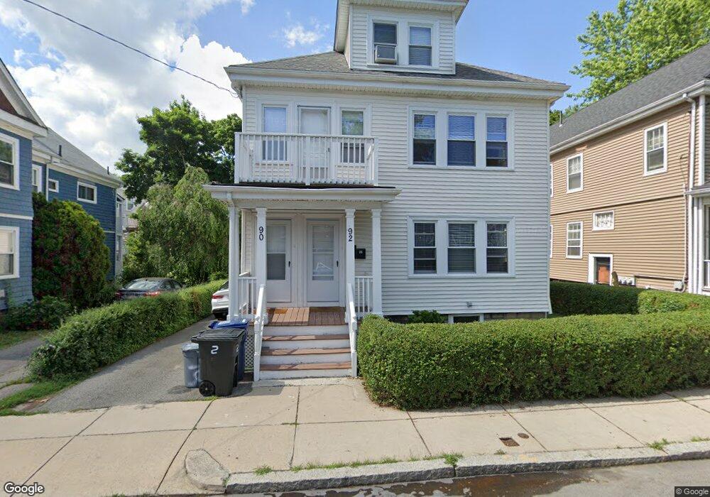
90 Saint Marks Rd Unit 92 Dorchester Center, MA 02124
Saint Marks NeighborhoodEstimated Value: $931,129 - $1,021,000
4
Beds
2
Baths
2,236
Sq Ft
$439/Sq Ft
Est. Value
About This Home
This home is located at 90 Saint Marks Rd Unit 92, Dorchester Center, MA 02124 and is currently estimated at $981,032, approximately $438 per square foot. 90 Saint Marks Rd Unit 92 is a home located in Suffolk County with nearby schools including Neighborhood House Charter School and Helen Y. Davis Leadership Academy Charter Public School.
Ownership History
Date
Name
Owned For
Owner Type
Purchase Details
Closed on
Feb 5, 2018
Sold by
Tran Tam M and Thi-Vu Dao X
Bought by
Deangelo Andrew D and Deangelo Patrick B
Current Estimated Value
Home Financials for this Owner
Home Financials are based on the most recent Mortgage that was taken out on this home.
Original Mortgage
$673,737
Outstanding Balance
$568,865
Interest Rate
3.87%
Mortgage Type
FHA
Estimated Equity
$412,167
Purchase Details
Closed on
Mar 20, 1995
Sold by
Dunphy Kathleen A
Bought by
Tran Thomas and Tran-Vu Dao
Create a Home Valuation Report for This Property
The Home Valuation Report is an in-depth analysis detailing your home's value as well as a comparison with similar homes in the area
Home Values in the Area
Average Home Value in this Area
Purchase History
| Date | Buyer | Sale Price | Title Company |
|---|---|---|---|
| Deangelo Andrew D | $779,000 | -- | |
| Tran Thomas | $109,000 | -- |
Source: Public Records
Mortgage History
| Date | Status | Borrower | Loan Amount |
|---|---|---|---|
| Open | Deangelo Andrew D | $673,737 |
Source: Public Records
Tax History Compared to Growth
Tax History
| Year | Tax Paid | Tax Assessment Tax Assessment Total Assessment is a certain percentage of the fair market value that is determined by local assessors to be the total taxable value of land and additions on the property. | Land | Improvement |
|---|---|---|---|---|
| 2025 | $8,892 | $767,900 | $272,000 | $495,900 |
| 2024 | $8,801 | $807,400 | $278,500 | $528,900 |
| 2023 | $7,956 | $740,800 | $255,500 | $485,300 |
| 2022 | $7,460 | $685,700 | $236,500 | $449,200 |
| 2021 | $6,837 | $640,800 | $221,000 | $419,800 |
| 2020 | $5,745 | $544,000 | $207,500 | $336,500 |
| 2019 | $5,220 | $495,300 | $174,000 | $321,300 |
| 2018 | $4,926 | $470,000 | $161,700 | $308,300 |
| 2017 | $4,525 | $427,300 | $161,700 | $265,600 |
| 2016 | $4,434 | $403,100 | $161,700 | $241,400 |
| 2015 | $3,847 | $317,700 | $113,300 | $204,400 |
| 2014 | $3,602 | $286,300 | $113,300 | $173,000 |
Source: Public Records
Map
Nearby Homes
- 41 King St Unit 1
- 543 Adams St Unit 24
- 334 Centre St Unit 101
- 334 Centre St Unit 2
- 20 Leslie St
- 17 Lafield St Unit 2
- 96 King St Unit 1
- 80-84 Shepton St Unit 80-3
- 51 Florida St Unit 3
- 104 King St Unit 2
- 108 King St Unit 3
- 28 Dix St Unit 3
- 34 Dix St Unit 3
- 381 Adams St Unit 2
- 381 Adams St Unit 1
- 381 Adams St Unit 3
- 61 Shepton St
- 6 Agawam St
- 382 Adams St Unit 384-1
- 20 Parkman St Unit 2
- 90 Saint Marks Rd Unit 2
- 94 Saint Marks Rd Unit 96
- 86-88 Saint Marks Rd Unit 86
- 86 Saint Marks Rd Unit 88
- 57 King St Unit 2
- 57 King St Unit 1
- 57 King St
- 59 King St
- 59 King St Unit 2
- 505 Adams St
- 55 King St Unit 3
- 55 King St Unit 2
- 55 King St Unit 1
- 55 King St Unit c
- 55 King St Unit 3-55
- 509 Adams St Unit 511
- 82 Saint Marks Rd Unit 84
- 51 King St
- 51 King St Unit 3
- 51 King St Unit 2