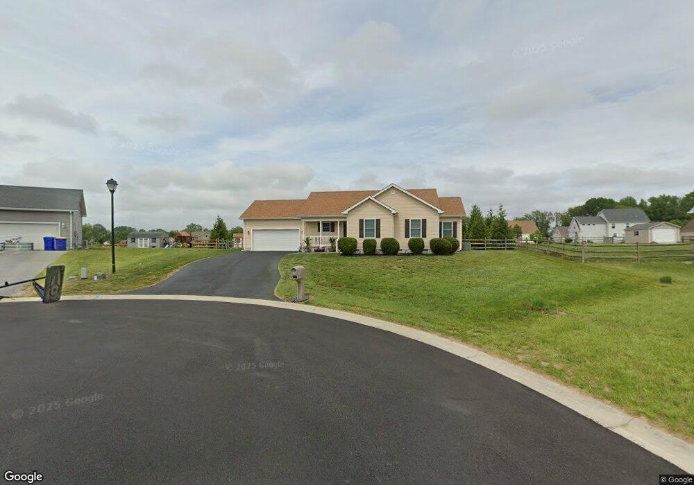
90 W Buck Point Rd Clayton, DE 19938
Estimated Value: $361,260 - $393,000
3
Beds
2
Baths
1,455
Sq Ft
$262/Sq Ft
Est. Value
About This Home
This home is located at 90 W Buck Point Rd, Clayton, DE 19938 and is currently estimated at $381,315, approximately $262 per square foot. 90 W Buck Point Rd is a home with nearby schools including Sunnyside Elementary School, John Bassett Moore Intermediate School, and Smyrna Middle School.
Ownership History
Date
Name
Owned For
Owner Type
Purchase Details
Closed on
Jan 19, 2016
Sold by
Pr Builders Inc
Bought by
Kotowski Leonard S and Kotowski Olga T
Current Estimated Value
Purchase Details
Closed on
Jul 3, 2013
Sold by
Hamilton Harrington Llc
Bought by
Pr Builders Inc
Home Financials for this Owner
Home Financials are based on the most recent Mortgage that was taken out on this home.
Original Mortgage
$1,000,000
Interest Rate
4.41%
Mortgage Type
Construction
Create a Home Valuation Report for This Property
The Home Valuation Report is an in-depth analysis detailing your home's value as well as a comparison with similar homes in the area
Home Values in the Area
Average Home Value in this Area
Purchase History
| Date | Buyer | Sale Price | Title Company |
|---|---|---|---|
| Kotowski Leonard S | $211,000 | None Available | |
| Pr Builders Inc | $480,000 | None Available |
Source: Public Records
Mortgage History
| Date | Status | Borrower | Loan Amount |
|---|---|---|---|
| Previous Owner | Pr Builders Inc | $1,000,000 |
Source: Public Records
Tax History Compared to Growth
Tax History
| Year | Tax Paid | Tax Assessment Tax Assessment Total Assessment is a certain percentage of the fair market value that is determined by local assessors to be the total taxable value of land and additions on the property. | Land | Improvement |
|---|---|---|---|---|
| 2025 | $1,023 | $325,700 | $100,300 | $225,400 |
| 2024 | $1,023 | $325,700 | $100,300 | $225,400 |
| 2023 | $763 | $42,100 | $5,600 | $36,500 |
| 2022 | $740 | $42,100 | $5,600 | $36,500 |
| 2021 | $393 | $42,100 | $5,600 | $36,500 |
| 2020 | $657 | $42,100 | $5,600 | $36,500 |
| 2019 | $665 | $42,100 | $5,600 | $36,500 |
| 2018 | $1,039 | $42,100 | $5,600 | $36,500 |
| 2017 | $1,029 | $42,100 | $0 | $0 |
| 2016 | $1,219 | $41,200 | $0 | $0 |
| 2015 | $207 | $5,600 | $0 | $0 |
| 2014 | $118 | $5,600 | $0 | $0 |
Source: Public Records
Map
Nearby Homes
- 58 New St
- 108 W Commerce St
- 263 Smoky Ln
- 294 Fieldcrest Dr
- 470 Rose Dale Ln
- 31 Summit Dr Unit HANCOCK
- 31 Summit Dr Unit LEGEND
- 31 Summit Dr Unit JACKSON
- 31 Summit Dr Unit JEFFERSON GRAND
- 31 Summit Dr Unit GATSBY
- 31 Summit Dr Unit JEFFERSON
- 31 Summit Dr Unit GLADWYN
- 31 Summit Dr Unit CHARLESTON GRAND
- 31 Summit Dr Unit BRANDYWINE
- 31 Summit Dr Unit PHILADELPHIAN
- 3 Summit Dr
- 174 Hardrock Dr
- 4535 Pearsons Corner Rd
- 35 Dapple Gray Ln
- 000 Chance Rd
- 72 W Buck Point Rd
- 93 W Buck Point Rd
- 52 W Buck Point Rd
- 50 W Buck Point Rd
- 152 E Deer Trail Rd
- 79 Velvet Antler Dr
- 30 W Buck Point Rd
- 63 Velvet Antler Dr
- 163 Velvet Antler Dr
- 99 Velvet Antler Dr
- 111 Velvet Antler Dr
- 170 E Deer Trail Rd
- 183 Velvet Antler Dr
- 76 E Deer Trail Rd
- 74 E Deer Trail Rd
- 16 W Buck Point Rd
- 47 Velvet Antler Dr
- 64 E Deer Trail Rd
- 77 E Deer Trail Rd
- 135 E Deer Trail Rd