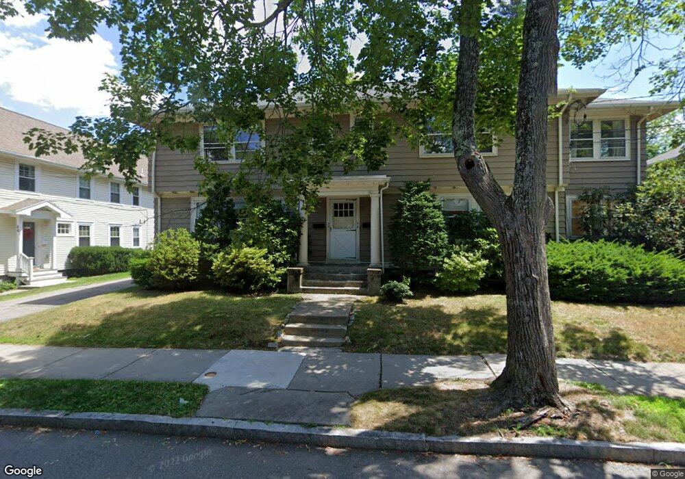
90 Withington Rd Unit 92 Newtonville, MA 02460
Newtonville NeighborhoodEstimated Value: $1,533,000 - $1,782,678
2
Beds
1
Bath
1,300
Sq Ft
$1,266/Sq Ft
Est. Value
About This Home
This home is located at 90 Withington Rd Unit 92, Newtonville, MA 02460 and is currently estimated at $1,646,170, approximately $1,266 per square foot. 90 Withington Rd Unit 92 is a home located in Middlesex County with nearby schools including Cabot Elementary School, F.A. Day Middle School, and Newton North High School.
Ownership History
Date
Name
Owned For
Owner Type
Purchase Details
Closed on
Mar 1, 2017
Sold by
Leahy Anne C and Leahy Richard C
Bought by
Panagioti Llc
Current Estimated Value
Purchase Details
Closed on
Jun 25, 2014
Sold by
Leahy Anne C
Bought by
Leahy Anne C and Leahy Richard C
Create a Home Valuation Report for This Property
The Home Valuation Report is an in-depth analysis detailing your home's value as well as a comparison with similar homes in the area
Home Values in the Area
Average Home Value in this Area
Purchase History
| Date | Buyer | Sale Price | Title Company |
|---|---|---|---|
| Panagioti Llc | $1,200,000 | -- | |
| Leahy Anne C | -- | -- |
Source: Public Records
Tax History Compared to Growth
Tax History
| Year | Tax Paid | Tax Assessment Tax Assessment Total Assessment is a certain percentage of the fair market value that is determined by local assessors to be the total taxable value of land and additions on the property. | Land | Improvement |
|---|---|---|---|---|
| 2025 | $14,944 | $1,524,900 | $1,027,800 | $497,100 |
| 2024 | $14,450 | $1,480,500 | $997,900 | $482,600 |
| 2023 | $13,793 | $1,354,900 | $810,800 | $544,100 |
| 2022 | $13,197 | $1,254,500 | $750,700 | $503,800 |
| 2021 | $12,384 | $1,150,900 | $688,700 | $462,200 |
| 2020 | $12,015 | $1,150,900 | $688,700 | $462,200 |
| 2019 | $11,240 | $1,075,600 | $643,600 | $432,000 |
| 2018 | $8,660 | $800,400 | $550,900 | $249,500 |
| 2017 | $8,165 | $734,300 | $505,400 | $228,900 |
| 2016 | $7,667 | $673,700 | $463,700 | $210,000 |
| 2015 | $7,310 | $629,600 | $433,400 | $196,200 |
Source: Public Records
Map
Nearby Homes
- 44 Blake St Unit 2
- 127-129 Withington Rd Unit 1
- 110 Harvard St Unit A
- 300 Cabot St
- 10 Washington Park
- 10 Washington Park Unit 2
- 10 Washington Park Unit 1
- 48 Harvard St Unit 1
- 22 Walnut Place Unit 1
- 3 Cedar St
- 77 Court St Unit 205
- 34 Morton Rd
- 73 Elmore St
- 686 Centre St
- 324 Adams St Unit 2
- 14 Summit St
- 35 George St Unit 35
- 37 George St Unit 37
- 22-24 Emerald St
- 911 Washington St
- 90/92 Withington Rd Unit 2
- 90 Withington Rd Unit 2
- 90 Withington Rd Unit 1
- 90-92 Withington Rd
- 84 Withington Rd Unit 86
- 84 Withington Rd Unit 1
- 84 Withington Rd Unit 84
- 84 Withington Rd
- 86 Withington Rd
- 96 Withington Rd Unit 98
- 96 Withington Rd Unit 96
- 98 Withington Rd Unit 98
- 84-86 Withington Rd Unit 1
- 84-86 Withington Rd
- 93 Withington Rd Unit 95
- 95 Withington Rd Unit 1
- 93 Withington Rd Unit 2
- 95 Withington Rd Unit 1B
- 82 Withington Rd
- 23 Blake St Unit 25