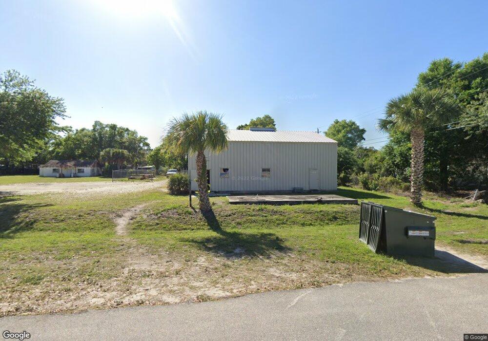
900 Buffalo Rd Titusville, FL 32796
Estimated Value: $194,000 - $235,000
--
Bed
--
Bath
5,511
Sq Ft
$40/Sq Ft
Est. Value
About This Home
This home is located at 900 Buffalo Rd, Titusville, FL 32796 and is currently estimated at $219,741, approximately $39 per square foot. 900 Buffalo Rd is a home located in Brevard County with nearby schools including Mims Elementary School, James Madison Middle School, and Astronaut High School.
Ownership History
Date
Name
Owned For
Owner Type
Purchase Details
Closed on
May 15, 2019
Sold by
The J L And Mary J Richards Trust
Bought by
Jssa Holdings Llc
Current Estimated Value
Purchase Details
Closed on
Jun 15, 1999
Sold by
Richards J L and Richards Mary J
Bought by
Richards J L
Purchase Details
Closed on
Jun 3, 1994
Sold by
Rizzo Joseph L
Bought by
Richards J L and Richards Mary J
Home Financials for this Owner
Home Financials are based on the most recent Mortgage that was taken out on this home.
Original Mortgage
$15,000
Interest Rate
8.27%
Create a Home Valuation Report for This Property
The Home Valuation Report is an in-depth analysis detailing your home's value as well as a comparison with similar homes in the area
Home Values in the Area
Average Home Value in this Area
Purchase History
| Date | Buyer | Sale Price | Title Company |
|---|---|---|---|
| Jssa Holdings Llc | $295,000 | First International Ttl Inc | |
| Richards J L | -- | -- | |
| Richards J L | $20,000 | -- |
Source: Public Records
Mortgage History
| Date | Status | Borrower | Loan Amount |
|---|---|---|---|
| Previous Owner | Richards J L | $15,000 |
Source: Public Records
Tax History Compared to Growth
Tax History
| Year | Tax Paid | Tax Assessment Tax Assessment Total Assessment is a certain percentage of the fair market value that is determined by local assessors to be the total taxable value of land and additions on the property. | Land | Improvement |
|---|---|---|---|---|
| 2025 | $3,871 | $151,390 | -- | -- |
| 2024 | $3,602 | $147,790 | -- | -- |
| 2023 | $3,602 | $138,190 | $36,310 | $101,880 |
| 2022 | $3,205 | $125,630 | $0 | $0 |
| 2021 | $3,077 | $114,210 | $36,310 | $77,900 |
| 2020 | $3,116 | $114,210 | $36,310 | $77,900 |
| 2019 | $3,227 | $114,210 | $36,310 | $77,900 |
| 2018 | $3,745 | $135,790 | $36,310 | $99,480 |
| 2017 | $3,662 | $131,120 | $32,680 | $98,440 |
| 2016 | $2,876 | $126,420 | $32,680 | $93,740 |
| 2015 | $2,675 | $106,850 | $25,420 | $81,430 |
| 2014 | $2,653 | $105,310 | $25,420 | $79,890 |
Source: Public Records
Map
Nearby Homes
- 2135 Mayfair Way Unit Lot 71
- 2135 Mayfair Way Unit 84
- 2135 Mayfair Way Unit 98
- 614 West Ct
- 610 East Ct
- 870 Century Medical Dr
- 2015 Malinda Ln
- 0000 Buffalo Rd
- 671 N Dixie Ave Unit 18A
- 970 Carolina Cir
- 502 Vaughn St
- 424 Lenore Ave
- 7.26 Route 1
- Tbd N Washington Ave
- 1636 Violet Ave
- 2565 Shady Oaks Dr
- 1615 Violet Ave
- 1539 Violet Ave
- 1035 S Mars Ct
- 160 N Williams Ave
- 00 Silver Star Rd
- 880 Buffalo Rd
- 2135 Silver Star Rd
- 2125 Silver Star Rd
- 2135 Mayfair Way Unit 104
- 2135 Mayfair Way Unit 13
- 2135 Mayfair Way Unit 113
- 2135 Mayfair Way Unit 65
- 2135 Mayfair Way Unit 26
- 2135 Mayfair Way Unit 16
- 2135 Mayfair Way Unit 66
- 2135 Mayfair Way Unit 27
- 2135 Mayfair Way Unit 42
- 2135 Mayfair Way Unit 14
- 2135 Mayfair Way Unit 73
- 2135 Mayfair Way Unit 95
- 2135 Mayfair Way
- 0 Silver Star Rd
- 875 Buffalo Rd
- 2140 Silver Star Rd