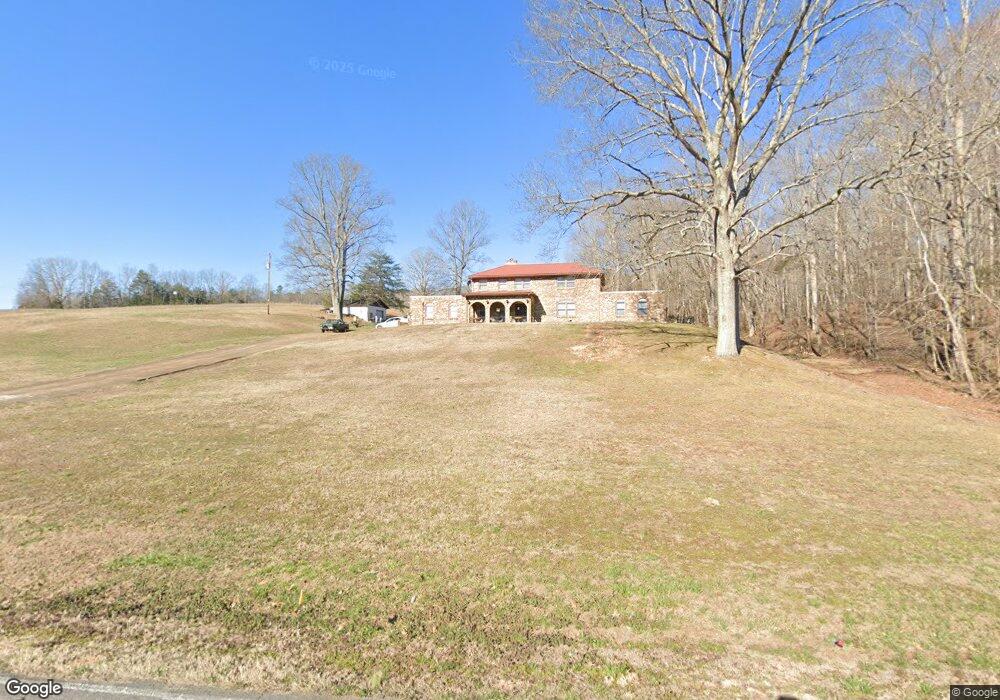
900 Longbranch Rd Hohenwald, TN 38462
Estimated Value: $386,975 - $451,000
--
Bed
2
Baths
2,455
Sq Ft
$166/Sq Ft
Est. Value
About This Home
This home is located at 900 Longbranch Rd, Hohenwald, TN 38462 and is currently estimated at $408,658, approximately $166 per square foot. 900 Longbranch Rd is a home located in Lewis County with nearby schools including Lewis County Elementary School, Lewis County Intermediate School, and Lewis County Middle School.
Ownership History
Date
Name
Owned For
Owner Type
Purchase Details
Closed on
Aug 1, 2025
Sold by
Odom Rodney
Bought by
Odom Caleb
Current Estimated Value
Purchase Details
Closed on
Aug 26, 2024
Sold by
Odom Rodney Allen
Bought by
Odom Caleb
Purchase Details
Closed on
Jan 20, 2023
Sold by
Odom Hubert Lonnie
Bought by
Odom Rodney
Purchase Details
Closed on
Oct 31, 1973
Bought by
Odom Hubert Lonnie
Create a Home Valuation Report for This Property
The Home Valuation Report is an in-depth analysis detailing your home's value as well as a comparison with similar homes in the area
Home Values in the Area
Average Home Value in this Area
Purchase History
| Date | Buyer | Sale Price | Title Company |
|---|---|---|---|
| Odom Caleb | -- | None Listed On Document | |
| Odom Caleb | -- | None Listed On Document | |
| Odom Caleb | -- | None Listed On Document | |
| Odom Caleb | -- | None Listed On Document | |
| Odom Rodney | -- | -- | |
| Odom Rodney | -- | None Listed On Document | |
| Odom Hubert Lonnie | -- | -- |
Source: Public Records
Tax History Compared to Growth
Tax History
| Year | Tax Paid | Tax Assessment Tax Assessment Total Assessment is a certain percentage of the fair market value that is determined by local assessors to be the total taxable value of land and additions on the property. | Land | Improvement |
|---|---|---|---|---|
| 2025 | $905 | $93,725 | $0 | $0 |
| 2024 | $905 | $48,025 | $9,550 | $38,475 |
| 2023 | $905 | $48,025 | $9,550 | $38,475 |
| 2022 | $905 | $48,025 | $9,550 | $38,475 |
| 2021 | $905 | $48,025 | $9,550 | $38,475 |
| 2020 | $905 | $48,025 | $9,550 | $38,475 |
| 2019 | $982 | $42,825 | $8,650 | $34,175 |
| 2018 | $982 | $42,825 | $8,650 | $34,175 |
| 2017 | $982 | $42,825 | $8,650 | $34,175 |
| 2016 | $982 | $42,825 | $8,650 | $34,175 |
| 2015 | -- | $42,825 | $8,650 | $34,175 |
| 2014 | -- | $42,825 | $8,650 | $34,175 |
| 2013 | -- | $40,350 | $0 | $0 |
Source: Public Records
Map
Nearby Homes
- 900 Longbranch Rd
- 675 Rockhouse Rd
- 649 Rockhouse Rd
- 645 Rockhouse Rd
- 0 Rockhouse Railroad Unit 1764557
- 0 Mt Joy Rd Unit RTC1558295
- 0 Mt Joy Rd Unit RTC979114
- 114 Stutts Rd
- 740 Rockhouse Rd
- 104 Morris Rd
- 756 Rockhouse Rd
- 165 Vista Point
- 165 Vista Pointe Rd
- 797 Rockhouse Rd
- 0 Stutts Rd
- 153 Vista Point
- 151 Morris Rd
- 147 Vista Point
- 170 Vista Point
- 122 Stutts Rd