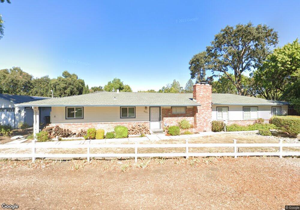
900 Mohr Ln Concord, CA 94518
Colony Park NeighborhoodEstimated Value: $1,087,000 - $1,522,220
3
Beds
3
Baths
2,600
Sq Ft
$478/Sq Ft
Est. Value
About This Home
This home is located at 900 Mohr Ln, Concord, CA 94518 and is currently estimated at $1,243,555, approximately $478 per square foot. 900 Mohr Ln is a home located in Contra Costa County with nearby schools including Fair Oaks Elementary School, Oak Grove Middle School, and Ygnacio Valley High School.
Ownership History
Date
Name
Owned For
Owner Type
Purchase Details
Closed on
Sep 13, 2002
Sold by
Percey William S and Percey Jodeen
Bought by
Blair Joseph and Blair Sarah
Current Estimated Value
Purchase Details
Closed on
Apr 8, 1998
Sold by
Newton Scott and Newton Nicki
Bought by
Percey William S and Percey Jodeen
Home Financials for this Owner
Home Financials are based on the most recent Mortgage that was taken out on this home.
Original Mortgage
$181,500
Interest Rate
7.15%
Mortgage Type
Purchase Money Mortgage
Create a Home Valuation Report for This Property
The Home Valuation Report is an in-depth analysis detailing your home's value as well as a comparison with similar homes in the area
Home Values in the Area
Average Home Value in this Area
Purchase History
| Date | Buyer | Sale Price | Title Company |
|---|---|---|---|
| Blair Joseph | -- | -- | |
| Percey William S | $242,000 | Placer Title Company |
Source: Public Records
Mortgage History
| Date | Status | Borrower | Loan Amount |
|---|---|---|---|
| Previous Owner | Percey William S | $181,500 |
Source: Public Records
Tax History Compared to Growth
Tax History
| Year | Tax Paid | Tax Assessment Tax Assessment Total Assessment is a certain percentage of the fair market value that is determined by local assessors to be the total taxable value of land and additions on the property. | Land | Improvement |
|---|---|---|---|---|
| 2025 | $7,606 | $688,392 | $199,584 | $488,808 |
| 2024 | $5,674 | $674,895 | $195,671 | $479,224 |
| 2023 | $5,674 | $496,663 | $191,835 | $304,828 |
| 2022 | $4,970 | $428,102 | $188,074 | $240,028 |
| 2021 | $4,869 | $419,709 | $184,387 | $235,322 |
| 2019 | $4,794 | $407,263 | $178,919 | $228,344 |
| 2018 | $4,631 | $399,278 | $175,411 | $223,867 |
| 2017 | $4,498 | $391,450 | $171,972 | $219,478 |
| 2016 | $4,397 | $383,775 | $168,600 | $215,175 |
| 2015 | $4,383 | $378,011 | $166,068 | $211,943 |
| 2014 | $4,341 | $370,607 | $162,815 | $207,792 |
Source: Public Records
Map
Nearby Homes
- 906 Hastings Dr
- 2172 La Salle Dr
- 913 Dartmouth Way
- 1640 Amhurst Way
- 55 Normandy Ln
- 1759 Crescent Dr
- 914 Bancroft Rd
- 901 Helix Dr
- 1533 Longford Ct
- 1628 Countrywood Ct
- 1668 Countrywood Ct
- 1730 Getoun Ct
- 951 Bancroft Rd Unit 212
- 1865 Countrywood Ct
- 1409 Dumaine St
- 1014 Bancroft Rd
- 1605 Countrywood Ct
- 1218 Hookston Rd
- 1905 Countrywood Ct
- 1909 Countrywood Ct