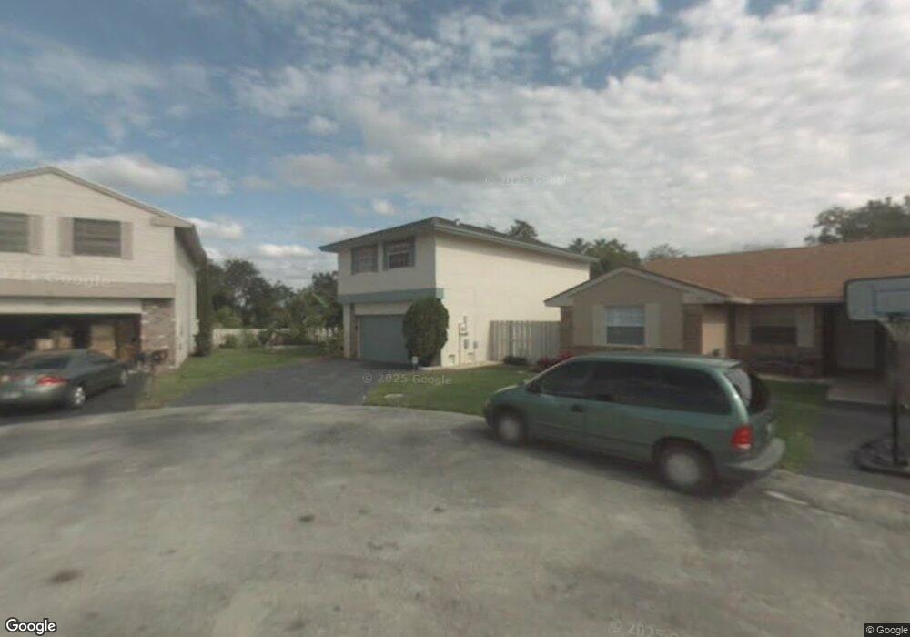
900 Seabrook Ave Davie, FL 33325
Shenandoah NeighborhoodEstimated Value: $642,000 - $749,000
4
Beds
3
Baths
1,814
Sq Ft
$386/Sq Ft
Est. Value
About This Home
This home is located at 900 Seabrook Ave, Davie, FL 33325 and is currently estimated at $700,242, approximately $386 per square foot. 900 Seabrook Ave is a home located in Broward County with nearby schools including Flamingo Elementary School, Indian Ridge Middle School, and Western High School.
Ownership History
Date
Name
Owned For
Owner Type
Purchase Details
Closed on
Jun 28, 2013
Sold by
Molero Elina and Molero Jose Luis
Bought by
Cuartas Carlos Andres and Forero Camilo Alberto Cuartas
Current Estimated Value
Home Financials for this Owner
Home Financials are based on the most recent Mortgage that was taken out on this home.
Original Mortgage
$236,000
Outstanding Balance
$168,743
Interest Rate
3.53%
Mortgage Type
New Conventional
Estimated Equity
$531,499
Purchase Details
Closed on
May 1, 1988
Sold by
Available Not
Bought by
Available Not
Create a Home Valuation Report for This Property
The Home Valuation Report is an in-depth analysis detailing your home's value as well as a comparison with similar homes in the area
Home Values in the Area
Average Home Value in this Area
Purchase History
| Date | Buyer | Sale Price | Title Company |
|---|---|---|---|
| Cuartas Carlos Andres | $300,000 | Cooperative Title Agency Of | |
| Available Not | $82,421 | -- |
Source: Public Records
Mortgage History
| Date | Status | Borrower | Loan Amount |
|---|---|---|---|
| Open | Cuartas Carlos Andres | $236,000 |
Source: Public Records
Tax History Compared to Growth
Tax History
| Year | Tax Paid | Tax Assessment Tax Assessment Total Assessment is a certain percentage of the fair market value that is determined by local assessors to be the total taxable value of land and additions on the property. | Land | Improvement |
|---|---|---|---|---|
| 2025 | $7,728 | $471,000 | -- | -- |
| 2024 | $7,571 | $392,310 | -- | -- |
| 2023 | $7,571 | $380,890 | $0 | $0 |
| 2022 | $7,103 | $369,800 | $0 | $0 |
| 2021 | $6,882 | $359,030 | $0 | $0 |
| 2020 | $6,824 | $354,080 | $0 | $0 |
| 2019 | $6,618 | $346,120 | $0 | $0 |
| 2018 | $6,414 | $339,670 | $0 | $0 |
| 2017 | $6,299 | $332,690 | $0 | $0 |
| 2016 | $6,253 | $325,850 | $0 | $0 |
| 2015 | $6,394 | $323,590 | $0 | $0 |
| 2014 | $6,454 | $279,000 | $0 | $0 |
| 2013 | -- | $228,680 | $74,540 | $154,140 |
Source: Public Records
Map
Nearby Homes
- 13491 SW 7th Place
- 13950 Oak Ridge Dr
- 14040 SW 14th St
- 13371 SW 9th St
- 1041 Amherst Ave
- 810 Greenbriar Ave
- 631 SW 135th Terrace Unit 13
- 930 Greenbriar Ave
- 611 SW 135th Terrace Unit 11
- 13551 SW 6th Place Unit 51
- 555 Abingdon Way
- 621 Lakeshore Terrace
- 13450 SW 6th Place Unit 26
- 13281 SW 10th Manor
- 13490 SW 6th Place Unit 22
- 1590 SW 139th Ave
- 13704 S Garden Cove Cir
- 13371 SW 6th Place Unit 69
- 909 SW 131st Way
- 13381 SW 6th St Unit 112
- 901 Seabrook Ave
- 910 Seabrook Ave
- 911 Seabrook Ave
- 920 Seabrook Ave
- 13800 Appalachian Trail
- 13810 Appalachian Trail
- 921 Seabrook Ave
- 13951 Oaklawn Place
- 13820 Appalachian Trail
- 1011 Monticello Ave
- 1021 Monticello Ave
- 13971 Oaklawn Place
- 1001 Monticello Ave
- 931 Seabrook Ave
- 1031 Monticello Ave
- 13830 Appalachian Trail
- 941 Seabrook Ave
- 1041 Monticello Ave
- 951 Seabrook Ave