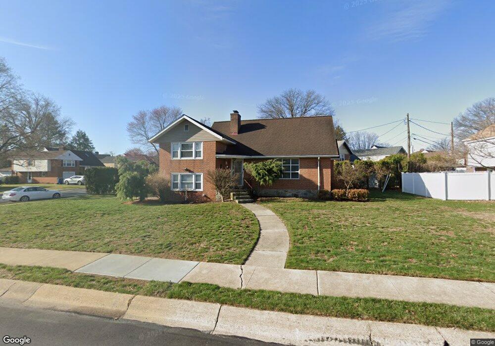
900 Snyder Rd Reading, PA 19609
Whitfield NeighborhoodEstimated Value: $329,183 - $354,000
3
Beds
2
Baths
1,786
Sq Ft
$193/Sq Ft
Est. Value
About This Home
This home is located at 900 Snyder Rd, Reading, PA 19609 and is currently estimated at $345,546, approximately $193 per square foot. 900 Snyder Rd is a home located in Berks County with nearby schools including Whitfield Elementary School, Wilson West Middle School, and Wilson High School.
Ownership History
Date
Name
Owned For
Owner Type
Purchase Details
Closed on
Oct 5, 2018
Sold by
Gantner Chris A and Gantner Lisa P
Bought by
Wurtz Thomas A and Wurtz Deborah D
Current Estimated Value
Home Financials for this Owner
Home Financials are based on the most recent Mortgage that was taken out on this home.
Original Mortgage
$191,105
Outstanding Balance
$166,655
Interest Rate
4.5%
Mortgage Type
VA
Estimated Equity
$178,891
Purchase Details
Closed on
May 13, 2009
Sold by
Dowling William C
Bought by
Gantner Chris A and Gantner Lisa P
Create a Home Valuation Report for This Property
The Home Valuation Report is an in-depth analysis detailing your home's value as well as a comparison with similar homes in the area
Home Values in the Area
Average Home Value in this Area
Purchase History
| Date | Buyer | Sale Price | Title Company |
|---|---|---|---|
| Wurtz Thomas A | $185,000 | Wyomissing Abstract Llc | |
| Gantner Chris A | $181,500 | None Available |
Source: Public Records
Mortgage History
| Date | Status | Borrower | Loan Amount |
|---|---|---|---|
| Open | Wurtz Thomas A | $191,105 |
Source: Public Records
Tax History Compared to Growth
Tax History
| Year | Tax Paid | Tax Assessment Tax Assessment Total Assessment is a certain percentage of the fair market value that is determined by local assessors to be the total taxable value of land and additions on the property. | Land | Improvement |
|---|---|---|---|---|
| 2025 | $2,031 | $107,100 | $34,000 | $73,100 |
| 2024 | $4,582 | $107,100 | $34,000 | $73,100 |
| 2023 | $4,366 | $107,100 | $34,000 | $73,100 |
| 2022 | $4,259 | $107,100 | $34,000 | $73,100 |
| 2021 | $4,109 | $107,100 | $34,000 | $73,100 |
| 2020 | $4,109 | $107,100 | $34,000 | $73,100 |
| 2019 | $3,992 | $107,100 | $34,000 | $73,100 |
| 2018 | $3,958 | $107,100 | $34,000 | $73,100 |
| 2017 | $3,891 | $107,100 | $34,000 | $73,100 |
| 2016 | $1,381 | $107,100 | $34,000 | $73,100 |
| 2015 | $1,354 | $107,100 | $34,000 | $73,100 |
| 2014 | $1,354 | $107,100 | $34,000 | $73,100 |
Source: Public Records
Map
Nearby Homes
- 2035 Franklin Place
- 802 Apple Dr
- 2912 State Hill Rd Unit B-2
- 125 Grandview Blvd
- 118 Laurel Ct Unit 118B
- 2900 State Hill Rd Unit I12
- 191 Hawthorne Ct Unit 191A
- 121 Grandview Blvd
- 120 Laurel Ct Unit 120A
- 150 Laurel Ct Unit 150A
- 179 Hawthorne Ct Unit 179A
- 1914 Andre Ct
- 204 Springmont Dr
- 101 Robert Rd
- 301 Warwick Dr
- 317 Warwick Dr
- 3029 Grandview Blvd
- 2408 Noble St
- 163 Thomas Place
- 2943 Reedy Rd