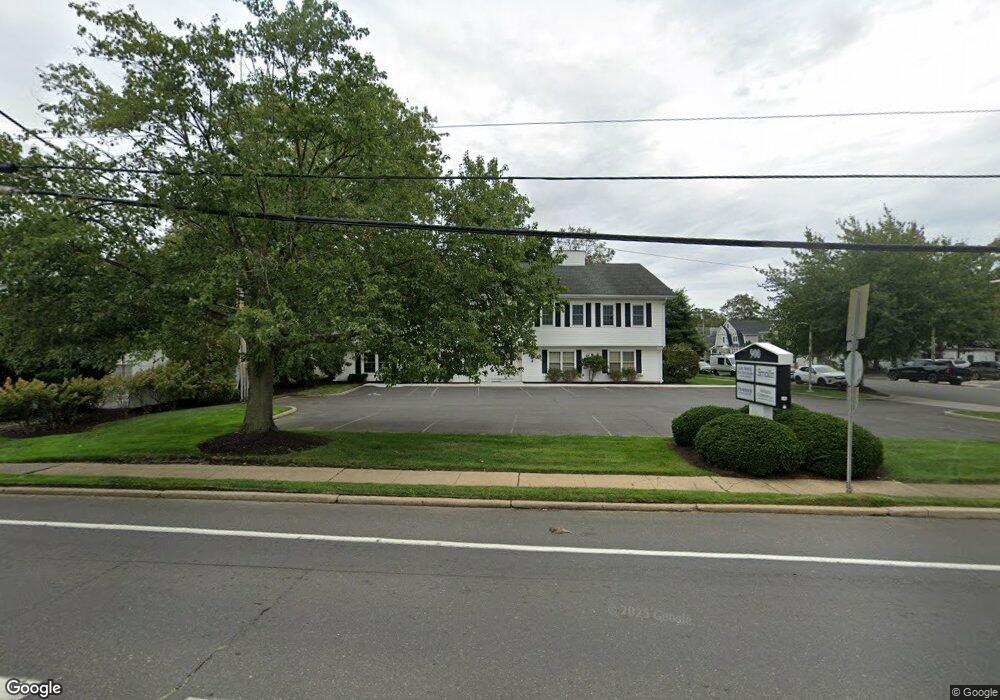
900 State Route 71 Spring Lake, NJ 07762
Estimated Value: $907,401
--
Bed
--
Bath
1,419
Sq Ft
$639/Sq Ft
Est. Value
About This Home
This home is located at 900 State Route 71, Spring Lake, NJ 07762 and is currently estimated at $907,401, approximately $639 per square foot. 900 State Route 71 is a home with nearby schools including Spring Lake Heights Elementary School and St. Catharine School.
Ownership History
Date
Name
Owned For
Owner Type
Purchase Details
Closed on
Aug 10, 2016
Sold by
Froehlich Thomas and Froehlich Susan
Bought by
Ffg Resources Llc
Current Estimated Value
Purchase Details
Closed on
May 30, 2007
Sold by
Calhoun Joan H
Bought by
Froehlich Thomas and Froehlich Susan
Home Financials for this Owner
Home Financials are based on the most recent Mortgage that was taken out on this home.
Original Mortgage
$50,000
Interest Rate
6.19%
Mortgage Type
Commercial
Create a Home Valuation Report for This Property
The Home Valuation Report is an in-depth analysis detailing your home's value as well as a comparison with similar homes in the area
Home Values in the Area
Average Home Value in this Area
Purchase History
| Date | Buyer | Sale Price | Title Company |
|---|---|---|---|
| Ffg Resources Llc | -- | Attorney | |
| Froehlich Thomas | $505,000 | None Available |
Source: Public Records
Mortgage History
| Date | Status | Borrower | Loan Amount |
|---|---|---|---|
| Previous Owner | Froehlich Thomas | $50,000 | |
| Previous Owner | Froehlich Thomas | $404,000 |
Source: Public Records
Tax History Compared to Growth
Tax History
| Year | Tax Paid | Tax Assessment Tax Assessment Total Assessment is a certain percentage of the fair market value that is determined by local assessors to be the total taxable value of land and additions on the property. | Land | Improvement |
|---|---|---|---|---|
| 2025 | $4,094 | $425,700 | $191,600 | $234,100 |
| 2024 | $4,132 | $388,800 | $174,900 | $213,900 |
| 2023 | $4,132 | $368,900 | $166,000 | $202,900 |
| 2022 | $4,171 | $335,600 | $162,800 | $172,800 |
| 2021 | $4,171 | $328,600 | $160,800 | $167,800 |
| 2020 | $4,374 | $322,100 | $160,800 | $161,300 |
| 2019 | $4,390 | $320,000 | $160,800 | $159,200 |
| 2018 | $4,512 | $320,000 | $160,800 | $159,200 |
| 2017 | $5,440 | $400,000 | $160,800 | $239,200 |
| 2016 | $6,666 | $484,100 | $160,800 | $323,300 |
| 2015 | $6,625 | $482,500 | $159,200 | $323,300 |
| 2014 | $6,480 | $482,500 | $159,200 | $323,300 |
Source: Public Records
Map
Nearby Homes
- 513 Mercer Ave
- 74 Linden Ct Unit 12A
- 404 5th Ave
- 418 Salem Ave
- 12 Wyckham Rd
- 15 Wyckham Rd
- 412 Brighton Ave
- 200 Monmouth Ave Unit 21
- 200 Monmouth Ave Unit 7
- 200 Monmouth Ave Unit 5
- 118 Warren Ave
- 1301 Warren Ave Unit 5
- 306 Ocean Rd
- 18 New Jersey 71
- 2412 Homestead Ave
- 20 Sussex Ave
- 16 Sussex Ave
- 1905 3rd Ave
- 700 Ocean Ave Unit G1
- 220 Ludlow Ave
- 614 Mercer Ave
- 612 Mercer Ave
- 610 Mercer Ave
- 608 Mercer Ave
- 615 Mercer Ave
- 611 Warren Ave
- 613 Mercer Ave
- 806 State Route 71
- 606 Mercer Ave
- 611 Mercer Ave
- 609 Warren Ave
- 609 Mercer Ave
- 804 State Route 71
- 602 Mercer Ave
- 604 Mercer Ave
- 607 Mercer Ave
- 605 Warren Ave
- 1 Warren Ct
- 802 State Route 71
- 614 Sussex Ave