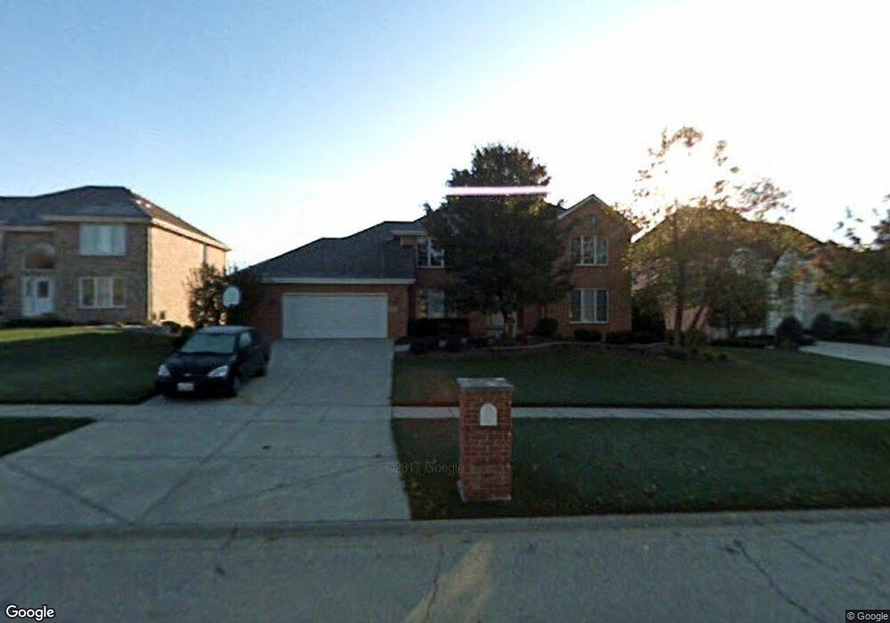
9001 Middleton Rd Darien, IL 60561
Estimated Value: $685,125 - $793,000
Studio
1
Bath
2,790
Sq Ft
$268/Sq Ft
Est. Value
About This Home
This home is located at 9001 Middleton Rd, Darien, IL 60561 and is currently estimated at $748,031, approximately $268 per square foot. 9001 Middleton Rd is a home located in DuPage County with nearby schools including Concord Elementary School, Cass Jr High School, and Hinsdale South High School.
Ownership History
Date
Name
Owned For
Owner Type
Purchase Details
Closed on
Oct 15, 1996
Sold by
Standard Bank & Trust Company
Bought by
Ramski William E and Ramski Sharon A
Current Estimated Value
Home Financials for this Owner
Home Financials are based on the most recent Mortgage that was taken out on this home.
Original Mortgage
$100,000
Outstanding Balance
$9,059
Interest Rate
7.94%
Estimated Equity
$738,972
Create a Home Valuation Report for This Property
The Home Valuation Report is an in-depth analysis detailing your home's value as well as a comparison with similar homes in the area
Home Values in the Area
Average Home Value in this Area
Purchase History
| Date | Buyer | Sale Price | Title Company |
|---|---|---|---|
| Ramski William E | $349,500 | -- |
Source: Public Records
Mortgage History
| Date | Status | Borrower | Loan Amount |
|---|---|---|---|
| Open | Ramski William E | $100,000 |
Source: Public Records
Tax History
| Year | Tax Paid | Tax Assessment Tax Assessment Total Assessment is a certain percentage of the fair market value that is determined by local assessors to be the total taxable value of land and additions on the property. | Land | Improvement |
|---|---|---|---|---|
| 2024 | $11,785 | $198,425 | $67,041 | $131,384 |
| 2023 | $11,273 | $182,410 | $61,630 | $120,780 |
| 2022 | $10,937 | $174,380 | $58,910 | $115,470 |
| 2021 | $10,152 | $172,400 | $58,240 | $114,160 |
| 2020 | $10,283 | $168,990 | $57,090 | $111,900 |
| 2019 | $9,893 | $162,150 | $54,780 | $107,370 |
| 2018 | $9,904 | $165,620 | $54,440 | $111,180 |
| 2017 | $9,678 | $159,380 | $52,390 | $106,990 |
| 2016 | $10,618 | $170,130 | $50,000 | $120,130 |
| 2015 | $10,417 | $160,060 | $47,040 | $113,020 |
| 2014 | $10,254 | $155,630 | $45,740 | $109,890 |
| 2013 | $9,885 | $154,910 | $45,530 | $109,380 |
Source: Public Records
Map
Nearby Homes
- 2221 Donegal Dr
- 9334 Waterfall Glen Blvd Unit 222
- 910 Oldfield Rd
- 8538 Washington St
- 607 Berkshire Ct
- 9014 Gloucester Rd
- 8885 Dryden St
- 2963 87th St
- 9038 Hillcrest Ln
- 2985 87th St
- 704 Plainfield Rd
- 8539 Thistlewood Ct
- 20W425 Peters Ct
- 8240 Lemont Rd
- 8200 Woodglen Ln Unit 107
- 1340 83rd St
- 10S241 Wallace Dr
- 8025 Woodglen Ln Unit 303
- 3253 Stewart Dr
- 7920 Woodglen Ln Unit 207
- 8933 Middleton Rd
- 9005 Middleton Rd
- 9000 Brandon Rd
- 8929 Middleton Rd
- 8936 Brandon Rd Unit 2
- 9004 Brandon Rd
- 9004 Middleton Rd
- 9000 Middleton Rd
- 8932 Brandon Rd
- 8932 Middleton Rd
- 8925 Middleton Rd
- 8928 Middleton Rd
- 9008 Middleton Rd
- 8928 Brandon Rd
- 2305 Kerry Ln
- 8924 Middleton Rd
- 2311 Kerry Ln
- 9001 Tara Hill Rd
- 9001 Brandon Rd
- 8920 Brandon Rd
Your Personal Tour Guide
Ask me questions while you tour the home.