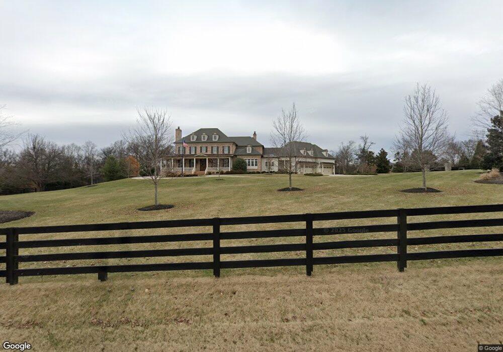
9004 Split Log Rd Brentwood, TN 37027
Estimated Value: $3,248,000 - $4,465,746
Studio
--
Bath
6,578
Sq Ft
$583/Sq Ft
Est. Value
About This Home
This home is located at 9004 Split Log Rd, Brentwood, TN 37027 and is currently estimated at $3,833,249, approximately $582 per square foot. 9004 Split Log Rd is a home with nearby schools including Kenrose Elementary School, Woodland Middle School, and Ravenwood High School.
Ownership History
Date
Name
Owned For
Owner Type
Purchase Details
Closed on
Nov 18, 2024
Sold by
Knox Timothy J and Knox Marcia N
Bought by
Knox Community Property Trust and Knox
Current Estimated Value
Purchase Details
Closed on
Dec 29, 2009
Sold by
West Roger O and West Vivian K
Bought by
West Roger O and West Vivian K
Purchase Details
Closed on
Jan 17, 1996
Sold by
Hoover Thomas S
Bought by
Brentwood Dev Co L P
Create a Home Valuation Report for This Property
The Home Valuation Report is an in-depth analysis detailing your home's value as well as a comparison with similar homes in the area
Home Values in the Area
Average Home Value in this Area
Purchase History
| Date | Buyer | Sale Price | Title Company |
|---|---|---|---|
| Knox Community Property Trust | -- | None Listed On Document | |
| West Roger O | -- | None Available | |
| Brentwood Dev Co L P | $450,000 | -- |
Source: Public Records
Tax History
| Year | Tax Paid | Tax Assessment Tax Assessment Total Assessment is a certain percentage of the fair market value that is determined by local assessors to be the total taxable value of land and additions on the property. | Land | Improvement |
|---|---|---|---|---|
| 2025 | $15,079 | $970,050 | $216,650 | $753,400 |
| 2024 | $15,079 | $694,900 | $121,075 | $573,825 |
| 2023 | $15,079 | $694,900 | $121,075 | $573,825 |
| 2022 | $15,079 | $694,900 | $121,075 | $573,825 |
| 2021 | $15,079 | $694,900 | $121,075 | $573,825 |
| 2020 | $14,851 | $575,625 | $72,225 | $503,400 |
| 2019 | $14,851 | $575,625 | $72,225 | $503,400 |
| 2018 | $7,869 | $313,500 | $72,225 | $241,275 |
| 2017 | $1,798 | $72,225 | $72,225 | $0 |
| 2016 | $0 | $72,225 | $72,225 | $0 |
| 2015 | -- | $49,025 | $49,025 | $0 |
| 2014 | -- | $0 | $0 | $0 |
Source: Public Records
Map
Nearby Homes
- 9012 Grey Pointe Ct
- 9003 Pointe Cross Ln
- 1811 Grey Pointe Dr
- 1811 Charity Dr
- 9204 Sydney Ln
- 1829 Bronwyn Ct
- 1852 Traditions Cir
- 258 Pennystone Cir
- 636 Patriot Ln
- 250 Pennystone Cir
- 1798 Northumberland Dr
- 1859 Trebor Ct
- 1931 Parade Dr
- 1706 Overcheck Ln
- 8344 Carriage Hills Dr
- 1705 Charity Dr
- 159 Pennystone Cir
- 9411 Highwood Hill Rd
- 1898 Traditions Cir
- 1819 Barnstaple Ln
- 1591 Cross Pointe Dr
- 9000 Split Log Rd
- 9010 Split Log Rd
- 1590 Cross Pointe Dr
- 1758 Wilson Pike
- 9010 Grey Pointe Ct
- 9008 Grey Pointe Ct
- 1588 Cross Pointe Dr
- 9014 Grey Pointe Ct
- 9001 Pointe Cross Lane L-13
- 9016 Grey Pointe Ct
- 9006 Grey Pointe Ct
- 1586 Cross Pointe Dr
- 9014 Split Log Rd
- 9000 Pointe Cross Ln
- 9005 Grey Pointe Ct
- 9011 Grey Pointe Ct
- 9002 Grey Pointe Ct
- 1752 Wilson Pike
- 9017 Grey Pointe Ct
Your Personal Tour Guide
Ask me questions while you tour the home.