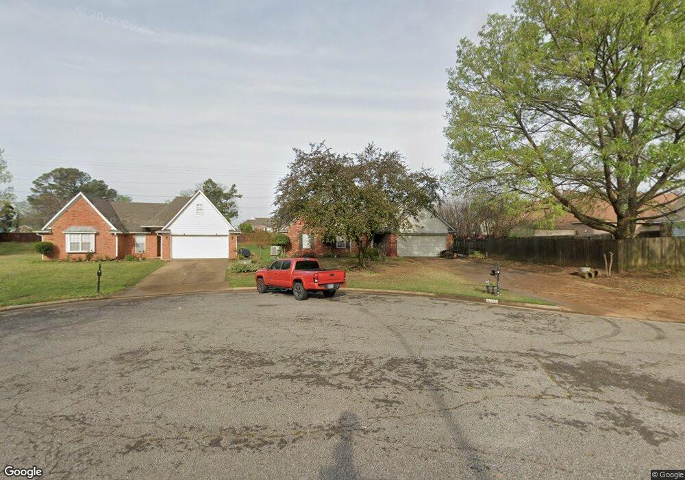
9008 Lakeside Cove Olive Branch, MS 38654
Estimated Value: $262,000 - $282,000
3
Beds
--
Bath
1,785
Sq Ft
$151/Sq Ft
Est. Value
About This Home
This home is located at 9008 Lakeside Cove, Olive Branch, MS 38654 and is currently estimated at $268,763, approximately $150 per square foot. 9008 Lakeside Cove is a home located in DeSoto County with nearby schools including Overpark Elementary School, Center Hill High School, and Desoto Christian Academy.
Ownership History
Date
Name
Owned For
Owner Type
Purchase Details
Closed on
Feb 26, 2025
Sold by
Hodgkiss & Swann Holdings Llc
Bought by
Hodgkiss & Swann Holdings Olive Branch Llc
Current Estimated Value
Home Financials for this Owner
Home Financials are based on the most recent Mortgage that was taken out on this home.
Original Mortgage
$5,000,000
Outstanding Balance
$4,975,242
Interest Rate
7.04%
Mortgage Type
Construction
Estimated Equity
-$4,706,479
Create a Home Valuation Report for This Property
The Home Valuation Report is an in-depth analysis detailing your home's value as well as a comparison with similar homes in the area
Home Values in the Area
Average Home Value in this Area
Purchase History
| Date | Buyer | Sale Price | Title Company |
|---|---|---|---|
| Hodgkiss & Swann Holdings Olive Branch Llc | -- | None Listed On Document | |
| Hodgkiss & Swann Holdings Olive Branch Llc | -- | None Listed On Document |
Source: Public Records
Mortgage History
| Date | Status | Borrower | Loan Amount |
|---|---|---|---|
| Open | Hodgkiss & Swann Holdings Olive Branch Llc | $5,000,000 |
Source: Public Records
Tax History Compared to Growth
Tax History
| Year | Tax Paid | Tax Assessment Tax Assessment Total Assessment is a certain percentage of the fair market value that is determined by local assessors to be the total taxable value of land and additions on the property. | Land | Improvement |
|---|---|---|---|---|
| 2024 | $1,616 | $11,844 | $2,500 | $9,344 |
| 2023 | $1,616 | $11,844 | $0 | $0 |
| 2022 | $1,616 | $11,844 | $2,500 | $9,344 |
| 2021 | $1,616 | $11,844 | $2,500 | $9,344 |
| 2020 | $1,514 | $11,096 | $2,500 | $8,596 |
| 2019 | $1,514 | $11,096 | $2,500 | $8,596 |
| 2017 | $1,486 | $19,156 | $10,828 | $8,328 |
| 2016 | $1,486 | $10,828 | $2,500 | $8,328 |
| 2015 | $1,486 | $19,156 | $10,828 | $8,328 |
| 2014 | $1,541 | $11,231 | $0 | $0 |
| 2013 | $1,496 | $11,231 | $0 | $0 |
Source: Public Records
Map
Nearby Homes
- 9004 Lakeside Cove
- 9081 Lakeside Dr
- 9037 Plantation Rd
- 9158 Lakeside Dr
- 9195 Lakeside Dr
- 8971 Tahoe Cove
- 9164 Superior Cove
- 8939 Travis Dr
- 8870 Collinswood Dr
- 7925 Kirkwood Cove
- 7906 Kirkwood Cove
- 8300 Waverly Cove
- 9097 Gavin Dr
- 8992 Gavin Dr
- 7689 Germantown Rd
- 7206 State Line Rd
- 9857 Tremont Dr
- 6400 State Line Rd
- 7129 Brook Mill Cove
- 9444 Geneva Loop E
- 9001 Plantation Lakes Dr
- 18 Lakeside Cove
- 1203 Lakeside Cove
- 9013 Plantation Lakes Dr
- 9002 Lakeside Cove
- 9015 Lakeside Cove
- 9003 Lakeside Cove
- 9055 Plantation Lakes Dr
- 9009 Lakeside Cove
- 8120 Lakeside Cove
- 8536 Courtly Cir E
- 8560 Courtly Cir E
- 9000 Plantation Lakes Dr
- 9012 Plantation Lakes Dr
- 9073 Plantation Lakes Dr
- 9024 Plantation Lakes Dr
- 8512 Courtly Cir E
- 9085 Plantation Lakes Dr
- 8781 Courtly Cir S
- 8770 Courtly Cir S