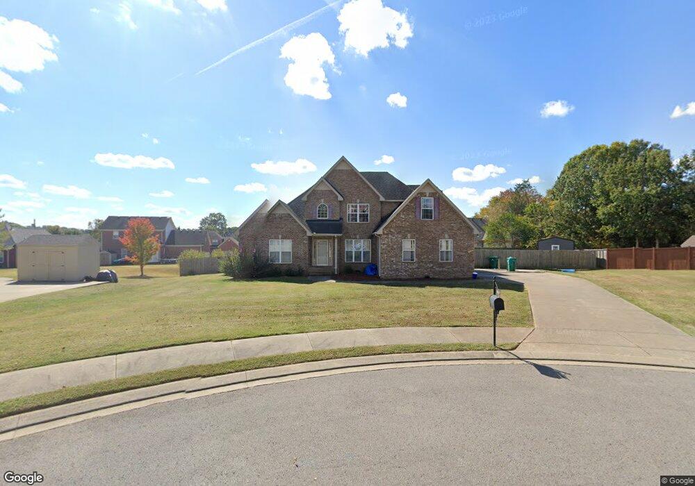
9009 Phoenix Ct La Vergne, TN 37086
Estimated Value: $528,416 - $544,000
--
Bed
4
Baths
2,745
Sq Ft
$195/Sq Ft
Est. Value
About This Home
This home is located at 9009 Phoenix Ct, La Vergne, TN 37086 and is currently estimated at $534,604, approximately $194 per square foot. 9009 Phoenix Ct is a home located in Rutherford County with nearby schools including Rock Springs Elementary School, Rock Springs Middle School, and Stewarts Creek High School.
Ownership History
Date
Name
Owned For
Owner Type
Purchase Details
Closed on
May 6, 2004
Sold by
Prince Properties Llc
Bought by
West Tamara M
Current Estimated Value
Home Financials for this Owner
Home Financials are based on the most recent Mortgage that was taken out on this home.
Original Mortgage
$140,900
Outstanding Balance
$66,016
Interest Rate
5.49%
Estimated Equity
$468,588
Create a Home Valuation Report for This Property
The Home Valuation Report is an in-depth analysis detailing your home's value as well as a comparison with similar homes in the area
Home Values in the Area
Average Home Value in this Area
Purchase History
| Date | Buyer | Sale Price | Title Company |
|---|---|---|---|
| West Tamara M | $210,900 | -- |
Source: Public Records
Mortgage History
| Date | Status | Borrower | Loan Amount |
|---|---|---|---|
| Open | West Tamara M | $140,900 |
Source: Public Records
Tax History Compared to Growth
Tax History
| Year | Tax Paid | Tax Assessment Tax Assessment Total Assessment is a certain percentage of the fair market value that is determined by local assessors to be the total taxable value of land and additions on the property. | Land | Improvement |
|---|---|---|---|---|
| 2025 | $2,612 | $108,250 | $13,750 | $94,500 |
| 2024 | $2,612 | $108,250 | $13,750 | $94,500 |
| 2023 | $1,978 | $105,425 | $13,750 | $91,675 |
| 2022 | $1,704 | $105,425 | $13,750 | $91,675 |
| 2021 | $1,723 | $77,650 | $13,750 | $63,900 |
| 2020 | $1,723 | $77,650 | $13,750 | $63,900 |
| 2019 | $1,723 | $77,650 | $13,750 | $63,900 |
| 2018 | $2,181 | $77,650 | $0 | $0 |
| 2017 | $2,190 | $60,350 | $0 | $0 |
| 2016 | $2,190 | $60,350 | $0 | $0 |
| 2015 | $2,205 | $60,350 | $0 | $0 |
| 2014 | $1,501 | $60,350 | $0 | $0 |
| 2013 | -- | $61,250 | $0 | $0 |
Source: Public Records
Map
Nearby Homes
- 11012 Sligo Ct
- 9005 Phoenix Ct
- 8039 Burntwood Dr
- 1011 Lily Ann Ct
- 1081 Large Poppy Dr
- 159 Snowdrop Ave
- 167 Snowdrop Ave
- 169 Snowdrop Ave
- 152 Snowdrop Ave
- 154 Snowdrop Ave
- 132 Dahlia Dr
- 130 Dahlia Dr
- 128 Dahlia Dr
- 1067 Large Poppy Dr
- 126 Dahlia Dr
- 124 Dahlia Dr
- 8054 Vineyard Ln
- 1072 Large Poppy Dr
- 6009 Inglenook Dr
- 122 Dahlia Dr
- 9011 Phoenix Ct
- 9007 Phoenix Ct
- 7012 Buffalo Dr
- 7014 Buffalo Dr
- 7010 Buffalo Dr
- 9010 Phoenix Ct
- 9008 Phoenix Ct
- 7008 Buffalo Dr
- 9006 Phoenix Ct
- 9003 Phoenix Ct
- 9004 Phoenix Ct
- 7006 Buffalo Dr
- 7011 Buffalo Dr
- 6009 Quincy Ct
- 7009 Buffalo Dr
- 6011 Quincy Ct
- 6007 Quincy Ct
- 9002 Phoenix Ct
- 9001 Phoenix Ct
- 7004 Buffalo Dr