Estimated Value: $355,000 - $430,000
3
Beds
2
Baths
2,904
Sq Ft
$135/Sq Ft
Est. Value
About This Home
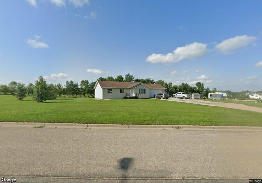
This home is located at 901 36th Ave NE, Minot, ND 58703 and is currently estimated at $390,673, approximately $134 per square foot. 901 36th Ave NE is a home located in Ward County with nearby schools including Lewis & Clark Elementary School, Erik Ramstad Middle School, and Central Campus School.
Ownership History
Date
Name
Owned For
Owner Type
Purchase Details
Closed on
Nov 30, 2007
Sold by
Bonebrake Jay D and Bonebrake Jamie L
Bought by
Abrahamson Steven J and Abrahamson Sara J
Current Estimated Value
Home Financials for this Owner
Home Financials are based on the most recent Mortgage that was taken out on this home.
Original Mortgage
$164,000
Outstanding Balance
$104,714
Interest Rate
6.47%
Mortgage Type
New Conventional
Estimated Equity
$285,959
Purchase Details
Closed on
Apr 15, 2005
Sold by
Heidrich Jeff and Heidrich Mary
Bought by
Bonebrake Jay D and Bonebrake Jamie L
Home Financials for this Owner
Home Financials are based on the most recent Mortgage that was taken out on this home.
Original Mortgage
$144,400
Interest Rate
5.88%
Mortgage Type
New Conventional
Create a Home Valuation Report for This Property
The Home Valuation Report is an in-depth analysis detailing your home's value as well as a comparison with similar homes in the area
Home Values in the Area
Average Home Value in this Area
Purchase History
| Date | Buyer | Sale Price | Title Company |
|---|---|---|---|
| Abrahamson Steven J | -- | None Available | |
| Bonebrake Jay D | -- | None Available |
Source: Public Records
Mortgage History
| Date | Status | Borrower | Loan Amount |
|---|---|---|---|
| Open | Abrahamson Steven J | $164,000 | |
| Previous Owner | Bonebrake Jay D | $144,400 |
Source: Public Records
Tax History Compared to Growth
Tax History
| Year | Tax Paid | Tax Assessment Tax Assessment Total Assessment is a certain percentage of the fair market value that is determined by local assessors to be the total taxable value of land and additions on the property. | Land | Improvement |
|---|---|---|---|---|
| 2024 | $3,228 | $154,500 | $30,000 | $124,500 |
| 2023 | $3,245 | $156,000 | $30,000 | $126,000 |
| 2022 | $3,277 | $164,000 | $35,000 | $129,000 |
| 2021 | $2,709 | $148,500 | $35,000 | $113,500 |
| 2020 | $2,601 | $143,000 | $35,000 | $108,000 |
| 2019 | $2,501 | $135,500 | $30,000 | $105,500 |
| 2018 | $2,686 | $135,500 | $30,000 | $105,500 |
| 2017 | $2,656 | $140,500 | $35,000 | $105,500 |
| 2016 | $2,619 | $156,400 | $8,600 | $147,800 |
| 2015 | $2,599 | $156,400 | $0 | $0 |
| 2014 | $2,599 | $153,300 | $0 | $0 |
Source: Public Records
Map
Nearby Homes
- 38 Mulberry Loop NE
- 3425 8th St NE
- 916 34th Ave NE
- 73 Olive Tree Cir NE
- 138 Mulberry Loop
- 134 Mulberry Loop
- 201 45th Ave Unit 225 45th Ave. NE & T
- 1505 30th Ave
- 4539 N Broadway
- 2731 N Broadway
- 0 NW Corner 4th Ave and 27th St Unit 240530
- 2621 4th St NW
- 2524 5th St NW
- 3801 N Broadway
- 605 N Broadway
- 3630 N Broadway
- 2524 6th St NW
- 2513 Skyline Dr
- 3001 NE 27th St Unit Lot 3 Block 3
- 3001 NE 27th St Unit Lot 1 Block 1
- 3621 10th St NE
- 9 Mulberry Loop NE
- 13 Mulberry Loop NE Unit Stonebridge Farms
- 13 Mulberry Loop NE
- 5 Mulberry Loop NE Unit Stonebridge Farms
- 5 Mulberry Loop NE
- 17 Mulberry Loop NE
- 1 Mulberry Loop
- 1 Mulberry Loop Unit Stonebridge Farms
- 21 Mulberry Loop NE
- 3701 10th St NE
- 25 Mulberry Loop NE
- 14 Mulberry Loop NE
- 10 Mulberry Loop NE
- 6 Mulberry Loop NE
- 18 Mulberry Loop NE
- 29 Mulberry Loop NE
- 2 Mulberry Loop NE
- 3620 10th St NE
- 22 Mulberry Loop NE