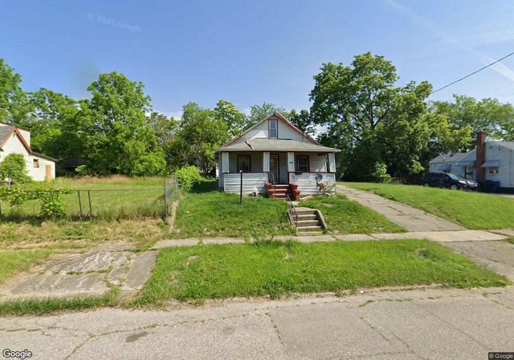
901 Carton St Flint, MI 48505
King Avenue Plus NeighborhoodEstimated Value: $28,000 - $48,000
2
Beds
1
Bath
744
Sq Ft
$55/Sq Ft
Est. Value
About This Home
This home is located at 901 Carton St, Flint, MI 48505 and is currently estimated at $40,781, approximately $54 per square foot. 901 Carton St is a home located in Genesee County with nearby schools including Brownell STEM Academy, Richfield Public School Academy, and Greater Heights Academy.
Ownership History
Date
Name
Owned For
Owner Type
Purchase Details
Closed on
Apr 28, 2025
Sold by
Cross Kim
Bought by
Cross Kim and Montgomery Robert
Current Estimated Value
Purchase Details
Closed on
Nov 8, 2017
Sold by
Neely Janise M
Bought by
Cross Kim
Purchase Details
Closed on
Sep 8, 2017
Sold by
Montgomery Robert
Bought by
Cross Kim
Purchase Details
Closed on
Mar 29, 2014
Sold by
Montgomery George
Bought by
Montgomery Robert E
Purchase Details
Closed on
Aug 19, 1999
Sold by
Michigan Department Of Natural Resources
Bought by
Grady James E and Grady Anna J
Create a Home Valuation Report for This Property
The Home Valuation Report is an in-depth analysis detailing your home's value as well as a comparison with similar homes in the area
Home Values in the Area
Average Home Value in this Area
Purchase History
| Date | Buyer | Sale Price | Title Company |
|---|---|---|---|
| Cross Kim | -- | None Listed On Document | |
| Cross Kim | -- | None Available | |
| Cross Kim | -- | None Available | |
| Montgomery Robert E | -- | None Available | |
| Grady James E | -- | -- |
Source: Public Records
Tax History Compared to Growth
Tax History
| Year | Tax Paid | Tax Assessment Tax Assessment Total Assessment is a certain percentage of the fair market value that is determined by local assessors to be the total taxable value of land and additions on the property. | Land | Improvement |
|---|---|---|---|---|
| 2025 | $480 | $10,200 | $0 | $0 |
| 2024 | $459 | $8,400 | $0 | $0 |
| 2023 | $461 | $5,200 | $0 | $0 |
| 2022 | $0 | $4,200 | $0 | $0 |
| 2021 | $460 | $4,000 | $0 | $0 |
| 2020 | $439 | $3,500 | $0 | $0 |
| 2019 | $440 | $2,700 | $0 | $0 |
| 2018 | $721 | $2,500 | $0 | $0 |
| 2017 | $426 | $0 | $0 | $0 |
| 2016 | $360 | $0 | $0 | $0 |
| 2015 | -- | $0 | $0 | $0 |
| 2014 | -- | $0 | $0 | $0 |
| 2012 | -- | $2,700 | $0 | $0 |
Source: Public Records
Map
Nearby Homes
- 4028 North St
- 638 E Pasadena Ave
- 613 E van Wagoner Ave
- 606 Damon St
- 418 Damon St
- 733 Black Ave
- 3810 Marvin St
- 370 E Moore St
- 313 Edwin Ave
- 3506 Esther St
- 0 E Marengo Ave Unit 50166417
- 218 E Jackson Ave
- 618 E Pulaski Ave
- 680 E Pierson Rd
- 2913 Martin Luther King Ave
- 2913
- 200 W Mcclellan St
- 1526 Montana Ave
- 1518 Leith St
- 1445 Maryland Ave