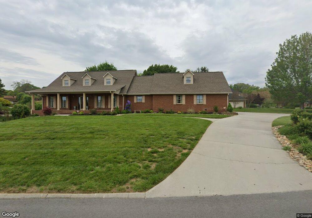
901 Colonial Dr Morristown, TN 37814
Estimated Value: $479,996 - $617,000
--
Bed
3
Baths
4,197
Sq Ft
$136/Sq Ft
Est. Value
About This Home
This home is located at 901 Colonial Dr, Morristown, TN 37814 and is currently estimated at $569,499, approximately $135 per square foot. 901 Colonial Dr is a home located in Hamblen County with nearby schools including Manley Elementary School, West View Middle School, and Morristown West High School.
Ownership History
Date
Name
Owned For
Owner Type
Purchase Details
Closed on
Mar 6, 1992
Bought by
Owens Hobert E and Owens Patricia I
Current Estimated Value
Purchase Details
Closed on
Dec 6, 1990
Bought by
Davidson Taylor L and Connie West
Purchase Details
Closed on
May 2, 1990
Bought by
Davidson Taylor L
Purchase Details
Closed on
Dec 21, 1988
Bought by
Jenkins Skelton Reneau & Assoc
Purchase Details
Closed on
Jan 2, 1985
Bought by
Colonial Standard Ventures Inc
Create a Home Valuation Report for This Property
The Home Valuation Report is an in-depth analysis detailing your home's value as well as a comparison with similar homes in the area
Home Values in the Area
Average Home Value in this Area
Purchase History
| Date | Buyer | Sale Price | Title Company |
|---|---|---|---|
| Owens Hobert E | $41,500 | -- | |
| Davidson Taylor L | -- | -- | |
| Davidson Taylor L | $39,000 | -- | |
| Jenkins Skelton Reneau & Assoc | $675,000 | -- | |
| Colonial Standard Ventures Inc | -- | -- |
Source: Public Records
Tax History Compared to Growth
Tax History
| Year | Tax Paid | Tax Assessment Tax Assessment Total Assessment is a certain percentage of the fair market value that is determined by local assessors to be the total taxable value of land and additions on the property. | Land | Improvement |
|---|---|---|---|---|
| 2024 | $1,750 | $99,450 | $12,025 | $87,425 |
| 2023 | $1,750 | $99,450 | $0 | $0 |
| 2022 | $3,142 | $99,450 | $12,025 | $87,425 |
| 2021 | $3,142 | $99,450 | $12,025 | $87,425 |
| 2020 | $3,138 | $99,450 | $12,025 | $87,425 |
| 2019 | $3,035 | $89,275 | $13,325 | $75,950 |
| 2018 | $2,812 | $89,275 | $13,325 | $75,950 |
| 2017 | $2,767 | $89,275 | $13,325 | $75,950 |
| 2016 | $2,642 | $89,275 | $13,325 | $75,950 |
| 2015 | $2,459 | $89,275 | $13,325 | $75,950 |
| 2014 | -- | $89,275 | $13,325 | $75,950 |
| 2013 | -- | $95,750 | $0 | $0 |
Source: Public Records
Map
Nearby Homes
- 2978 Wilshire Blvd
- 1054 Colonial Dr
- 801 Colonial Dr
- 1086 St Ives Ct
- 700 Drinnon Dr
- 3471 Walden Dr
- 3475 Walden Dr
- 400 Drinnon Dr
- 3542 Wedgewood Dr
- 725 Barton Dr
- 3641 Meadowland Dr
- 490 E Sunset Hills
- 2444 Sandstone Dr
- 2454 Sandstone Dr
- 2430 Sandstone Dr
- 2310 Sandstone Dr
- 837 Foxglove Ln
- 1736 Jellicorse Rd
- 2045 N Economy Rd Unit A3
- 3864 Apostle Rd
- 917 Colonial Dr
- 3043 Brandywine Cir
- 900 Colonial Dr
- 857 Colonial Dr
- 908 Colonial Dr
- 916 Colonial Dr
- 925 Colonial Dr
- 3035 Brandywine Cir
- 848 Colonial Dr
- 3109 Providence Cir
- 3048 Brandywine Cir
- 924 Colonial Dr
- 3117 Providence Cir
- 840 Colonial Dr
- 849 Colonial Dr
- 3040 Brandywine Cir
- 3072 Federal Blvd
- 3027 Brandywine Cir
- 2989 Wilshire Blvd
- 2983 Wilshire Blvd