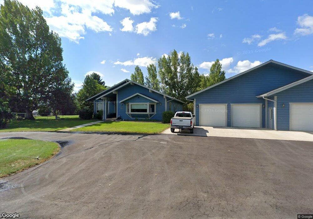
901 Lodestar Rd Helena, MT 59602
West Helena Valley NeighborhoodEstimated Value: $550,000 - $600,000
3
Beds
2
Baths
2,628
Sq Ft
$216/Sq Ft
Est. Value
About This Home
This home is located at 901 Lodestar Rd, Helena, MT 59602 and is currently estimated at $567,970, approximately $216 per square foot. 901 Lodestar Rd is a home located in Lewis and Clark County with nearby schools including Four Georgians Elementary School, C.R. Anderson Middle School, and St Andrew School.
Ownership History
Date
Name
Owned For
Owner Type
Purchase Details
Closed on
May 31, 2023
Sold by
Delahunt Kimberly Dawn
Bought by
1985 Properties Llc
Current Estimated Value
Create a Home Valuation Report for This Property
The Home Valuation Report is an in-depth analysis detailing your home's value as well as a comparison with similar homes in the area
Home Values in the Area
Average Home Value in this Area
Purchase History
| Date | Buyer | Sale Price | Title Company |
|---|---|---|---|
| 1985 Properties Llc | -- | None Listed On Document |
Source: Public Records
Tax History Compared to Growth
Tax History
| Year | Tax Paid | Tax Assessment Tax Assessment Total Assessment is a certain percentage of the fair market value that is determined by local assessors to be the total taxable value of land and additions on the property. | Land | Improvement |
|---|---|---|---|---|
| 2025 | $2,229 | $553,800 | $0 | $0 |
| 2024 | $2,980 | $466,500 | $0 | $0 |
| 2023 | $3,269 | $466,500 | $0 | $0 |
| 2022 | $2,794 | $361,600 | $0 | $0 |
| 2021 | $3,121 | $361,600 | $0 | $0 |
| 2020 | $2,663 | $303,900 | $0 | $0 |
| 2019 | $2,683 | $303,900 | $0 | $0 |
| 2018 | $2,448 | $277,400 | $0 | $0 |
| 2017 | $2,388 | $277,400 | $0 | $0 |
| 2016 | $2,248 | $218,800 | $0 | $0 |
| 2015 | $1,924 | $218,800 | $0 | $0 |
| 2014 | $1,865 | $116,229 | $0 | $0 |
Source: Public Records
Map
Nearby Homes
- 4324 N Montana Ave
- 835 Onyx Place
- 845 Faw Rd
- 1344 Beaverhead Rd
- 885 Amethyst Ave
- 769 Insulator Ave
- 4435 Woodchuck Dr
- 855 Jade St
- 4506 Porcupine Dr
- 1325 Cambray Loop
- 1010 Motsiff Rd
- 1030 Motsiff Rd
- 322 Andesite Ave Unit A and B
- 4015 Green Meadow Dr
- 40 Hummingbird Ct
- 630 Stadler Rd
- 3570 Juniper Dr
- 360 Barney St Unit C
- 350 Barney St Unit A
- 340 Barney St Unit A
- 903 Menlo Park Rd
- 899 Lodestar Rd
- 790 Middlemas Rd
- 901 Menlo Park Rd
- 840 Middlemas Rd
- 903 Lodestar Rd
- 904 Lodestar Rd
- 870 Middlemas Rd
- 760 Middlemas Rd
- 895 Lodestar Rd
- 905 Menlo Park Rd
- 900 Menlo Park Rd
- 905 Lodestar Rd
- 825 Middlemas Rd
- 906 Lodestar Rd
- 907 Menlo Park Rd
- 904 Middlemas Rd
- 775 Middlemas Rd
- 902 Menlo Park Rd
- 720 Middlemas Rd