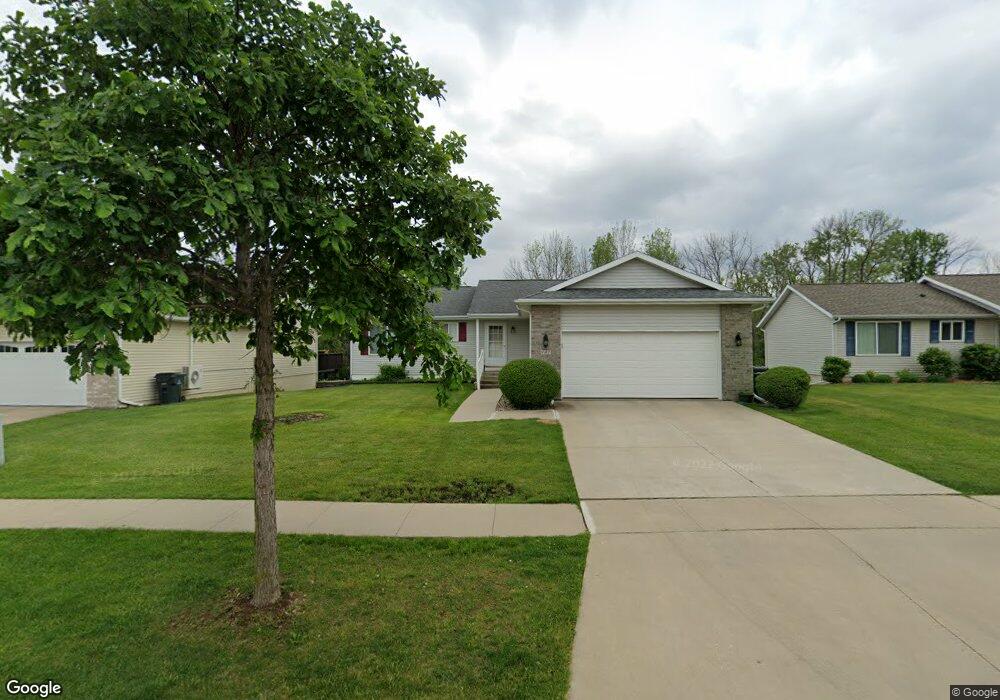
901 Moose Dr NW Cedar Rapids, IA 52405
Estimated Value: $288,000 - $332,000
4
Beds
4
Baths
1,400
Sq Ft
$223/Sq Ft
Est. Value
About This Home
This home is located at 901 Moose Dr NW, Cedar Rapids, IA 52405 and is currently estimated at $312,054, approximately $222 per square foot. 901 Moose Dr NW is a home located in Linn County with nearby schools including Maple Grove Elementary School, North Middletown Elementary School, and Ponderosa Elementary School.
Ownership History
Date
Name
Owned For
Owner Type
Purchase Details
Closed on
May 16, 2005
Sold by
Brinkman Jeffrey S and Brinkman Jessica J
Bought by
Ha Youane V and Ha Chouang T
Current Estimated Value
Home Financials for this Owner
Home Financials are based on the most recent Mortgage that was taken out on this home.
Original Mortgage
$140,000
Outstanding Balance
$74,072
Interest Rate
6.07%
Mortgage Type
Fannie Mae Freddie Mac
Estimated Equity
$237,982
Purchase Details
Closed on
Jun 13, 2000
Sold by
Kacs Lc
Bought by
Brinkman Jeffrey S and Brinkman Jessica J
Home Financials for this Owner
Home Financials are based on the most recent Mortgage that was taken out on this home.
Original Mortgage
$139,400
Interest Rate
8.66%
Create a Home Valuation Report for This Property
The Home Valuation Report is an in-depth analysis detailing your home's value as well as a comparison with similar homes in the area
Home Values in the Area
Average Home Value in this Area
Purchase History
| Date | Buyer | Sale Price | Title Company |
|---|---|---|---|
| Ha Youane V | $174,500 | -- | |
| Brinkman Jeffrey S | $146,500 | -- |
Source: Public Records
Mortgage History
| Date | Status | Borrower | Loan Amount |
|---|---|---|---|
| Open | Ha Youane V | $140,000 | |
| Previous Owner | Brinkman Jeffrey S | $139,400 |
Source: Public Records
Tax History Compared to Growth
Tax History
| Year | Tax Paid | Tax Assessment Tax Assessment Total Assessment is a certain percentage of the fair market value that is determined by local assessors to be the total taxable value of land and additions on the property. | Land | Improvement |
|---|---|---|---|---|
| 2025 | $4,478 | $296,800 | $60,600 | $236,200 |
| 2024 | $4,756 | $270,500 | $57,200 | $213,300 |
| 2023 | $4,756 | $270,500 | $57,200 | $213,300 |
| 2022 | $4,528 | $234,400 | $50,200 | $184,200 |
| 2021 | $4,590 | $227,500 | $43,300 | $184,200 |
| 2020 | $4,590 | $216,600 | $43,300 | $173,300 |
| 2019 | $4,056 | $196,700 | $34,700 | $162,000 |
| 2018 | $3,940 | $196,700 | $34,700 | $162,000 |
| 2017 | $3,977 | $188,700 | $34,700 | $154,000 |
| 2016 | $3,977 | $187,100 | $34,700 | $152,400 |
| 2015 | $4,205 | $197,577 | $34,650 | $162,927 |
| 2014 | $4,020 | $197,577 | $34,650 | $162,927 |
| 2013 | $3,928 | $197,577 | $34,650 | $162,927 |
Source: Public Records
Map
Nearby Homes
- 4819 Fruitwood Ln NW
- 1608 Morris Ave NW
- 1722 Gardner Dr NW
- 272 Peace Ave NW
- 4819 Ford Ave NW
- 281 Jacolyn Dr NW
- 208 Lenora Dr NW
- 4975 Kesler Rd NW
- 229 Jacolyn Dr NW
- 3802 Richland Dr NW
- 5127 Holly Ave NW
- 4910 Gordon Ave NW
- 3313 Crestwood Dr NW
- 3507 E Ave NW Unit F
- 3509 E Ave NW Unit D
- 3312 G Ave NW
- 200 Cherry Park Dr NW
- 3600 Midway Dr NW
- 327* Edgewood Rd NW
- 1410 Adair Ct SW Unit Lot 2
- 907 Moose Dr NW
- 829 Moose Dr NW
- 823 Moose Dr NW
- 915 Moose Dr NW
- 902 Moose Dr NW
- 822 Moose Dr NW
- 908 Moose Dr NW
- 817 Moose Dr NW
- 814 Moose Dr NW
- 921 Moose Dr NW
- 1001 Wolf Dr NW
- 811 Moose Dr NW
- 804 Moose Dr NW
- 1005 Koudsi Blvd NW
- 927 Moose Dr NW
- 1007 Wolf Dr NW
- 1008 Wolf Dr NW
- 1011 Koudsi Blvd NW
- 1012 Moose Dr NW
- 805 Moose Dr NW