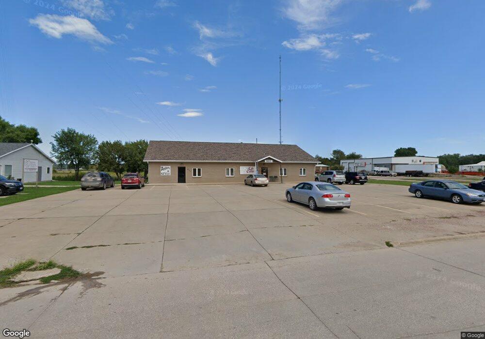
901 W 21st St Unit 1 South Sioux City, NE 68776
--
Bed
--
Bath
1,740
Sq Ft
0.52
Acres
About This Home
This home is located at 901 W 21st St Unit 1, South Sioux City, NE 68776. 901 W 21st St Unit 1 is a home located in Dakota County with nearby schools including Covington Elementary School, South Sioux City Middle School, and South Sioux Senior High School.
Ownership History
Date
Name
Owned For
Owner Type
Purchase Details
Closed on
Sep 11, 2024
Sold by
Spt Ventures Inc
Bought by
Suncoast Properties Llc
Home Financials for this Owner
Home Financials are based on the most recent Mortgage that was taken out on this home.
Original Mortgage
$435,500
Outstanding Balance
$430,492
Interest Rate
6.35%
Mortgage Type
Seller Take Back
Purchase Details
Closed on
Dec 29, 2022
Sold by
Cardinal Capital Group Llc
Bought by
Spt Ventures Inc
Purchase Details
Closed on
Oct 1, 2021
Sold by
Prenger Sr Donald E and Prenger Sharon K
Bought by
Cardinal Capital Group Llc
Home Financials for this Owner
Home Financials are based on the most recent Mortgage that was taken out on this home.
Original Mortgage
$225,000
Interest Rate
2.1%
Mortgage Type
Seller Take Back
Create a Home Valuation Report for This Property
The Home Valuation Report is an in-depth analysis detailing your home's value as well as a comparison with similar homes in the area
Home Values in the Area
Average Home Value in this Area
Purchase History
| Date | Buyer | Sale Price | Title Company |
|---|---|---|---|
| Suncoast Properties Llc | $436,000 | None Listed On Document | |
| Suncoast Properties Llc | $436,000 | None Listed On Document | |
| Spt Ventures Inc | $438,000 | Lewis & Clark Title | |
| Cardinal Capital Group Llc | -- | Lewis & Clark Title |
Source: Public Records
Mortgage History
| Date | Status | Borrower | Loan Amount |
|---|---|---|---|
| Open | Suncoast Properties Llc | $435,500 | |
| Closed | Suncoast Properties Llc | $435,500 | |
| Previous Owner | Cardinal Capital Group Llc | $225,000 |
Source: Public Records
Tax History Compared to Growth
Tax History
| Year | Tax Paid | Tax Assessment Tax Assessment Total Assessment is a certain percentage of the fair market value that is determined by local assessors to be the total taxable value of land and additions on the property. | Land | Improvement |
|---|---|---|---|---|
| 2024 | $5,796 | $428,780 | $74,870 | $353,910 |
| 2023 | $5,574 | $313,910 | $74,870 | $239,040 |
| 2022 | $6,003 | $313,910 | $74,870 | $239,040 |
| 2021 | $6,222 | $313,910 | $74,870 | $239,040 |
| 2020 | $5,726 | $286,415 | $74,870 | $211,545 |
| 2019 | $5,743 | $286,415 | $74,870 | $211,545 |
| 2018 | $5,790 | $286,415 | $74,870 | $211,545 |
| 2017 | $6,338 | $314,205 | $95,290 | $218,915 |
| 2016 | $4,881 | $246,155 | $20,800 | $225,355 |
| 2014 | $5,068 | $246,155 | $20,800 | $225,355 |
Source: Public Records
Map
Nearby Homes
- 2434 U S 77
- 3312 Cedar Mill Way
- 3200 Cider Mill Way
- 389 Willow Gardens
- 405 W 17th St
- 1401 & 1402 5th Ave
- 202 E 23rd St
- 423 Golf Rd
- 314 E 17th St
- 114 Oakmont Dr
- 125 E 30th St
- 214 W 31st St
- 2101 F St
- 429 E 15th St
- 1018 & 1018 1/2 B St
- 424 S Ridge Dr
- 605 Stagecoach Rd
- 1840 Ogden Ct
- 1700 Ogden Ct
- 423 W 3rd St
- 901 W 21st St Unit 2
- 901 W 21st St
- 900 W 21st St
- 825 W 21st St
- 920 W 21st St
- 1035 W 21st St
- 1033 W 21st St
- 1027 W 21st St
- 730 W 21st St Unit (Office/Retail)
- 2001 Cornhusker Dr
- 1906 Cornhusker Dr
- TBD Cornhusker Dr
- 21 Cornhusker
- 2371 9th Ave
- 1902 Cornhusker Dr
- TBD W 21st St
- TBD W 21st St Unit Lot 12
- TBD W 21st St Unit Lot 11
- TBD W 21st St Unit Lot 10
- TBD W 21st St Unit Lot 9