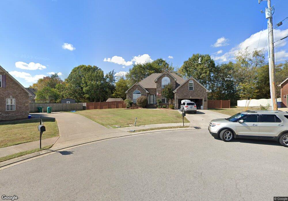
9011 Phoenix Ct La Vergne, TN 37086
Estimated Value: $451,947 - $528,000
--
Bed
3
Baths
2,388
Sq Ft
$209/Sq Ft
Est. Value
About This Home
This home is located at 9011 Phoenix Ct, La Vergne, TN 37086 and is currently estimated at $498,237, approximately $208 per square foot. 9011 Phoenix Ct is a home located in Rutherford County with nearby schools including Rock Springs Elementary School, Rock Springs Middle School, and Stewarts Creek High School.
Ownership History
Date
Name
Owned For
Owner Type
Purchase Details
Closed on
Nov 18, 2013
Sold by
Davis Michael R
Bought by
Davis Nicholle M
Current Estimated Value
Purchase Details
Closed on
May 20, 2010
Sold by
Schafer Brian E
Bought by
Davis Michael R
Home Financials for this Owner
Home Financials are based on the most recent Mortgage that was taken out on this home.
Original Mortgage
$219,000
Interest Rate
5.5%
Mortgage Type
FHA
Purchase Details
Closed on
Aug 18, 2003
Sold by
Prince Properties Llc
Bought by
Schafer Brian E and Schafer Kimberly D
Home Financials for this Owner
Home Financials are based on the most recent Mortgage that was taken out on this home.
Original Mortgage
$157,680
Interest Rate
5.72%
Mortgage Type
Purchase Money Mortgage
Create a Home Valuation Report for This Property
The Home Valuation Report is an in-depth analysis detailing your home's value as well as a comparison with similar homes in the area
Home Values in the Area
Average Home Value in this Area
Purchase History
| Date | Buyer | Sale Price | Title Company |
|---|---|---|---|
| Davis Nicholle M | -- | -- | |
| Davis Michael R | $221,950 | -- | |
| Schafer Brian E | $197,100 | -- |
Source: Public Records
Mortgage History
| Date | Status | Borrower | Loan Amount |
|---|---|---|---|
| Previous Owner | Schafer Brian E | $219,000 | |
| Previous Owner | Schafer Brian E | $157,680 | |
| Previous Owner | Schafer Brian E | $19,710 |
Source: Public Records
Tax History Compared to Growth
Tax History
| Year | Tax Paid | Tax Assessment Tax Assessment Total Assessment is a certain percentage of the fair market value that is determined by local assessors to be the total taxable value of land and additions on the property. | Land | Improvement |
|---|---|---|---|---|
| 2025 | $2,349 | $97,400 | $13,750 | $83,650 |
| 2024 | $2,349 | $97,400 | $13,750 | $83,650 |
| 2023 | $1,827 | $97,400 | $13,750 | $83,650 |
| 2022 | $1,574 | $97,400 | $13,750 | $83,650 |
| 2021 | $1,523 | $68,625 | $13,750 | $54,875 |
| 2020 | $1,523 | $68,625 | $13,750 | $54,875 |
| 2019 | $1,523 | $68,625 | $13,750 | $54,875 |
| 2018 | $1,928 | $68,625 | $0 | $0 |
| 2017 | $1,999 | $55,075 | $0 | $0 |
| 2016 | $1,999 | $55,075 | $0 | $0 |
| 2015 | $2,013 | $55,075 | $0 | $0 |
| 2014 | $1,370 | $55,075 | $0 | $0 |
| 2013 | -- | $55,250 | $0 | $0 |
Source: Public Records
Map
Nearby Homes
- 9005 Phoenix Ct
- 11012 Sligo Ct
- 8039 Burntwood Dr
- 1081 Large Poppy Dr
- 1011 Lily Ann Ct
- 159 Snowdrop Ave
- 152 Snowdrop Ave
- 154 Snowdrop Ave
- 167 Snowdrop Ave
- 169 Snowdrop Ave
- 1067 Large Poppy Dr
- Brentley Plan at Arbor Ridge - Ascent at Arbor Ridge
- Bartlett Plan at Arbor Ridge - Ascent at Arbor Ridge
- Montgomery Plan at Arbor Ridge - Ascent at Arbor Ridge
- Westmore Plan at Arbor Ridge - Ascent at Arbor Ridge
- Wyatt Plan at Arbor Ridge - Ascent at Arbor Ridge
- Blake Plan at Arbor Ridge - Ascent at Arbor Ridge
- Washington Plan at Arbor Ridge - Ascent at Arbor Ridge
- Macon Plan at Arbor Ridge - Ascent at Arbor Ridge
- 1055 Large Poppy Dr
- 9009 Phoenix Ct
- 9010 Phoenix Ct
- 7014 Buffalo Dr
- 7012 Buffalo Dr
- 9007 Phoenix Ct
- 9008 Phoenix Ct
- 7010 Buffalo Dr
- 9006 Phoenix Ct
- 6009 Quincy Ct
- 6011 Quincy Ct
- 7008 Buffalo Dr
- 9004 Phoenix Ct
- 6007 Quincy Ct
- 9003 Phoenix Ct
- 7011 Buffalo Dr
- 7006 Buffalo Dr
- 6005 Quincy Ct
- 9002 Phoenix Ct
- 6010 Quincy Ct
- 7009 Buffalo Dr