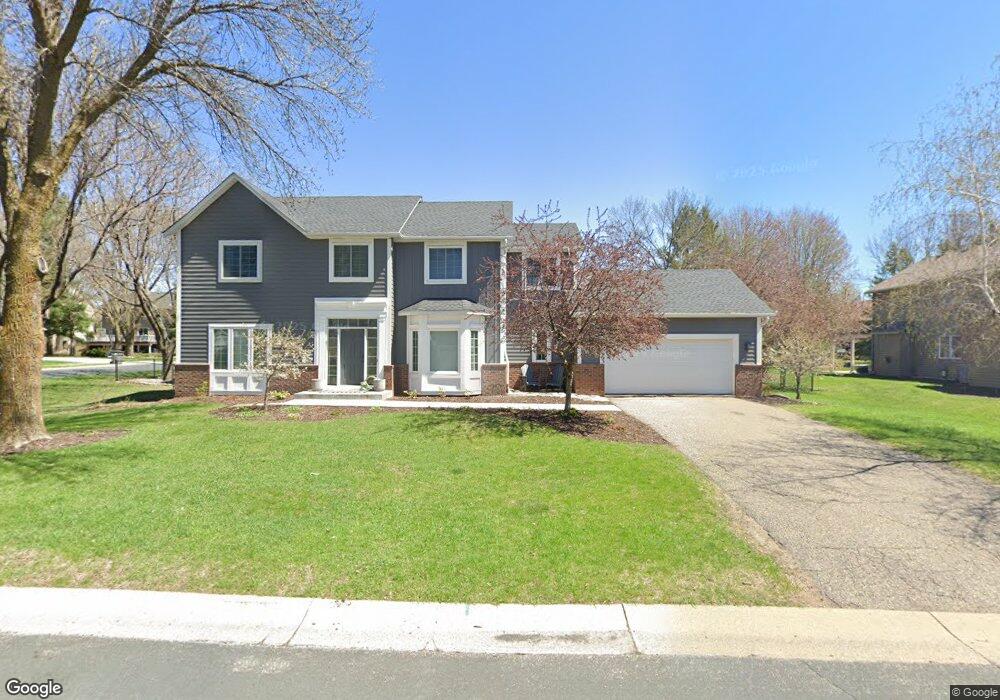
9013 McGuffey Rd Eden Prairie, MN 55347
Estimated Value: $597,000 - $639,086
4
Beds
4
Baths
2,414
Sq Ft
$255/Sq Ft
Est. Value
About This Home
This home is located at 9013 McGuffey Rd, Eden Prairie, MN 55347 and is currently estimated at $614,772, approximately $254 per square foot. 9013 McGuffey Rd is a home located in Hennepin County with nearby schools including Central Middle School, Eden Prairie High School, and Primrose School of Eden Prairie.
Ownership History
Date
Name
Owned For
Owner Type
Purchase Details
Closed on
Jun 25, 2018
Sold by
Printup James B and Printup Tammi L
Bought by
Brown Joshua P and Brown Jennifer A
Current Estimated Value
Home Financials for this Owner
Home Financials are based on the most recent Mortgage that was taken out on this home.
Original Mortgage
$178,000
Outstanding Balance
$154,285
Interest Rate
4.6%
Mortgage Type
New Conventional
Estimated Equity
$460,487
Create a Home Valuation Report for This Property
The Home Valuation Report is an in-depth analysis detailing your home's value as well as a comparison with similar homes in the area
Home Values in the Area
Average Home Value in this Area
Purchase History
| Date | Buyer | Sale Price | Title Company |
|---|---|---|---|
| Brown Joshua P | $440,000 | All American Title Co |
Source: Public Records
Mortgage History
| Date | Status | Borrower | Loan Amount |
|---|---|---|---|
| Open | Brown Joshua P | $178,000 |
Source: Public Records
Tax History Compared to Growth
Tax History
| Year | Tax Paid | Tax Assessment Tax Assessment Total Assessment is a certain percentage of the fair market value that is determined by local assessors to be the total taxable value of land and additions on the property. | Land | Improvement |
|---|---|---|---|---|
| 2024 | $6,767 | $554,900 | $174,200 | $380,700 |
| 2023 | $6,178 | $538,900 | $169,200 | $369,700 |
| 2022 | $5,460 | $525,700 | $165,000 | $360,700 |
| 2021 | $5,316 | $443,600 | $168,600 | $275,000 |
| 2020 | $5,497 | $435,000 | $165,300 | $269,700 |
| 2019 | $5,252 | $435,000 | $165,300 | $269,700 |
| 2018 | $5,149 | $410,500 | $156,000 | $254,500 |
| 2017 | $4,837 | $367,600 | $121,100 | $246,500 |
| 2016 | $5,040 | $378,900 | $124,800 | $254,100 |
| 2015 | $4,978 | $360,900 | $118,900 | $242,000 |
| 2014 | -- | $350,500 | $115,500 | $235,000 |
Source: Public Records
Map
Nearby Homes
- 16597 Kenning Rd
- 8855 Sylvan Ridge
- 16957 Valley Rd
- 17027 Candlewood Pkwy
- 9035 Briarglen Rd
- 9200 Belvedere Dr
- 16344 Millford Dr
- 17400 Frondell Ct
- 17244 Valley Rd
- 16996 Hanover Ln
- 9252 Larimar Trail
- 9280 Larimar Trail
- 9268 Larimar Trail
- 9245 Larimar Trail
- Hadley Plan at Kinsley - Freedom
- Ashton Plan at Kinsley - Freedom
- Duncan Plan at Kinsley - Freedom
- 9264 Larimar Trail
- 9240 Larimar Trail
- 9256 Larimar Trail
- 9006 Gould Rd
- 16564 Kenning Rd
- 16628 Rogers Rd
- 16656 Rogers Rd
- 9008 McGuffey Rd
- 9037 McGuffey Rd
- 8998 Gould Rd
- 9020 McGuffey Rd
- 16572 Kenning Rd
- 9032 McGuffey Rd
- 8982 Gould Rd
- 16712 Rogers Rd
- 9049 McGuffey Rd
- 16596 Kenning Rd
- 9011 Douglas Dr
- 9044 McGuffey Rd
- 8999 Gould Rd
- 9023 Douglas Dr
- 16565 Kenning Rd
- 8959 Sylvan Ridge