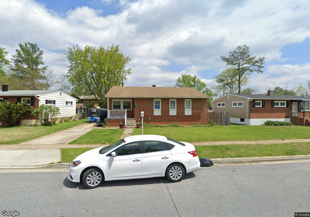
9014 Meadow Heights Rd Randallstown, MD 21133
Estimated Value: $361,000 - $411,000
4
Beds
3
Baths
1,576
Sq Ft
$246/Sq Ft
Est. Value
About This Home
This home is located at 9014 Meadow Heights Rd, Randallstown, MD 21133 and is currently estimated at $387,512, approximately $245 per square foot. 9014 Meadow Heights Rd is a home located in Baltimore County with nearby schools including Randallstown Elementary School, Deer Park Middle Magnet School, and Randallstown High School.
Ownership History
Date
Name
Owned For
Owner Type
Purchase Details
Closed on
Feb 2, 2006
Sold by
Starkey Robert Shawn
Current Estimated Value
Purchase Details
Closed on
Jan 30, 2006
Sold by
Starkey Robert Shawn
Purchase Details
Closed on
Mar 18, 2005
Sold by
Murray Tapper
Bought by
Starkey Robert Shawn
Create a Home Valuation Report for This Property
The Home Valuation Report is an in-depth analysis detailing your home's value as well as a comparison with similar homes in the area
Home Values in the Area
Average Home Value in this Area
Purchase History
| Date | Buyer | Sale Price | Title Company |
|---|---|---|---|
| -- | -- | -- | |
| -- | -- | -- | |
| Starkey Robert Shawn | $200,000 | -- |
Source: Public Records
Tax History Compared to Growth
Tax History
| Year | Tax Paid | Tax Assessment Tax Assessment Total Assessment is a certain percentage of the fair market value that is determined by local assessors to be the total taxable value of land and additions on the property. | Land | Improvement |
|---|---|---|---|---|
| 2025 | $4,119 | $289,367 | -- | -- |
| 2024 | $4,119 | $270,600 | $72,300 | $198,300 |
| 2023 | $1,965 | $257,833 | $0 | $0 |
| 2022 | $3,766 | $245,067 | $0 | $0 |
| 2021 | $5,558 | $232,300 | $54,300 | $178,000 |
| 2020 | $5,558 | $230,067 | $0 | $0 |
| 2019 | $3,329 | $227,833 | $0 | $0 |
| 2018 | $3,306 | $225,600 | $54,300 | $171,300 |
| 2017 | $3,490 | $203,467 | $0 | $0 |
| 2016 | $2,836 | $181,333 | $0 | $0 |
| 2015 | $2,836 | $159,200 | $0 | $0 |
| 2014 | $2,836 | $159,200 | $0 | $0 |
Source: Public Records
Map
Nearby Homes
- 9044 Allenswood Rd
- 3854 Terka Cir
- 8908 Meadow Heights Rd
- 3805 Terka Cir
- 9012 Allenswood Rd
- 3705 Allenswood Ct
- 3907 Roxanne Rd
- 3816 Cassandra Rd
- 20 Sunrise Ct
- 9112 Meadow Heights Rd
- 28 Sunrise Ct
- 9202 Samoset Rd
- 1205/99 Winands Rd
- 8806 Gilly Way Unit D
- 8802 Falcon Ridge Dr
- 4105 Kiwi Ct
- 3506 Bayer Ave
- 9208A Liberty Rd
- 9210 Liberty Rd
- 4135 Brookside Oaks
- 9016 Meadow Heights Rd
- 9012 Meadow Heights Rd
- 9019 Bruno Rd
- 9018 Meadow Heights Rd
- 9021 Bruno Rd
- 9010 Meadow Heights Rd
- 9017 Meadow Heights Rd
- 9017 Bruno Rd
- 9008 Meadow Heights Rd
- 9013 Meadow Heights Rd
- 9019 Meadow Heights Rd
- 9025 Bruno Rd
- 9023 Bruno Rd
- 9011 Meadow Heights Rd
- 9006 Meadow Heights Rd
- 9015 Bruno Rd
- 9009 Meadow Heights Rd
- 9023 Meadow Heights Rd
- 9004 Meadow Heights Rd
- 9013 Bruno Rd