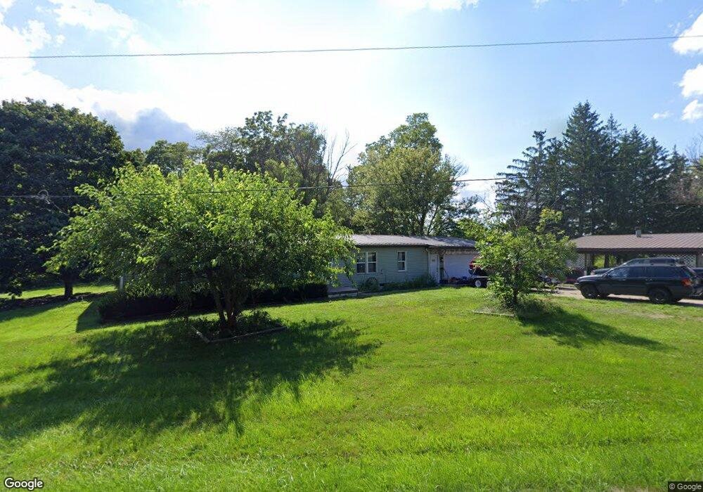
9015 County Road 21 West Unity, OH 43570
Estimated Value: $193,019 - $224,000
2
Beds
2
Baths
1,668
Sq Ft
$124/Sq Ft
Est. Value
About This Home
This home is located at 9015 County Road 21, West Unity, OH 43570 and is currently estimated at $207,005, approximately $124 per square foot. 9015 County Road 21 is a home located in Williams County with nearby schools including Stryker Elementary School and Stryker High School.
Ownership History
Date
Name
Owned For
Owner Type
Purchase Details
Closed on
Nov 26, 2019
Sold by
Castleline Limited
Bought by
Bass Gregory T and Bass Shannon E
Current Estimated Value
Home Financials for this Owner
Home Financials are based on the most recent Mortgage that was taken out on this home.
Original Mortgage
$154,549
Outstanding Balance
$136,311
Interest Rate
3.62%
Mortgage Type
FHA
Estimated Equity
$70,694
Purchase Details
Closed on
Jul 25, 2018
Sold by
Mapes James M
Bought by
Castleline Limited
Purchase Details
Closed on
Jun 15, 2015
Sold by
L & M Short Llc
Bought by
Mapes James M and Mapes Emma J
Purchase Details
Closed on
Dec 7, 1998
Sold by
Schmucker Jerry
Bought by
Mapes James M and Mapes Emma J
Purchase Details
Closed on
Jan 1, 1990
Bought by
Schmucker Jerry
Create a Home Valuation Report for This Property
The Home Valuation Report is an in-depth analysis detailing your home's value as well as a comparison with similar homes in the area
Home Values in the Area
Average Home Value in this Area
Purchase History
| Date | Buyer | Sale Price | Title Company |
|---|---|---|---|
| Bass Gregory T | $157,400 | Merestone Title Agency | |
| Castleline Limited | $71,000 | None Available | |
| Mapes James M | -- | None Available | |
| Mapes James M | $115,500 | -- | |
| Schmucker Jerry | -- | -- |
Source: Public Records
Mortgage History
| Date | Status | Borrower | Loan Amount |
|---|---|---|---|
| Open | Bass Gregory T | $154,549 |
Source: Public Records
Tax History Compared to Growth
Tax History
| Year | Tax Paid | Tax Assessment Tax Assessment Total Assessment is a certain percentage of the fair market value that is determined by local assessors to be the total taxable value of land and additions on the property. | Land | Improvement |
|---|---|---|---|---|
| 2024 | $2,247 | $55,870 | $9,700 | $46,170 |
| 2023 | $2,247 | $44,490 | $9,210 | $35,280 |
| 2022 | $1,987 | $44,490 | $9,210 | $35,280 |
| 2021 | $1,986 | $44,490 | $9,210 | $35,280 |
| 2020 | $1,761 | $37,100 | $7,700 | $29,400 |
| 2019 | $1,776 | $37,100 | $7,700 | $29,400 |
| 2018 | $858 | $37,100 | $7,700 | $29,400 |
| 2017 | $1,812 | $38,080 | $7,560 | $30,520 |
| 2016 | $1,717 | $38,080 | $7,560 | $30,520 |
| 2015 | $1,655 | $38,080 | $7,560 | $30,520 |
| 2014 | $1,655 | $34,620 | $6,860 | $27,760 |
| 2013 | $1,667 | $34,620 | $6,860 | $27,760 |
Source: Public Records
Map
Nearby Homes
- 340 S Main St
- 305 W Mulberry St
- 301 Horton St
- 000 W Jackson
- 3063 County Road 26-2
- 205 Taylor Dr
- 22018 County Road F
- 22227 Us Highway 20a
- 311 W Rings St
- 18 Cobblestone Rd
- 0 County Road F
- 5065 County Road 20-50
- 24218 State Route 2
- 4532 County Road 19
- 0 County Road 18
- 16806 US Highway 20a
- 17738 County Rd E
- 18097 State Route 34
- 222 Lakeview Dr
- 552 Quail Run
- 9015 County Road 21
- 9032 County Road 21
- 9032 County Road 21
- 8943 County Road 21
- 8975 County Road 21
- 8846 County Road 21
- 8712 County Road 21
- 0 County Road 21
- 20898 County Road I50
- 21040 County Road I50
- 8520 21st Rd
- 08520 County Road 21
- 8520 County Road 21
- 20845 County Road H50
- 20845 County Road H-50
- 20845 Co Rd H-50
- 21117 County Road I50
- 0 County Road H-50
- 20843 County Road I50
- 21117 C R I-50