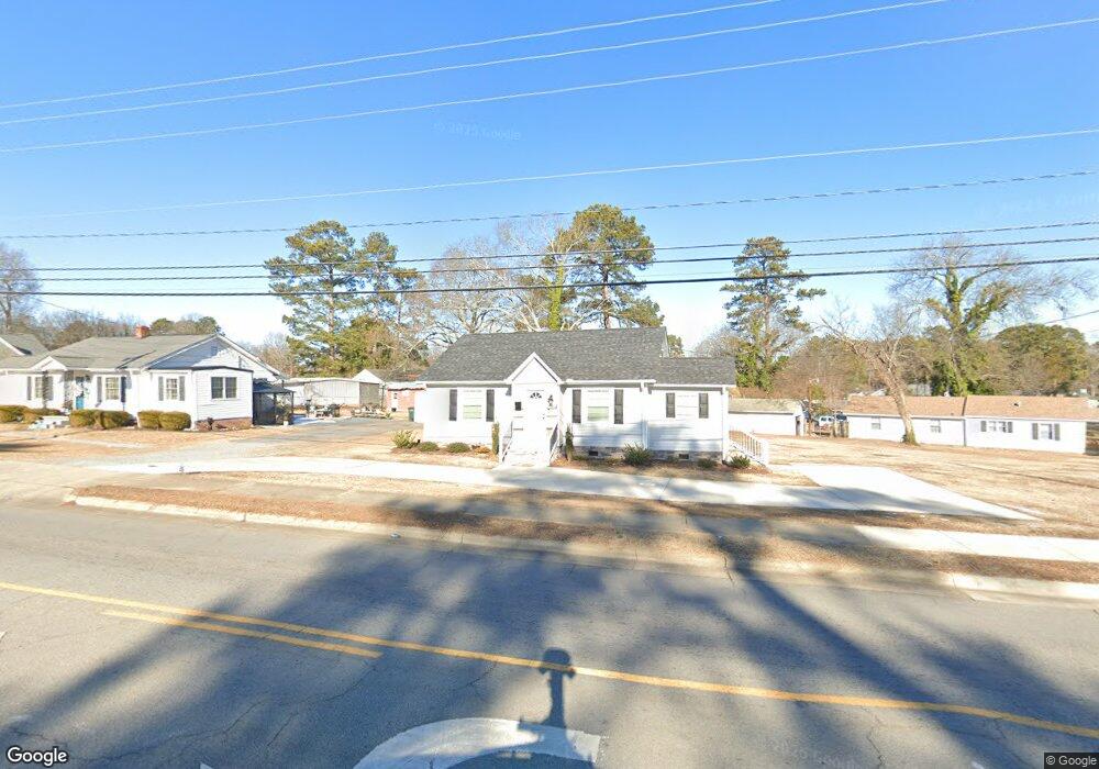
902 Bolling Rd Roanoke Rapids, NC 27870
Estimated Value: $110,000 - $132,000
2
Beds
1
Bath
1,098
Sq Ft
$108/Sq Ft
Est. Value
About This Home
This home is located at 902 Bolling Rd, Roanoke Rapids, NC 27870 and is currently estimated at $118,855, approximately $108 per square foot. 902 Bolling Rd is a home located in Halifax County with nearby schools including Roanoke Rapids High School and Victory Christian Academy.
Ownership History
Date
Name
Owned For
Owner Type
Purchase Details
Closed on
Nov 30, 2021
Sold by
Phillips Sarah A and Estate Of Donald Stanley Phill
Bought by
King Melinda Renee
Current Estimated Value
Purchase Details
Closed on
May 12, 2010
Sold by
Baggett Phillip and Baggett Patrick
Bought by
Phillips Donald Stanley
Purchase Details
Closed on
Mar 27, 2008
Sold by
Phillips Donald Stanley
Bought by
Baggett Sherry Phillips
Purchase Details
Closed on
Sep 1, 2006
Sold by
Phillips Donald Stanley
Bought by
Phillips Donald Stanely and Phillips Judith F
Purchase Details
Closed on
Jun 28, 2006
Sold by
Phillips Shannon Watrous
Bought by
Phillips Donald Stanley
Create a Home Valuation Report for This Property
The Home Valuation Report is an in-depth analysis detailing your home's value as well as a comparison with similar homes in the area
Purchase History
We collect this data history from publicly available records. To have your information removed, we recommend requesting removal directly through your county’s website.
| Date | Buyer | Sale Price | Title Company |
|---|---|---|---|
| King Melinda Renee | $52,500 | None Available | |
| Phillips Donald Stanley | -- | None Available | |
| Baggett Sherry Phillips | -- | None Available | |
| Phillips Donald Stanely | -- | None Available | |
| Phillips Donald Stanley | -- | None Available |
Source: Public Records
Tax History
| Year | Tax Paid | Tax Assessment Tax Assessment Total Assessment is a certain percentage of the fair market value that is determined by local assessors to be the total taxable value of land and additions on the property. | Land | Improvement |
|---|---|---|---|---|
| 2025 | $1,951 | $104,800 | $17,300 | $87,500 |
| 2024 | $19 | $104,800 | $17,300 | $87,500 |
| 2023 | $1,171 | $52,400 | $17,300 | $35,100 |
| 2022 | $1,170 | $52,400 | $17,300 | $35,100 |
| 2021 | $1,121 | $52,400 | $17,300 | $35,100 |
| 2020 | $1,115 | $52,400 | $17,300 | $35,100 |
| 2019 | $1,058 | $44,200 | $17,300 | $26,900 |
| 2018 | $1,033 | $48,300 | $17,300 | $31,000 |
| 2017 | $1,024 | $48,300 | $17,300 | $31,000 |
| 2016 | $1,064 | $48,300 | $17,300 | $31,000 |
| 2015 | $624 | $48,300 | $17,300 | $31,000 |
| 2014 | $653 | $53,670 | $18,690 | $34,980 |
Source: Public Records
Map
Nearby Homes
- 340 Rapids St
- 1005 W 8th St
- 817 Vance St
- 700 Henry St
- 906 Rapids St
- 815 Franklin St
- 515 Oakwood Ave
- 424 Madison St
- 808 Monroe St
- 410 Madison St
- 1203 W 10th St
- 922 Franklin St
- 541 Roanoke Ave
- 909 Monroe St
- 321 Shell Dr
- 2077, 91 W 10th St
- 112 E 7th St
- 1118 Mapleton St
- 512 Washington St
- 537 Jefferson St
Your Personal Tour Guide
Ask me questions while you tour the home.