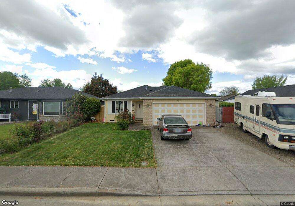
902 Hopkins Rd Central Point, OR 97502
Estimated Value: $362,000 - $375,829
3
Beds
2
Baths
1,342
Sq Ft
$275/Sq Ft
Est. Value
About This Home
This home is located at 902 Hopkins Rd, Central Point, OR 97502 and is currently estimated at $368,957, approximately $274 per square foot. 902 Hopkins Rd is a home located in Jackson County with nearby schools including Central Point Elementary School, Scenic Middle School, and Crater High School.
Ownership History
Date
Name
Owned For
Owner Type
Purchase Details
Closed on
Jul 30, 2002
Sold by
Olson Eldon J and Olson Shirley A
Bought by
Delacruz Salvador and Delacruz Maria
Current Estimated Value
Home Financials for this Owner
Home Financials are based on the most recent Mortgage that was taken out on this home.
Original Mortgage
$127,006
Outstanding Balance
$53,935
Interest Rate
6.6%
Mortgage Type
FHA
Estimated Equity
$315,022
Create a Home Valuation Report for This Property
The Home Valuation Report is an in-depth analysis detailing your home's value as well as a comparison with similar homes in the area
Home Values in the Area
Average Home Value in this Area
Purchase History
| Date | Buyer | Sale Price | Title Company |
|---|---|---|---|
| Delacruz Salvador | $129,000 | Key Title Company |
Source: Public Records
Mortgage History
| Date | Status | Borrower | Loan Amount |
|---|---|---|---|
| Open | Delacruz Salvador | $127,006 |
Source: Public Records
Tax History Compared to Growth
Tax History
| Year | Tax Paid | Tax Assessment Tax Assessment Total Assessment is a certain percentage of the fair market value that is determined by local assessors to be the total taxable value of land and additions on the property. | Land | Improvement |
|---|---|---|---|---|
| 2025 | $3,501 | $210,560 | $74,300 | $136,260 |
| 2024 | $3,501 | $204,430 | $72,140 | $132,290 |
| 2023 | $3,388 | $198,480 | $70,040 | $128,440 |
| 2022 | $3,309 | $198,480 | $70,040 | $128,440 |
| 2021 | $3,214 | $192,700 | $68,000 | $124,700 |
| 2020 | $3,121 | $187,090 | $66,020 | $121,070 |
| 2019 | $3,044 | $176,360 | $62,230 | $114,130 |
| 2018 | $2,951 | $171,230 | $60,420 | $110,810 |
| 2017 | $2,877 | $171,230 | $60,420 | $110,810 |
| 2016 | $2,793 | $161,410 | $56,950 | $104,460 |
| 2015 | $2,676 | $161,410 | $56,950 | $104,460 |
| 2014 | $2,604 | $152,150 | $53,690 | $98,460 |
Source: Public Records
Map
Nearby Homes
- 851 Juanita Way
- 571 Briarwood Dr
- 928 Brandi Way
- 921 Pittview Ave
- 1060 Hopkins Rd
- 3496 Edella St
- 1017 Fairfield Ave
- 1025 Fairfield Ave
- 555 Freeman Rd Unit 128
- 555 Freeman Rd Unit 146
- 555 Freeman Rd Unit 204
- 555 Freeman Rd Unit 209
- 881 Westrop Dr
- 1065 Edwina Ave
- 301 Freeman Rd Unit 100
- 301 Freeman Rd Unit 23
- 301 Freeman Rd Unit 85
- 755 S 4th St
- 531 Bush St
- 230 Peninger Rd
- 906 Hopkins Rd
- 611 Primrose Dr
- 651 Primrose Dr
- 910 Hopkins Rd
- 909 Juanita Way
- 583 Mountain View Dr
- 901 Hopkins Rd
- 901 Hopkins 903 Rd
- 691 Primrose Dr
- 911 Juanita Way
- 914 Hopkins Rd
- 581 Mountain View Dr
- 892 Hopkins Rd
- 915 Juanita Way
- 573 Mountain View Dr
- 586 Primrose Dr
- 650 Primrose Dr
- 584 Mountain View Dr
- 918 Hopkins Rd
- 571 Mountain View Dr