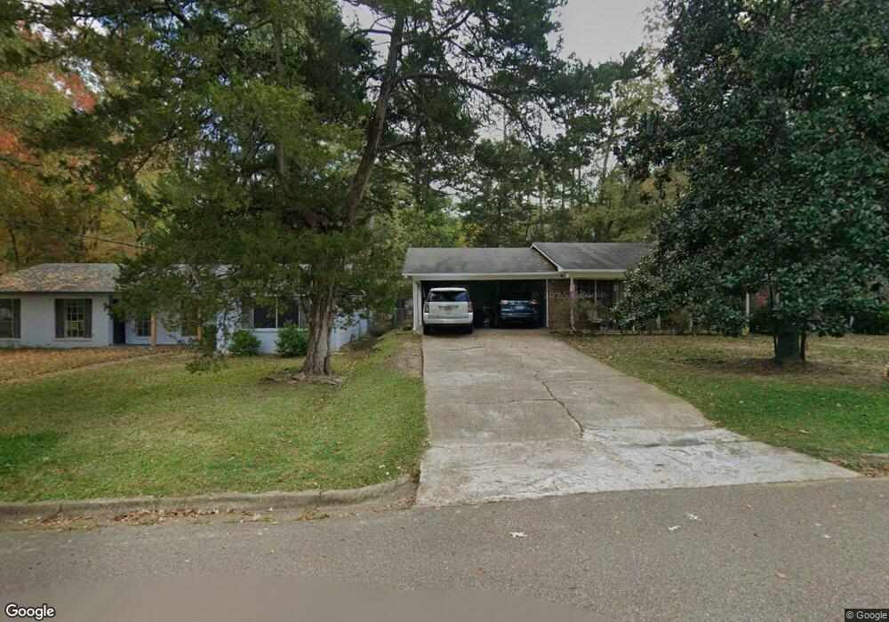
902 Kent Dr Clinton, MS 39056
Estimated Value: $189,000 - $241,000
3
Beds
2
Baths
1,582
Sq Ft
$130/Sq Ft
Est. Value
About This Home
This home is located at 902 Kent Dr, Clinton, MS 39056 and is currently estimated at $205,117, approximately $129 per square foot. 902 Kent Dr is a home located in Hinds County with nearby schools including Clinton Park Elementary School, Eastside Elementary School, and Northside Elementary School.
Ownership History
Date
Name
Owned For
Owner Type
Purchase Details
Closed on
Aug 18, 2021
Sold by
Penick Robert D
Bought by
Atlas Property Investors Llc
Current Estimated Value
Purchase Details
Closed on
Dec 8, 2017
Sold by
Saxton Claudie G
Bought by
Penick Robert D
Home Financials for this Owner
Home Financials are based on the most recent Mortgage that was taken out on this home.
Original Mortgage
$61,430
Interest Rate
3.9%
Mortgage Type
Unknown
Create a Home Valuation Report for This Property
The Home Valuation Report is an in-depth analysis detailing your home's value as well as a comparison with similar homes in the area
Home Values in the Area
Average Home Value in this Area
Purchase History
| Date | Buyer | Sale Price | Title Company |
|---|---|---|---|
| Atlas Property Investors Llc | -- | None Available | |
| Penick Robert D | -- | -- |
Source: Public Records
Mortgage History
| Date | Status | Borrower | Loan Amount |
|---|---|---|---|
| Previous Owner | Penick Robert D | $61,430 |
Source: Public Records
Tax History Compared to Growth
Tax History
| Year | Tax Paid | Tax Assessment Tax Assessment Total Assessment is a certain percentage of the fair market value that is determined by local assessors to be the total taxable value of land and additions on the property. | Land | Improvement |
|---|---|---|---|---|
| 2025 | $1,979 | $12,890 | $4,500 | $8,390 |
| 2024 | $1,979 | $12,890 | $4,500 | $8,390 |
| 2023 | $1,979 | $12,890 | $4,500 | $8,390 |
| 2022 | $1,960 | $12,890 | $4,500 | $8,390 |
| 2021 | $1,960 | $12,890 | $4,500 | $8,390 |
| 2020 | $1,931 | $12,792 | $4,500 | $8,292 |
| 2019 | $1,970 | $12,792 | $4,500 | $8,292 |
| 2018 | $1,970 | $12,792 | $4,500 | $8,292 |
| 2017 | $1,897 | $12,792 | $4,500 | $8,292 |
| 2016 | $1,897 | $12,792 | $4,500 | $8,292 |
| 2015 | $1,889 | $12,786 | $4,500 | $8,286 |
| 2014 | $1,889 | $12,786 | $4,500 | $8,286 |
Source: Public Records
Map
Nearby Homes
- 0 Monroe St
- 1200 Canterbury Ln
- 00002 E Northside Dr
- 00001 E Northside Dr
- 0 Lakeridge Cove Unit 4130731
- 1213 Foxhill Dr
- 605 Herndon Hill
- 809 Normandy Dr
- 1219 Canterbury Ln
- 102 Friars Cove
- 532 Bellevue St
- 1221 Huntcliff Way
- 908 Live Oak Dr
- 0005 Jefferson St
- 0004 Jefferson St
- 0002 Jefferson St
- 835 Post Rd
- 001 Oakwood Dr
- 1206 Shady Glen Dr
- 711 E Leake St