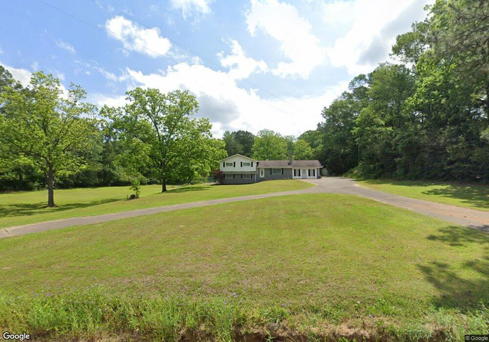
902 Service Rd Laurel, MS 39443
Estimated Value: $230,675 - $306,000
Studio
--
Bath
2,581
Sq Ft
$101/Sq Ft
Est. Value
About This Home
This home is located at 902 Service Rd, Laurel, MS 39443 and is currently estimated at $261,892, approximately $101 per square foot. 902 Service Rd is a home located in Jones County.
Ownership History
Date
Name
Owned For
Owner Type
Purchase Details
Closed on
Sep 9, 2016
Sold by
Tew William A and Tew Sandra J
Bought by
Tew William B and Tew Amanda R
Current Estimated Value
Purchase Details
Closed on
Aug 6, 2013
Sold by
Donovan Shaun and Secretary Of Housing And Urban
Bought by
Tew William A and Tew Sandra J
Create a Home Valuation Report for This Property
The Home Valuation Report is an in-depth analysis detailing your home's value as well as a comparison with similar homes in the area
Purchase History
| Date | Buyer | Sale Price | Title Company |
|---|---|---|---|
| Tew William B | -- | -- | |
| Tew William A | -- | -- |
Source: Public Records
Tax History
| Year | Tax Paid | Tax Assessment Tax Assessment Total Assessment is a certain percentage of the fair market value that is determined by local assessors to be the total taxable value of land and additions on the property. | Land | Improvement |
|---|---|---|---|---|
| 2025 | $1,007 | $10,849 | $0 | $0 |
| 2024 | $1,044 | $10,621 | $0 | $0 |
| 2023 | $1,044 | $10,622 | $0 | $0 |
| 2022 | $1,075 | $10,624 | $0 | $0 |
| 2021 | $1,291 | $10,628 | $0 | $0 |
| 2020 | $1,124 | $10,771 | $0 | $0 |
| 2019 | $1,169 | $11,067 | $0 | $0 |
| 2018 | $1,169 | $11,067 | $0 | $0 |
| 2017 | $1,167 | $11,065 | $0 | $0 |
| 2016 | $1,026 | $10,228 | $0 | $0 |
| 2015 | $967 | $10,236 | $0 | $0 |
| 2014 | $967 | $10,233 | $0 | $0 |
Source: Public Records
Map
Nearby Homes
- 31 Leonard Holloway Rd
- 1013 Service Rd
- 688 Joe Perrett Rd
- 6 Rebel Ln
- 13 Iris Ln
- 1163/65 Mississippi 28
- 0 Calma Dr
- 309 Lebanon Rd
- 253 Maxey Rd
- 84 Maxey Rd
- 0 Maxey Rd
- 422 Maxey Rd
- 372 Jessie's Ln
- 215 Grafton Rd
- 0 Northridge Rd
- 260 Crepe Myrtle Ln
- 214 Little Sawmill Rd
- 96 Hines Rd
- 5 Westerly Dr
- 727 Soso Big Creek Rd
- 886 Service Rd
- 895 Service Rd
- 11 R H Robinson Rd
- 81 Abb Holifield Rd
- 874 Service Rd
- 889 Service Rd
- 30 R H Robinson Rd
- 30 R H Robinson Rd
- 893 Service Rd
- 933 Service Rd
- 860 Service Rd
- 0 Abb Holifield Rd
- 937 Service Rd
- 897 Service Rd
- 935 Service Rd
- 19 Floyd Walters Rd
- 954 Service Rd
- 0 Leonard Holloway Rd
- 51 Leonard Holloway Rd
- 887 Service Rd
Your Personal Tour Guide
Ask me questions while you tour the home.