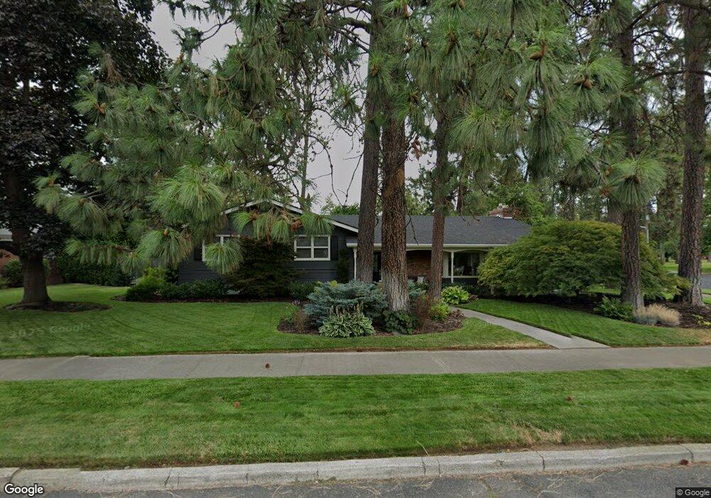
902 W Melinda Ln Spokane, WA 99203
Comstock NeighborhoodEstimated Value: $794,692 - $877,000
4
Beds
3
Baths
2,604
Sq Ft
$325/Sq Ft
Est. Value
About This Home
This home is located at 902 W Melinda Ln, Spokane, WA 99203 and is currently estimated at $846,923, approximately $325 per square foot. 902 W Melinda Ln is a home located in Spokane County with nearby schools including Wilson Elementary School, Sacajawea Middle School, and Lewis & Clark High School.
Ownership History
Date
Name
Owned For
Owner Type
Purchase Details
Closed on
Jun 18, 2001
Sold by
Chisholm Barbara Ann
Bought by
Davey Michael G and Davey Margaret J
Current Estimated Value
Home Financials for this Owner
Home Financials are based on the most recent Mortgage that was taken out on this home.
Original Mortgage
$190,400
Outstanding Balance
$72,580
Interest Rate
7.15%
Estimated Equity
$774,343
Purchase Details
Closed on
May 8, 2000
Sold by
Kearns Dorothy W
Bought by
Chisholm Barbara Ann
Create a Home Valuation Report for This Property
The Home Valuation Report is an in-depth analysis detailing your home's value as well as a comparison with similar homes in the area
Home Values in the Area
Average Home Value in this Area
Purchase History
| Date | Buyer | Sale Price | Title Company |
|---|---|---|---|
| Davey Michael G | $238,000 | Pacific Nw Title | |
| Chisholm Barbara Ann | -- | -- | |
| Chisholm Barbara Ann | -- | -- |
Source: Public Records
Mortgage History
| Date | Status | Borrower | Loan Amount |
|---|---|---|---|
| Open | Davey Michael G | $190,400 |
Source: Public Records
Tax History Compared to Growth
Tax History
| Year | Tax Paid | Tax Assessment Tax Assessment Total Assessment is a certain percentage of the fair market value that is determined by local assessors to be the total taxable value of land and additions on the property. | Land | Improvement |
|---|---|---|---|---|
| 2025 | $7,854 | $781,300 | $225,000 | $556,300 |
| 2024 | $7,854 | $792,700 | $140,000 | $652,700 |
| 2023 | $7,148 | $757,300 | $125,000 | $632,300 |
| 2022 | $6,879 | $731,900 | $120,000 | $611,900 |
| 2021 | $6,318 | $531,970 | $101,970 | $430,000 |
| 2020 | $5,429 | $440,300 | $99,000 | $341,300 |
| 2019 | $4,869 | $407,700 | $90,000 | $317,700 |
| 2018 | $5,399 | $388,500 | $80,000 | $308,500 |
| 2017 | $4,881 | $357,600 | $80,000 | $277,600 |
| 2016 | $4,622 | $331,300 | $80,000 | $251,300 |
| 2015 | $4,652 | $326,300 | $75,000 | $251,300 |
| 2014 | -- | $290,100 | $50,000 | $240,100 |
| 2013 | -- | $0 | $0 | $0 |
Source: Public Records
Map
Nearby Homes
- 3223 S High Dr
- 2825 S Wall St
- 3510 S Jefferson Dr
- 532 W 28th Ave
- 3331 S Bernard St
- 2609 S Lincoln St
- 617 W 26th Ave
- 125 W 32nd Ave
- 204 W 36th Ave
- 208 W 28th Ave
- 417 W 26th Ave
- 1123 W 25th Ave
- 411 W 26th Ave
- 207 W 27th Ave
- 227 W 26th Ave
- 17 W 31st Ave
- 19 W 29th Ave
- 1105 W 23rd Ave
- 3524 S Division St Unit Not the busy road
- 3331 S Inland Empire Way
- 3212 S Lincoln Dr
- 908 W Melinda Ln
- 903 W Melinda Ln
- 911 W 32nd Ave
- 903 W 32nd Ave
- 909 W Melinda Ln
- 916 W Melinda Ln
- 0 S Lincoln Dr
- 917 W Melinda Ln
- 904 W Comstock Ct
- 910 W Comstock Ct
- 929 W 32nd Ave
- 906 W 32nd Ave
- 912 W 32nd Ave
- 927 W Melinda Ln
- 920 W Comstock Ct
- 922 W 32nd Ave
- 933 W 32nd Ave
- 903 W 31st Ave
- 933 W Melinda Ln