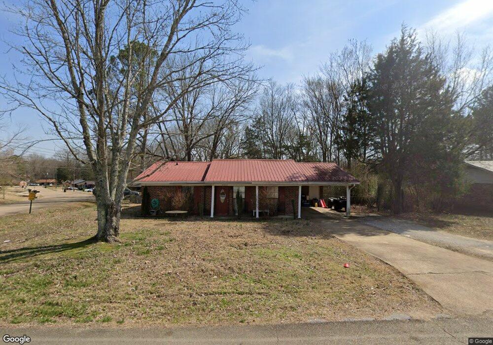
903 Forrest Dr Baldwyn, MS 38824
Estimated Value: $93,000 - $117,000
3
Beds
--
Bath
1,020
Sq Ft
$103/Sq Ft
Est. Value
About This Home
This home is located at 903 Forrest Dr, Baldwyn, MS 38824 and is currently estimated at $105,000, approximately $102 per square foot. 903 Forrest Dr is a home located in Prentiss County with nearby schools including Baldwyn Elementary School, Baldwyn Middle School, and Baldwyn High School.
Ownership History
Date
Name
Owned For
Owner Type
Purchase Details
Closed on
Nov 3, 2023
Sold by
Coggins Rex S and Coggins Diannah
Bought by
Bmo Properties Llc
Current Estimated Value
Home Financials for this Owner
Home Financials are based on the most recent Mortgage that was taken out on this home.
Original Mortgage
$350,000
Interest Rate
7.19%
Mortgage Type
Construction
Purchase Details
Closed on
Apr 10, 2006
Sold by
Fortner James A and Forner Greta B
Bought by
Spencer William H and Spencer Donna
Create a Home Valuation Report for This Property
The Home Valuation Report is an in-depth analysis detailing your home's value as well as a comparison with similar homes in the area
Home Values in the Area
Average Home Value in this Area
Purchase History
| Date | Buyer | Sale Price | Title Company |
|---|---|---|---|
| Bmo Properties Llc | -- | None Listed On Document | |
| Spencer William H | -- | -- |
Source: Public Records
Mortgage History
| Date | Status | Borrower | Loan Amount |
|---|---|---|---|
| Closed | Bmo Properties Llc | $350,000 |
Source: Public Records
Property History
| Date | Event | Price | List to Sale | Price per Sq Ft |
|---|---|---|---|---|
| 03/21/2025 03/21/25 | Off Market | $1,000 | -- | -- |
| 03/10/2025 03/10/25 | For Rent | $1,000 | -- | -- |
Tax History Compared to Growth
Tax History
| Year | Tax Paid | Tax Assessment Tax Assessment Total Assessment is a certain percentage of the fair market value that is determined by local assessors to be the total taxable value of land and additions on the property. | Land | Improvement |
|---|---|---|---|---|
| 2024 | $441 | $6,809 | $0 | $0 |
| 2023 | $401 | $6,203 | $0 | $0 |
| 2022 | $476 | $7,364 | $0 | $0 |
| 2021 | $476 | $7,364 | $0 | $0 |
| 2020 | $457 | $7,146 | $0 | $0 |
| 2019 | $427 | $6,684 | $0 | $0 |
| 2018 | $427 | $6,684 | $0 | $0 |
| 2017 | $427 | $6,684 | $0 | $0 |
| 2016 | $427 | $6,684 | $0 | $0 |
| 2015 | -- | $6,684 | $0 | $0 |
| 2014 | -- | $5,879 | $0 | $0 |
Source: Public Records
Map
Nearby Homes
- 1105 Carrollville Ave
- 134 Cox St
- 340 W Main St
- Tbd N 4th St
- 0 Hwy 45 (12 40 Ac)
- 0 Windance Dr
- 537 Latimer St
- 0 Co Rd 6311
- 314 Latimer St
- 1169 Cr 167
- 0 Cr 170 Unit 25-1046
- 0 Hwy 45 Hwy 370
- 328 S 2nd St
- 553 Holly Dr
- 547 Holly Dr
- 889 Mallard Lake Dr
- Lot 52 & 33 Mallard Lake Ridgewood Dr
- Lot 26 Ridgewood Dr
- Lot 18 Mallard Lake Dr
- Lot 19 Mallard Lake Dr
- 903 Forrest Dr
- 850 Fernwood
- 851 Fernwood
- 905 Forrest Dr
- 855 Fernwood Dr
- 855 Fernwood Dr
- 858 Fernwood Dr
- 858 Fernwood St
- 858 Fernwood Dr
- 904 Forrest Dr
- 851 Fernwood Dr
- 860 Forrest Dr
- 925 Ripley Rd
- 850 Fernwood Dr
- 906 Forrest Dr
- 908 Ripley Rd
- 847 Fernwood Dr
- 915 Ripley Rd
- 846 Fernwood Dr
- 915 Ripley Rd