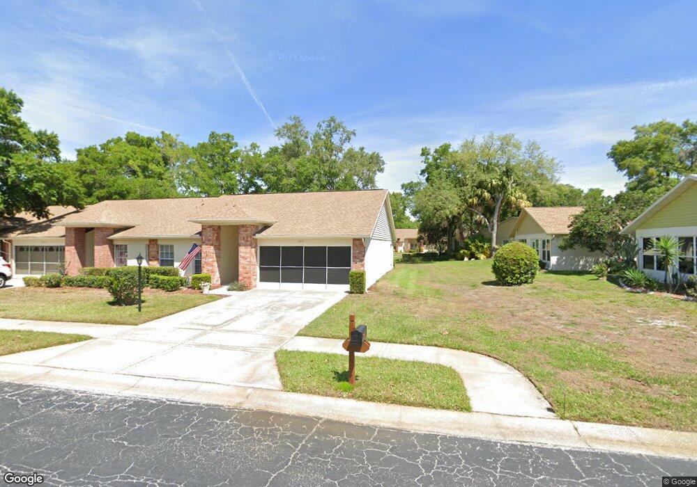
9031 Ramsgate Dr Unit 5 New Port Richey, FL 34655
Heritage Lake NeighborhoodEstimated Value: $224,619 - $250,000
2
Beds
2
Baths
1,407
Sq Ft
$165/Sq Ft
Est. Value
About This Home
This home is located at 9031 Ramsgate Dr Unit 5, New Port Richey, FL 34655 and is currently estimated at $232,155, approximately $165 per square foot. 9031 Ramsgate Dr Unit 5 is a home located in Pasco County with nearby schools including Longleaf Elementary School, River Ridge High School, and River Ridge Middle School.
Ownership History
Date
Name
Owned For
Owner Type
Purchase Details
Closed on
Feb 23, 2009
Sold by
Reinholt Carl M
Bought by
Pete Elwood Joseph and Pete Barbara E
Current Estimated Value
Purchase Details
Closed on
Sep 25, 2006
Sold by
Reinholt Dolores A
Bought by
Reinholt Dolores A
Purchase Details
Closed on
Mar 26, 2004
Sold by
Velie Dianalee
Bought by
Reinholt Dolores A
Purchase Details
Closed on
Mar 25, 2004
Sold by
Velie Joseph and Velie Fay
Bought by
Reinholt Dolores A
Purchase Details
Closed on
Nov 21, 2003
Sold by
Velie Joseph and Velie Fay
Bought by
Velie Joseph and Velie Fay
Create a Home Valuation Report for This Property
The Home Valuation Report is an in-depth analysis detailing your home's value as well as a comparison with similar homes in the area
Home Values in the Area
Average Home Value in this Area
Purchase History
| Date | Buyer | Sale Price | Title Company |
|---|---|---|---|
| Pete Elwood Joseph | $108,000 | Capstone Title Llc | |
| Reinholt Dolores A | -- | Attorney | |
| Reinholt Dolores A | $124,900 | -- | |
| Reinholt Dolores A | -- | -- | |
| Velie Joseph | -- | -- |
Source: Public Records
Tax History Compared to Growth
Tax History
| Year | Tax Paid | Tax Assessment Tax Assessment Total Assessment is a certain percentage of the fair market value that is determined by local assessors to be the total taxable value of land and additions on the property. | Land | Improvement |
|---|---|---|---|---|
| 2025 | $956 | $82,250 | -- | -- |
| 2024 | $956 | $79,940 | -- | -- |
| 2023 | $799 | $77,620 | $0 | $0 |
| 2022 | $702 | $75,360 | $0 | $0 |
| 2021 | $694 | $73,170 | $6,097 | $67,073 |
| 2020 | $686 | $72,160 | $6,097 | $66,063 |
| 2019 | $679 | $70,540 | $0 | $0 |
| 2018 | $671 | $69,229 | $0 | $0 |
| 2017 | $675 | $69,229 | $0 | $0 |
| 2016 | $635 | $66,410 | $0 | $0 |
| 2015 | $644 | $65,948 | $0 | $0 |
| 2014 | $624 | $87,356 | $6,097 | $81,259 |
Source: Public Records
Map
Nearby Homes
- 9032 Arundle Place
- 4646 Lacrosse Ct
- 4916 Troon Ln
- 9142 Cotswald Way Unit 86
- 9139 Nile Dr
- 9326 Whitstone Ct
- 9321 Whitstone Ct
- 4961 Grist Mill Cir
- 4955 Grist Mill Cir
- 4951 Grist Mill Cir
- 9327 Whitstone Ct
- 9334 Whitstone Ct
- 4635 Gazebo Ct
- 4841 Wakefield Ct Unit 4841
- 9402 Stonewall Ln
- 9444 Rockbridge Cir
- 9433 Stonewall Ln
- 4912 Enfield Ct
- 4339 Tiburon Dr Unit 15
- 4707 Wallingford Ct
- 9025 Ramsgate Dr
- 4745 Vicksburg Ct Unit 4745
- 4745 Vicksburg Ct
- 4745 Vicksburg Ct
- 9021 Ramsgate Dr Unit 7
- 4739 Vicksburg Ct Unit 4739
- 4739 Vicksburg Ct Unit 9
- 9026 Severn Ln
- 9026 Severn Ln
- 4751 Vicksburg Ct
- 9020 Severn Ln
- 9024 Ramsgate Dr
- 9032 Ramsgate Dr
- 9036 Ramsgate Dr Unit 4
- 9036 Ramsgate Dr Unit 1
- 9014 Severn Ln Unit 8
- 9014 Severn Ln
- 9014 Severn Ln Unit 9014
- 4755 Vicksburg Ct Unit 6
- 9033 Severn Ln