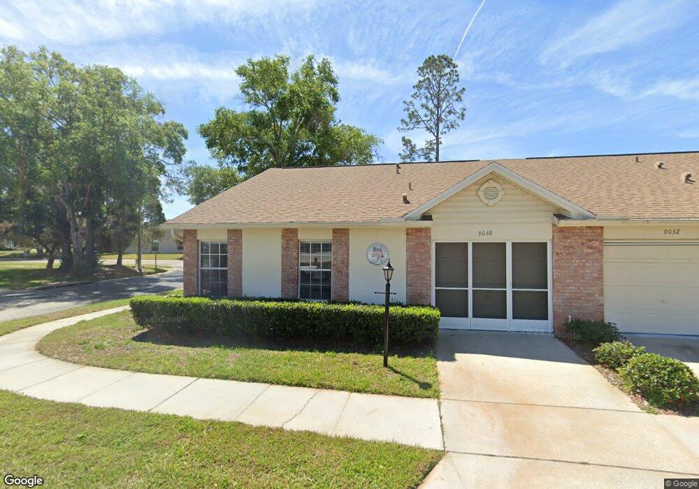
9036 Ramsgate Dr Unit 1 New Port Richey, FL 34655
Heritage Lake NeighborhoodEstimated Value: $188,000 - $219,000
2
Beds
2
Baths
1,485
Sq Ft
$137/Sq Ft
Est. Value
About This Home
This home is located at 9036 Ramsgate Dr Unit 1, New Port Richey, FL 34655 and is currently estimated at $203,900, approximately $137 per square foot. 9036 Ramsgate Dr Unit 1 is a home located in Pasco County with nearby schools including Longleaf Elementary School, River Ridge High School, and River Ridge Middle School.
Ownership History
Date
Name
Owned For
Owner Type
Purchase Details
Closed on
Oct 23, 2015
Sold by
Latour Diane E and Theriault Diane E
Bought by
Culbertson Susan
Current Estimated Value
Purchase Details
Closed on
May 29, 2008
Sold by
Carrington James Patrick
Bought by
Theriault Diane E
Purchase Details
Closed on
Jul 28, 2003
Sold by
Canetta Linda C and Canetta Tom
Bought by
Carrington James Patrick
Home Financials for this Owner
Home Financials are based on the most recent Mortgage that was taken out on this home.
Original Mortgage
$90,250
Interest Rate
5.17%
Mortgage Type
Unknown
Create a Home Valuation Report for This Property
The Home Valuation Report is an in-depth analysis detailing your home's value as well as a comparison with similar homes in the area
Home Values in the Area
Average Home Value in this Area
Purchase History
| Date | Buyer | Sale Price | Title Company |
|---|---|---|---|
| Culbertson Susan | $94,000 | Executive Title Svcs Fl Inc | |
| Theriault Diane E | $103,000 | Trinity Title Of Pasco Inc | |
| Carrington James Patrick | $95,000 | Multiple |
Source: Public Records
Mortgage History
| Date | Status | Borrower | Loan Amount |
|---|---|---|---|
| Previous Owner | Carrington James Patrick | $90,250 |
Source: Public Records
Tax History Compared to Growth
Tax History
| Year | Tax Paid | Tax Assessment Tax Assessment Total Assessment is a certain percentage of the fair market value that is determined by local assessors to be the total taxable value of land and additions on the property. | Land | Improvement |
|---|---|---|---|---|
| 2025 | $1,363 | $106,970 | -- | -- |
| 2024 | $1,363 | $103,960 | -- | -- |
| 2023 | $1,193 | $100,940 | $0 | $0 |
| 2022 | $1,058 | $98,000 | $0 | $0 |
| 2021 | $1,026 | $95,150 | $6,097 | $89,053 |
| 2020 | $1,003 | $93,840 | $6,097 | $87,743 |
| 2019 | $976 | $91,730 | $0 | $0 |
| 2018 | $950 | $90,028 | $0 | $0 |
| 2017 | $939 | $90,028 | $0 | $0 |
| 2016 | $883 | $86,362 | $6,097 | $80,265 |
| 2015 | $585 | $57,642 | $0 | $0 |
| 2014 | $565 | $78,174 | $6,097 | $72,077 |
Source: Public Records
Map
Nearby Homes
- 9032 Arundle Place
- 4646 Lacrosse Ct
- 4916 Troon Ln
- 9142 Cotswald Way Unit 86
- 9139 Nile Dr
- 9326 Whitstone Ct
- 9321 Whitstone Ct
- 4961 Grist Mill Cir
- 4955 Grist Mill Cir
- 4951 Grist Mill Cir
- 9327 Whitstone Ct
- 9334 Whitstone Ct
- 4635 Gazebo Ct
- 4841 Wakefield Ct Unit 4841
- 9402 Stonewall Ln
- 9444 Rockbridge Cir
- 9433 Stonewall Ln
- 4912 Enfield Ct
- 4339 Tiburon Dr Unit 15
- 4707 Wallingford Ct
- 9036 Ramsgate Dr Unit 4
- 9032 Ramsgate Dr
- 9024 Ramsgate Dr
- 4739 Vicksburg Ct Unit 4739
- 4739 Vicksburg Ct Unit 9
- 9031 Ramsgate Dr Unit 5
- 4728 Vicksburg Ct
- 4736 Vicksburg Ct Unit 2
- 4745 Vicksburg Ct Unit 4745
- 4745 Vicksburg Ct
- 4745 Vicksburg Ct
- 9025 Ramsgate Dr
- 4713 Tiburon Dr
- 9021 Ramsgate Dr Unit 7
- 4712 Tiburon Dr
- 4740 Vicksburg Ct
- 4751 Vicksburg Ct
- 4705 Tiburon Dr
- 9026 Severn Ln
- 9026 Severn Ln