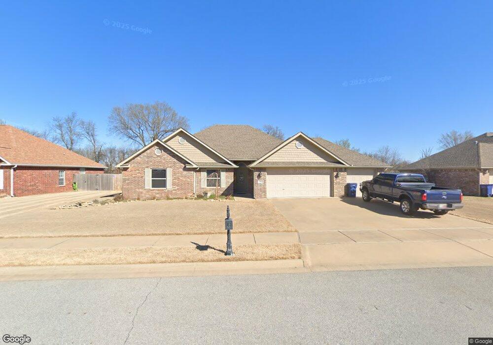
904 Carter Ct Siloam Springs, AR 72761
Estimated Value: $333,560 - $387,000
4
Beds
2
Baths
1,815
Sq Ft
$192/Sq Ft
Est. Value
About This Home
This home is located at 904 Carter Ct, Siloam Springs, AR 72761 and is currently estimated at $348,390, approximately $191 per square foot. 904 Carter Ct is a home located in Benton County with nearby schools including Northside Elementary School, Southside Elementary School, and Delbert Pete & Pat Allen Elementary School.
Ownership History
Date
Name
Owned For
Owner Type
Purchase Details
Closed on
Sep 26, 2008
Sold by
Kevin Gerlt Construction Inc
Bought by
Demoss Chris and Demoss Erin
Current Estimated Value
Home Financials for this Owner
Home Financials are based on the most recent Mortgage that was taken out on this home.
Original Mortgage
$162,000
Outstanding Balance
$107,443
Interest Rate
6.46%
Mortgage Type
Purchase Money Mortgage
Estimated Equity
$240,947
Create a Home Valuation Report for This Property
The Home Valuation Report is an in-depth analysis detailing your home's value as well as a comparison with similar homes in the area
Home Values in the Area
Average Home Value in this Area
Purchase History
| Date | Buyer | Sale Price | Title Company |
|---|---|---|---|
| Demoss Chris | $175,000 | Waco Title Company |
Source: Public Records
Mortgage History
| Date | Status | Borrower | Loan Amount |
|---|---|---|---|
| Open | Demoss Chris | $162,000 |
Source: Public Records
Tax History Compared to Growth
Tax History
| Year | Tax Paid | Tax Assessment Tax Assessment Total Assessment is a certain percentage of the fair market value that is determined by local assessors to be the total taxable value of land and additions on the property. | Land | Improvement |
|---|---|---|---|---|
| 2025 | $2,469 | $56,738 | $10,400 | $46,338 |
| 2024 | $2,419 | $56,738 | $10,400 | $46,338 |
| 2023 | $2,304 | $41,650 | $8,000 | $33,650 |
| 2022 | $1,827 | $41,650 | $8,000 | $33,650 |
| 2021 | $1,722 | $41,650 | $8,000 | $33,650 |
| 2020 | $1,628 | $34,780 | $3,000 | $31,780 |
| 2019 | $1,628 | $34,780 | $3,000 | $31,780 |
| 2018 | $1,653 | $34,780 | $3,000 | $31,780 |
| 2017 | $1,498 | $34,780 | $3,000 | $31,780 |
| 2016 | $1,498 | $34,780 | $3,000 | $31,780 |
| 2015 | $1,756 | $30,490 | $5,000 | $25,490 |
| 2014 | $1,406 | $30,490 | $5,000 | $25,490 |
Source: Public Records
Map
Nearby Homes
- 509 Carter Rd
- 7004 David Dr
- 8006 David Dr
- 6008 David Dr
- 0 E Sugarloaf St
- 16013 N Airport Rd
- 15564 Airport Rd
- 19941 Edgewood Cir
- 925 S Canvasback Dr
- 920 S Canvasback Dr
- 1729-4 Plan at
- 820 S Parrot Ln
- 824 S Parrot Ln
- 4108 E Razorbill Dr
- 3605 N Marian St
- 0 Old Highway 68 Unit 25340983
- 19372 Old Highway 68 E
- 813 S Katlyn Dr
- 829 S Katlyn Dr
- 3217 E Hagen St
- 808 Carter Ct
- 906 Carter Ct
- 806 Carter Ct
- 903 Carter Ct
- 908 Carter Ct
- 809 Carter Ct
- 905 Carter Ct
- 807 Carter Ct
- 907 Carter Ct
- 804 Carter Ct
- 8005 Overland Rd
- 1005 Carter Ct
- 8003 Overland Rd
- 805 Carter Ct
- 8007 Overland Rd
- 8005 Overland Dr
- 8003 Overland Dr
- 7009 Overland Rd
- 9003 Overland Rd
- 7009 Overland Dr